FREE! Click here to Join FunTrivia. Thousands of games, quizzes, and lots more!
Quiz about A Northern Territory Odyssey

A Northern Territory Odyssey Trivia Quiz


The license plates on cars in the Northern Territory read "Outback Australia". Join me in an Outback odyssey as we explore for ourselves the beauty of Australia's "Top End".

A multiple-choice quiz by NatalieW. Estimated time: 5 mins.
  1. Home
  2. »
  3. Quizzes
  4. »
  5. Geography Trivia
  6. »
  7. Australia
  8. »
  9. Northern Territory

Author
NatalieW
Time
5 mins
Type
Multiple Choice
Quiz #
154,828
Updated
Aug 18 23
# Qns
10
Difficulty
Average
Avg Score
8 / 10
Plays
2420
Awards
Top 5% quiz!
Last 3 plays: Guest 146 (10/10), Guest 13 (10/10), Guest 81 (9/10).
- -
Question 1 of 10
1. In Darwin, the capital city of the Northern Territory, we notice that all the buildings seem very new and modern-looking. A local tells us that this is because on Christmas Eve, 1974, the city of Darwin was all but flattened by a tropical cyclone. What was the cyclone's name? Hint


Question 2 of 10
2. Hitting the road in our 4-wheel drive (a must for travelling on outback roads!), we head due east out of Darwin en route to one of the many national parks in the Northern Territory. This one has been accorded double World Heritage status by the United Nations because of both its cultural and natural significance. Where are we going? Hint


Question 3 of 10
3. We join the Stuart Highway and travel south on the way to a magnificent gorge with a very feminine name. Hint


Question 4 of 10
4. Travelling south along the Stuart Highway, we enter outback Australia. Our next destination became one of the stations on the Overland Telegraph Line in 1872 and was at the centre of Australia's last great goldrush in the 1930s. What is the name of our next stop? Hint


Question 5 of 10
5. We take a slight detour off the Stuart Highway to take in another of nature's wonders. We pull up to an area that has large boulders scattered all over it, like a giant has been playing a game. What are we looking at? Hint


Question 6 of 10
6. Travelling south on the extensive Stuart Highway, we're not far from our next destination, but before we get there, we cross an imaginary line circling the Earth that officially separates tropical regions from the temperate zone. What is this imaginary line called? Hint


Question 7 of 10
7. We're about to enter the next town on our itinerary. This place is an important cog in the wheel of Australia's Royal Flying Doctor Service (RFDS) and was named after the wife of Charles Todd (the instigator of the Overland Telegraph Line). We're driving into _________. Hint


Question 8 of 10
8. Waving goodbye to the locals (while wondering why they're running along what seems to be a dry riverbed in some kind of strange land-bound boat race ... oh well!), we head slightly southwest this time on the way to our next destination. On the way, we see a beautiful mountain range off in the distance. What is its name? Hint


Question 9 of 10
9. Our next destination is one of Australia's best-known landmarks and one of the largest monoliths in the world. Hint


Question 10 of 10
10. As we approach this destination, we can see a series of rounded dome-shaped rocks rising from the ground. What is their name? Hint


(Optional) Create a Free FunTrivia ID to save the points you are about to earn:

arrow Select a User ID:
arrow Choose a Password:
arrow Your Email:


Most Recent Scores
Nov 18 2024 : Guest 146: 10/10
Nov 15 2024 : Guest 13: 10/10
Nov 13 2024 : Guest 81: 9/10
Nov 11 2024 : Guest 111: 10/10
Nov 02 2024 : Guest 120: 9/10
Oct 23 2024 : Guest 81: 7/10
Oct 12 2024 : Guest 1: 10/10
Sep 30 2024 : Guest 1: 10/10

Score Distribution

quiz
Quiz Answer Key and Fun Facts
1. In Darwin, the capital city of the Northern Territory, we notice that all the buildings seem very new and modern-looking. A local tells us that this is because on Christmas Eve, 1974, the city of Darwin was all but flattened by a tropical cyclone. What was the cyclone's name?

Answer: Cyclone Tracy

The city of Darwin (named after famous evolution scientist Charles Darwin) was settled in 1839. On Christmas Eve, 1974, the city was hit by the full force of tropical Cyclone Tracy. The city was all but destroyed but has since been rebuilt with cyclone-proof houses and is now Australia's most modern city. Darwin is also a fast-growing city - the population has risen from around 44000 to over 100000 people in the years since Cyclone Tracy.
2. Hitting the road in our 4-wheel drive (a must for travelling on outback roads!), we head due east out of Darwin en route to one of the many national parks in the Northern Territory. This one has been accorded double World Heritage status by the United Nations because of both its cultural and natural significance. Where are we going?

Answer: Kakadu

Aborigines have been living in Kakadu for 40,000 years, making it the world's longest continuous surviving culture. Descendants of these people still live in Kakadu today. Kakadu and the adjacent Arnhem Land area to the east contain more than 5000 rock-painting galleries, illustrating this rich human history. Kakadu is also rich in wildlife, containing over 12,000 species of plants, 10,000 species of insects and hundreds of bird, mammal and reptile species.

The region relies on the "wet" season (from November to March) for its water, which can be found in the many billabongs, creeks and other waterways that cover the area.
3. We join the Stuart Highway and travel south on the way to a magnificent gorge with a very feminine name.

Answer: Katherine Gorge

Katherine Gorge was made famous by the book "We of the Never Never" ("the Never Never" has now become synonymous with the Australian Outback and is so called because it is said that once you live there, you "never-never" want to leave), by Jeannie Gunn, which gives an autobiographical account of how she and her husband managed a cattle station 300 kilometres south east of the town of Katherine.

The Gorge itself began as rushing water running along cracks in the ground and is now a magnificent example of nature at its finest, winding along for 12 kilometres with walls reaching up to 70 metres high.

The Gorge is part of the Nitmiluk National Park and home to the Jawoyn people, the traditional owners of the land. Like Kakadu, the Nitmiluk National Park contains many examples of Aboriginal rock painting.
4. Travelling south along the Stuart Highway, we enter outback Australia. Our next destination became one of the stations on the Overland Telegraph Line in 1872 and was at the centre of Australia's last great goldrush in the 1930s. What is the name of our next stop?

Answer: Tennant Creek

The town of Tennant Creek derives its name from the nearby creek of the same name, which was named in 1860 by explorer John McDouall Stuart after a pastoralist who had helped him in his travels. The 3600 kilometre long Overland Telegraph Line was erected between Adelaide (in South Australia) and Darwin as a means for Australia to keep in closer contact with Britain.

The original Tennant Creek telegraph station built in 1872 was a temporary structure and was replaced by a stone building in 1875.

The station is now a museum located in a reserve approximately ten kilometres outside Tennant Creek.
5. We take a slight detour off the Stuart Highway to take in another of nature's wonders. We pull up to an area that has large boulders scattered all over it, like a giant has been playing a game. What are we looking at?

Answer: Devils Marbles (Karlu Karlu)

The Devils Marbles (known as Karlu Karlu to the traditional owners of the area) are so named because they look exactly like a giant game of interrupted marbles! In fact, they have been created by simple erosion of a single bed of granite over a period of 1500 million years, leaving a large number of smooth, round boulders ranging from one to three metres in diameter.

The rocks seem to be balanced extremely precariously, as if one simple touch would knock them over! Aboriginal legend refers to the boulders as "Eggs of the Rainbow Serpent", and it's not hard to see why.

At sunset, the boulders take on amazing colours ranging from warm gold to ruby red and are a sight to behold.
6. Travelling south on the extensive Stuart Highway, we're not far from our next destination, but before we get there, we cross an imaginary line circling the Earth that officially separates tropical regions from the temperate zone. What is this imaginary line called?

Answer: Tropic of Capricorn

The Tropic of Capricorn is the southern equivalent of the Tropic of Cancer, both of which enclose the tropical regions either side of the Equator and provide an official dividing line between the world's tropical and temperate regions. A good deal of Australia lies above the Tropic of Capricorn; as well as the tropical north of the Northern Territory, there are tropical regions in far north Queensland and the north of Western Australia. Hmmm ... somewhere to go for our next trip, perhaps?
7. We're about to enter the next town on our itinerary. This place is an important cog in the wheel of Australia's Royal Flying Doctor Service (RFDS) and was named after the wife of Charles Todd (the instigator of the Overland Telegraph Line). We're driving into _________.

Answer: Alice Springs

Alice Springs (also known simply as "The Alice") was originally called "Stuart", but after much campaigning by the locals was granted the name of the nearby waterhole in 1933 (since everyone had been calling the town Alice Springs for years by that time anyway!). Alice Springs is home to the Royal Flying Doctor visitor centre, which receives over 100000 visitors a year, eager to explore the story of the RFDS.

The RFDS's first flight was in 1928 in a De Havilland DH50 aeroplane, hired from a company later to become the airline Qantas. Since then, the RFDS has grown to be a vital part of the Australian outback, providing medical care to the thousands of people living in isolated areas.
8. Waving goodbye to the locals (while wondering why they're running along what seems to be a dry riverbed in some kind of strange land-bound boat race ... oh well!), we head slightly southwest this time on the way to our next destination. On the way, we see a beautiful mountain range off in the distance. What is its name?

Answer: MacDonnell Ranges

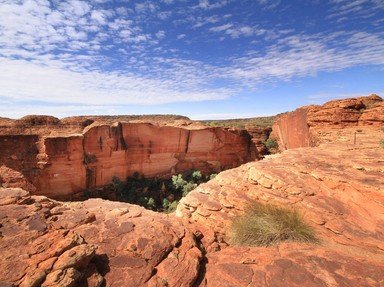
The MacDonnell Ranges contain more of the amazing scenery we've come to expect from the Northern Territory - peaceful waterholes, breathtaking gorges and dramatic rock formations. The MacDonnell Ranges are actually two separate mountain ranges running west to east; west of Alice Springs are the West MacDonnell Ranges, and to the east (you guessed it!) the East MacDonnell Ranges.

While one of the longest sets of mountain ranges in the Northern Territory, they are broken up in several places by gaps caused by the running water of ancient waterways.

The rock of the mountains is a rich red colour and is even more impressive at certain times of the day, such as when the rock is directly in the sunlight.
9. Our next destination is one of Australia's best-known landmarks and one of the largest monoliths in the world.

Answer: Ayers Rock (Uluru)

Ayers Rock was named for a premier of South Australia, Henry Ayers; it is now also widely known by its Aboriginal name, Uluru. It is located in the Kata Tjuta National Park, which is owned and run by the local Aboriginal people. The rock is made up of a type of sandstone and rises over 300 metres above the surface and has a circumference of 8 kilometres. 500 million years ago, the rock was part of the ocean floor in an inland sea; since then, it has been steadily eroded by the elements, giving it the shape we recognise today. Depending on the time of day, the rock's colour can vary between anything from blue to red, and photographers often prepare for hours to get that one perfect shot.

The area is a special place for local Aborigines, who tell stories of Tjukurpa ("the Dreamtime") based on Uluru and the surrounding landmarks. Rock paintings at Uluru dating back thousands of years also tell these stories of the Dreamtime.
10. As we approach this destination, we can see a series of rounded dome-shaped rocks rising from the ground. What is their name?

Answer: The Olgas

The Olgas, known as Kata Tjuta to the local Aboriginal people, are a series of rock mounds west of Uluru. The name Kata Tjuta means "many heads", which is extremely appropriate, given that they do look rather like giant people popping their heads up from under the ground to see what's going on! There are 36 rock domes in total, with the tallest being Mt Olga at a shade under 550 metres.

Sitting back in the car, we watch the setting sun's rays turn the Olgas a fiery red and decide that we'll definitely be back!
Source: Author NatalieW

This quiz was reviewed by FunTrivia editor minch before going online.
Any errors found in FunTrivia content are routinely corrected through our feedback system.
11/21/2024, Copyright 2024 FunTrivia, Inc. - Report an Error / Contact Us