FREE! Click here to Join FunTrivia. Thousands of games, quizzes, and lots more!
Quiz about We the North

We the North Trivia Quiz

Countries Above the Arctic Circle

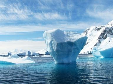
There are eight countries that extend above the Arctic Circle. I have a question for you for each country, with a couple of extra for the two largest countries represented. Join me as I travel from Canada eastward along (or above) 66°30′ N.

A photo quiz by reedy. Estimated time: 5 mins.
  1. Home
  2. »
  3. Quizzes
  4. »
  5. Geography Trivia
  6. »
  7. Polar Regions

Author
reedy
Time
5 mins
Type
Photo Quiz
Quiz #
408,309
Updated
Oct 26 24
# Qns
10
Difficulty
Average
Avg Score
7 / 10
Plays
369
Awards
Top 20% Quiz
Last 3 plays: Guest 75 (6/10), fire261 (5/10), Guest 35 (7/10).
-
Question 1 of 10
1. Nestled in the boreal forest of the Northwest Territories, this lake is the largest lake fully within Canada's borders, and the eighth largest lake in the world, by surface area. What is its name? Hint


Question 2 of 10
2. Named for whaling captain William Penny, the Penny Ice Cap is a 6,000 km2 glacier located within Auyuittuq National Park, which is on the same island as Iqaluit, the capital of the Canadian territory of Nunavut. Which island? Hint


Question 3 of 10
3. The Greenland ice sheet is vast, just over 1.7 million km2 in area, extending almost 2,900 km south to north and 1,100 km across at its widest point. Referred to in Danish as 'Grønlands indlandsis', what is the ice sheet called in Greenlandic? Hint


Question 4 of 10
4. The island of Grímsey intersects the Arctic Circle, making it the only part of this country, known for its active volcanoes and geysers, to do so. Which country?

Answer: (One word)
Question 5 of 10
5. Established in 2008, the Global Seed Vault is a repository of more than a million distinct crop samples, protected on the island of Spitsbergen in which Norwegian archipelago in the Arctic Ocean? Hint


Question 6 of 10
6. Every winter since 1989, an ice hotel has been constructed in the Swedish town of Jukkasjäarvi, created from blocks of ice cut from which river, that forms a 200 km stretch of the border between Sweden and Finland? Hint


Question 7 of 10
7. Straddling the Arctic Circle near Rovaniemi, Finland, this amusement park and themed village is the "official home of Santa Claus," 365 days a year (even Christmas day!). In which Finnish county, the largest and northernmost, does Santa live? Hint


Question 8 of 10
8. The Alyosha Monument was erected in 1974 "To the Defenders of the Soviet Arctic during the Great Patriotic War" (WWII). In which port city, the world's largest city north of the Arctic Circle, is it located? Hint


Question 9 of 10
9. The closest Russian island to the North Pole is Rudolf Island, part of the uninhabited archipelago named 'Franz Josef Land' between the Kara and Barents Seas. Which expedition discovered and named the archipelago? Hint


Question 10 of 10
10. Point Barrow, Alaska marks the northernmost point of the United States, but it also marks the division between which two marginal seas of the Arctic Ocean? Hint


(Optional) Create a Free FunTrivia ID to save the points you are about to earn:

arrow Select a User ID:
arrow Choose a Password:
arrow Your Email:


View Image Attributions for This Quiz

Most Recent Scores
Dec 20 2024 : Guest 75: 6/10
Dec 10 2024 : fire261: 5/10
Dec 04 2024 : Guest 35: 7/10
Nov 24 2024 : Guest 216: 6/10
Nov 15 2024 : Guest 76: 5/10
Nov 01 2024 : Guest 54: 8/10
Oct 24 2024 : Guest 136: 6/10

Quiz Answer Key and Fun Facts
1. Nestled in the boreal forest of the Northwest Territories, this lake is the largest lake fully within Canada's borders, and the eighth largest lake in the world, by surface area. What is its name?

Answer: Great Bear Lake

Great Bear Lake straddles the Arctic Circle, with just the upper extension (Dease Arm) crossing the line. In the NASA picture given, the lake is canted slightly to the right, and the arm that you see on the right side of the picture is the portion that extends above 66°30′ N.

The area of Great Bear Lake is 31,153 km2, with a length of 373 km.
2. Named for whaling captain William Penny, the Penny Ice Cap is a 6,000 km2 glacier located within Auyuittuq National Park, which is on the same island as Iqaluit, the capital of the Canadian territory of Nunavut. Which island?

Answer: Baffin Island

Auyuittuq National Park was originally established in 1972 as Baffin Island National Park, but the name was changed in 1976 to better reflect the Inuit history and culture in the region. At first it only created as a national park reserve, but that was upgraded to full national park status in the year 2000.

Auyuittuq National Park is a full 21,470 km2 in size, located on the Cumberland Peninsula of Baffin Island, just over 400 km north of Iqaluit. The nearest towns (that provide access to the park) are Qikiqtarjuaq and Pangnirtung.
3. The Greenland ice sheet is vast, just over 1.7 million km2 in area, extending almost 2,900 km south to north and 1,100 km across at its widest point. Referred to in Danish as 'Grønlands indlandsis', what is the ice sheet called in Greenlandic?

Answer: Sermersuaq

Greenlandic is an Eskimo-Aleut language that is closely related to the Inuit languages of Canada. It was declared the official language of Greenland in 2009, with about 85% of the population speaking one of the three dialects. Danish is the island's other language, dating back to colonial days.

The other terms given for 'ice sheet' come from Afrikaans (ysplaat), German (eisschild), and Polish (lodowiec).

Greenland's ice sheet covers about 80% of the island's surface area and ranges between two and three kilometers in thickness. Approximately two thirds of Greenland extends north of the Arctic Circle, up to 83°37′39″N.
4. The island of Grímsey intersects the Arctic Circle, making it the only part of this country, known for its active volcanoes and geysers, to do so. Which country?

Answer: Iceland

The small island of Grímsey (just 5.3 km2 in area) is approximately 40 km north of Iceland's mainland north coast, and is the northernmost inhabited Icelandic territory. As of the 2018 census, Grímsey had a population of 61, and just one settlement, by the name of Sandvík.

In 2017, an eight-tonne spherical stone monument, entitled 'Orbis et Globus', was placed along the invisible line of the Arctic Circle, and it is periodically moved to reflect the continuous oscillations in the Earth's axis (it is moving northwards at a rate of approximately 14.5 metres per year).
5. Established in 2008, the Global Seed Vault is a repository of more than a million distinct crop samples, protected on the island of Spitsbergen in which Norwegian archipelago in the Arctic Ocean?

Answer: Svalbard Archipelago

The Svalbard Archipelago is situated about halfway between the north coast of Norway and the North Pole, falling between the latitudes of 74° and 81° N. There are three main islands in the archipelago (Spitsbergen, Nordaustlandet and Edgeøya), but only the largest island (Spitsbergen) has a permanent population.

About 60% of the 61,022 km2 total area of the island group is covered in glaciers, and 65% of the archipelago, according to worldatlas.com, is "protected by seven National Parks, six Nature Reserves, 15 bird sanctuaries, and one geotope protected area."

The Global Seed Vault was established by American agriculturist Cary Fowler, with support from the Crop Trust, NordGen, and the Norwegian Government.
6. Every winter since 1989, an ice hotel has been constructed in the Swedish town of Jukkasjäarvi, created from blocks of ice cut from which river, that forms a 200 km stretch of the border between Sweden and Finland?

Answer: Torne River

Jukkasjärvi's ice hotel was the first of its kind in the world, and is a concept that has been copied by others since. In 1989, Jukkasjäarvi, about 200 km north of the Arctic Circle, was the site of an art exhibit of ice and snow sculptures that became the basis for the ice hotels that followed. The ice blocks are cut out of the Torne River every year in March and stored until it is time to build the hotel for the winter season. Artists are invited to design the rooms, and every year it is very different from the last. There is even a chapel (as seen in the photo), which makes for a popular destination wedding venue.

The Torne River starts at Lake Torne (near the border with Norway) and flows southeast until it reaches the Gulf of Bothnia at Tornio (Finland) after a distance of 522 km. The river forms the border between Sweden and Finland from the point where the Torne is joined by the Muonio River.
7. Straddling the Arctic Circle near Rovaniemi, Finland, this amusement park and themed village is the "official home of Santa Claus," 365 days a year (even Christmas day!). In which Finnish county, the largest and northernmost, does Santa live?

Answer: Lapland

Each of the Nordic countries claim that Santa resides within its borders. In Finland, traditionally, Santa (Joulupukki in Finnish) lived in the fell Korvatunturi, which today lies within Urho Kekkonen National Park, adjacent to the border with Russia. In Rovaniemi (about 350 km away), the Santa Claus Village was opened in 1985. Then in 1998, another attraction, called SantaPark (just a 20 minute drive away, was built into a large cavern (a former air raid shelter) as 'Santa Claus's own home cavern.'

And all of this falls within the County of Lapland, which comprises about one third of the total area of Finland. The name 'Lapland' comes from the term 'Lapp', which is the name that Scandinavians gave to the Sami people, who have lived in the region (encompassing Norway, Sweden and Finland's Arctic regions, as well as part of the Kola Peninsula in Russia) for several thousand years.
8. The Alyosha Monument was erected in 1974 "To the Defenders of the Soviet Arctic during the Great Patriotic War" (WWII). In which port city, the world's largest city north of the Arctic Circle, is it located?

Answer: Murmansk

During the Second World War, the port city of Murmansk (on the eastern shore of Kola Bay in the Barents Sea) was a key target of Nazi Germany when Hitler decided to invade the Soviet Union in 1941. Operation Silver Fox sought to cut Murmansk off from a potential avenue for the Allies to provide aid to the Soviets while his main overland thrust was happening (Operation Barbarossa) towards Moscow.

While German (and Finnish) forces did take ground in the operation, they were ultimately unsuccessful in achieving their strategic objectives, and Murmansk (and its rail link to the rest of the Soviet Union) remained intact. While this battle ended in November of 1941, the defeat of German forces in the Arctic was not complete until October 19, 1944. The 35.5 metre tall Alyosha Monument was dedicated on the 30th anniversary of that date, and the tomb of the unknown soldier was moved to the site the following year (in 1975).
9. The closest Russian island to the North Pole is Rudolf Island, part of the uninhabited archipelago named 'Franz Josef Land' between the Kara and Barents Seas. Which expedition discovered and named the archipelago?

Answer: Austro-Hungarian North Pole Expedition of 1872-1874

Upon discovery by the 1872 Austro-Hungarian North Pole Expedition (led by Captain Karl Weyprecht and Julius von Payer), the archipelago was named for Franz Joseph I, Emperor of Austria, King of Hungary, Bohemia, Galicia and Lodomeria, Croatia, Slavonia and Dalmatia. Ownership of the islands was disputed (or ignored) for many years until the Soviet Union annexed them on 15 April 1926.

Rudolf Island (named for Archduke Rudolf, Crown Prince of Austria, Hungary and Bohemia) is the closest piece of real estate to the North Pole in the eastern hemisphere.
10. Point Barrow, Alaska marks the northernmost point of the United States, but it also marks the division between which two marginal seas of the Arctic Ocean?

Answer: Chukchi and Beaufort Seas

The Arctic Ocean has nine marginal seas, and Alaska borders two of them along its northern shore: the Beaufort Sea to the east (also borders Canada) and the Chukchi Sea to the west (between the USA and Russia). Alaska also touches the Bering Sea along its eastern shore, but the Bering Sea is not marginal to the Arctic Ocean, as it lies south of the Chukchi Sea, separated by the Bering Strait.

Continuing westward around the Arctic Circle, the remaining marginal seas are the East Siberian Sea, the Laptev Sea, the Lara Sea (all bordering only Russia), the Queen Victoria and Barents Seas (bordering Russia and Norway), and the Greenland and Wandel Seas (bordering Norway and Greenland).

Honourable mention goes to the Lincoln Sea, which borders Greenland and Canada's Ellesmere Island - recognized by the International Hydrographic Organization (IHO), but not by the International Maritime Organization (IMO).
Source: Author reedy

This quiz was reviewed by FunTrivia editor agony before going online.
Any errors found in FunTrivia content are routinely corrected through our feedback system.
Related Quizzes
This quiz is part of series Photographic Memory, Take 11:

My next collection of ten photo quizzes, covering a mixture of FunTrivia categories. Enjoy!

  1. Feathered Friends in the Wild Easier
  2. Let's Talk About Sax Average
  3. We the North Average
  4. Insert Coins to Continue (1983) Average
  5. There's a Fungus Among Us Average
  6. Flags of the Pacific Easier
  7. Oboes, Oh Boy! Average
  8. The Sun Will Come Out Tomorrow Average
  9. The Okanagan Landscape Average
  10. Do You Know What You're Doing? Very Easy

Also part of quiz list
12/21/2024, Copyright 2024 FunTrivia, Inc. - Report an Error / Contact Us