FREE! Click here to Join FunTrivia. Thousands of games, quizzes, and lots more!
Quiz about Difficult Meteorology

Difficult Meteorology Trivia Quiz


A quiz on meteorologcal phenomena

A multiple-choice quiz by wallos. Estimated time: 5 mins.
  1. Home
  2. »
  3. Quizzes
  4. »
  5. Science Trivia
  6. »
  7. Environment
  8. »
  9. Weather

Author
wallos
Time
5 mins
Type
Multiple Choice
Quiz #
86,510
Updated
Dec 03 21
# Qns
10
Difficulty
Difficult
Avg Score
5 / 10
Plays
1733
Last 3 plays: Guest 73 (6/10), Guest 67 (3/10), Guest 162 (6/10).
- -
Question 1 of 10
1. From which generic type of cloud do thunderstorms/tornados come from? Hint


Question 2 of 10
2. What does an isohyet represent? Hint


Question 3 of 10
3. According to the Beaufort scale, what wind speed (in knots) is deemed to be a fresh breeze? Hint


Question 4 of 10
4. Can steam fog form when warm air moves over cold water?


Question 5 of 10
5. What is the term for an anticlockwise change in wind direction without an alteration in strength? Hint


Question 6 of 10
6. The Dry Adiabatic Lapse Rate (DALR) is approximately equal to? Hint


Question 7 of 10
7. What is CAPE? Hint


Question 8 of 10
8. What type of cloud would be more to likely give showers of precipitation reaching the ground? Hint


Question 9 of 10
9. The lowest 100km of the atmosphere is divided into four parts. What is the correct order from the ground up? Hint


Question 10 of 10
10. Which of these is a formation requirement of a tropical cyclone (hurricane)? Hint


(Optional) Create a Free FunTrivia ID to save the points you are about to earn:

arrow Select a User ID:
arrow Choose a Password:
arrow Your Email:


Most Recent Scores
Jan 06 2025 : Guest 73: 6/10
Dec 30 2024 : Guest 67: 3/10
Dec 27 2024 : Guest 162: 6/10
Dec 02 2024 : Guest 14: 2/10
Nov 27 2024 : Guest 185: 5/10
Nov 26 2024 : Guest 198: 0/10

Score Distribution

quiz
Quiz Answer Key and Fun Facts
1. From which generic type of cloud do thunderstorms/tornados come from?

Answer: Cumulonimbus

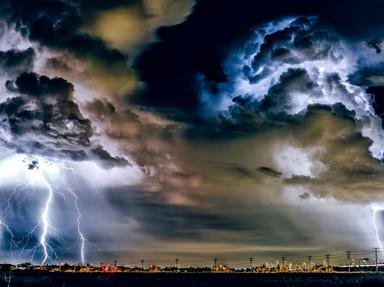
Cumulus (Cu) clouds have mainly flat bottoms and distinct fluffy, 'cauliflower-like' tops. Cumulonimbus (Cb) clouds can have ragged bottoms (due to downdrafts) but their tops reach the top of the troposphere (some times the updrafts are so strong they tops punch through) and become glaciated and less distinct.

A mature Cb cloud will then spread out along the tropopause giving a shape like an anvil. Cumulonimbus clouds are the only source on thunderstorms and if the wind shear is great enough can cause tornadoes. Towering Cu are similar to Cbs but are not glaciated and can cause heavy showers. Nimbostratus (Ns) clouds are rare and are associated with heavy rainfall. Stratocumulus (Sc) clouds are quite common and are a major source of drizzle precipitation.
2. What does an isohyet represent?

Answer: A line of equal rainfall

You see isohyets on a rainfall map/chart.
3. According to the Beaufort scale, what wind speed (in knots) is deemed to be a fresh breeze?

Answer: 17-21kts

The Beaufort scale is a scale to give a numerical representation of wind speed to observed effect of the wind. Initially Rear Admiral Beaufort of the Royal Navy around 1805 devised a scheme which related wind force to its effect on a 'well conditioned man-o-war' (a ship). The Beaufort scale as it in use today was accepted in 1926 and revised slightly in 1946.
4. Can steam fog form when warm air moves over cold water?

Answer: No

Advection fog forms when warm air moves over cool water (or warm moist air moves over cool ground). Steam fog is formed when cold air moves over warm water.
5. What is the term for an anticlockwise change in wind direction without an alteration in strength?

Answer: backing

In the Southern Hemisphere winds back as a cold front passes. Veering is a clockwise change, freshening is an increase in wind strength and moderating is a decrease in wind stregnth. Both freshening and moderating imply no change in wind direction.
6. The Dry Adiabatic Lapse Rate (DALR) is approximately equal to?

Answer: -10 degrees K/1000m

The DALR is a measure of how a dry air parcel, which does not mix with the surrounding atmosphere would cool as it rises. The parcel expands as it rises due to decreasing pressure and thereby cools.
7. What is CAPE?

Answer: Convective Available Potential Energy

CAPE is one measure of the instability of the atmosphere. It gives an indication of the avaiable energey a parcel would have if it was buoyant in comparison to the environmental conditions. On a Skew T/Log P diagram (or F160 as it is known in Australia) it is the area where the parcel trace is greater than the environmental trace.
8. What type of cloud would be more to likely give showers of precipitation reaching the ground?

Answer: Cumulus

Cumulus (Cu) clouds are generally formed by convective processes (giving their distinctive flat bases and cauliflower-like tops). Stratocumulus (Sc) clouds are not in distinct cells like cumulus clouds, and can be formed by mixing or also by moisture trapped under an inversion layer. Any precipitation from Sc is most likely to be drizzle. Cirrocumulus (Cc) clouds are rare, above 20,000ft and are not associated with any precipitation. Altocumulus (Ac) clouds are above 8,500ft and are either formed in very hot, dry climates where convective processes reach the middle of the troposphere or by some mid level processes and can indicate mid level instability (especially altocumulus castellanus). Altocumulus clouds can give showers but it is less likely to reach the ground as either the atmosphere is very dry below the cloud thereby the precipitation would evaporate or the atmosphere is too cool to promote coalescence as is required of droplet formation.
9. The lowest 100km of the atmosphere is divided into four parts. What is the correct order from the ground up?

Answer: Troposphere, Stratosphere, Mesosphere and Thermosphere

The troposphere extends to about 15km above the earth's surface(dependent on laltitude), the stratosphere to about 50km, the mesosphere to about 80km and the thermosphere above that.
10. Which of these is a formation requirement of a tropical cyclone (hurricane)?

Answer: All of these

All of these things are required as well as a pre-existing low pressure area and upper level divergence.
Source: Author wallos

This quiz was reviewed by FunTrivia editor crisw before going online.
Any errors found in FunTrivia content are routinely corrected through our feedback system.
Related Quizzes
1. A Question of Weather Easier
2. Quite a Cloudy Day Average
3. Hazard a Guess? Average
4. Dust In the Wind Average
5. Let It Rain Average
6. Riders on the Storm Average
7. Weird Weather Average
8. Sometimes It Snows In April Average
9. Seasonal Weather in the USA Average
10. The Science of Snowflakes Average
11. Lightning Facts Average
12. Marine Weather Average

1/22/2025, Copyright 2025 FunTrivia, Inc. - Report an Error / Contact Us