FREE! Click here to Join FunTrivia. Thousands of games, quizzes, and lots more!
Tabulating Territories Trivia Quiz
Canada
Today we are visiting Canada's three territories. Your task is to sort through the geographic features, locations, and cities in order to list each one with its correct territory. Good luck!
A classification quiz
by ponycargirl.
Estimated time: 3 mins.
Last 3 plays: teachdpo (10/15), Guest 68 (4/15), Baldfroggie (9/15).
Northwest Territories
Yukon
Nunavut
Klondike Gold Rush 1896-1899Named for riverBanks IslandHudson BayMary River MineFort Selkirk Volcanic FieldAlertYellowknifeQuttinirpaaq National ParkWhitehorseIqaluitMount LoganDiavik Diamond MineChurch of our Lady of Good HopeGreat Bear Lake
* Drag / drop or click on the choices above to move them to the correct categories.
Most Recent Scores
Dec 10 2024
:
teachdpo: 10/15
Dec 10 2024
:
Guest 68: 4/15
Nov 22 2024
:
Baldfroggie: 9/15
Nov 20 2024
:
Edzell_Blue: 12/15
Nov 19 2024
:
hosertodd: 13/15
Quiz Answer Key and Fun Facts
1. Great Bear Lake
Answer: Northwest Territories
Great Bear Lake is the largest lake in Canada that is totally contained there; both Lake Superior and Lake Huron are larger, but they are shared with the United States. Formed by glaciers during the Pleistocene Epoch, the lake is larger than the country of Belgium, with an area of 12,275 miles.
Great Bear Lake was named for the bears that the first explorers in the area saw on its shorelines, and was originally called Bear Lake. The word "great" was added when the lake's size was determined. Bisected by the Arctic Circle, the lake is covered with ice eight months of the year, from November through July.
2. Banks Island
Answer: Northwest Territories
While the mainland area of the Northwest Territories has a subarctic climate, the islands have an Arctic tundra climate, with short, cool summers and very long, cold winters. Part of the area called the Arctic Archipelago, Banks Island, named for Sir Joseph Banks, only has one permanent settlement called Sachs Harbour; in 2021 it had a population of 104. Most people make their living by hunting or trapping; tourism is also an important industry.
3. Diavik Diamond Mine
Answer: Northwest Territories
The Northwest Territories does have diamond mines, and Canadian residents are encouraged to buy local rather than diamonds from other continents that might be considered blood diamonds. Owned by the Rio Tinto Group and Dominion Diamond Corporation, the Diavik Diamond Mine produces approximately 7 million carats annually and employs around 1,100 people.
Its location is rather remote, and is only accessible by ice road or air.
4. Church of our Lady of Good Hope
Answer: Northwest Territories
One of the National Historic Sites located in the Northwest Territories, the Church of our Lady of Good Hope was constructed from 1865-1885 by the Oblate Fathers, a Roman Catholic religious order; its purpose was to assist in the conversion of Indigenous people in Canada.
It's a very small building - only 45 x 25 feet - but is a beautiful example of Carpenter Gothic architecture with its exquisitely painted sanctuary.
5. Yellowknife
Answer: Northwest Territories
The capital of the Northwest Territories, Yellowknife, is considered to be the only city in the Northwest Territories. Located about 250 miles from the Arctic Circle, the city was founded in 1934, after gold was discovered in the area, and became the capital in 1967.
Although the gold mining industry was abandoned due to high cost and low prices in 2004, diamonds have subsequently been discovered in the area. Mining and government services, along with tourism, are important economic activities in Yellowknife.
6. Named for river
Answer: Yukon
The smallest Canadian territory, Yukon was named after the Yukon River, which is the longest river in the territory. With a source in the province of British Columbia, the Yukon River flows approximately 1980 miles to Alaska and empties into the Bering Sea.
It is known for its long salmon runs, and villages along the river rely heavily on the fishing industry for both personal needs and commercial income.
7. Klondike Gold Rush 1896-1899
Answer: Yukon
Within three years an estimated 100,000 miners made their way to the Klondike region of what is now the Yukon Territory. It took some time for the news of the discovery of gold there in 1896 to reach miners in California, and traveling to the remote, cold region was extremely difficult. Centered around Dawson City, the boom was relatively short-lived, as gold was found in other areas, however, the increase in population prompted the separation of the Yukon from the Northwest Territories in 1898.
8. Whitehorse
Answer: Yukon
Whitehorse is the capital and largest city in Yukon. While members of the First Nations have lived in the area for centuries, the area became inhabited by miners who were looking for gold in 1898 - not because of the gold there, but because of the copper.
In 1953 the territorial seat was moved from Dawson City to Whitehorse. The city is known for its sports; the annual Yukon Quest, a 1,000 miles sled dog race, begins there, and it has hosted the Canada Winter Games and Arctic Winter Games.
9. Mount Logan
Answer: Yukon
Mount Logan, the highest peak in Canada, is located in southwestern Yukon. It was first discovered in 1890, but it was 1925 before anyone tried to reach its summit. The team of climbers had to walk 120 miles before establishing their base camp on the Logan Glacier; it took 65 days to travel from the closest town, McCarthy, Alaska, to reach the mountain.
Interestingly, Mount Logan is getting a bit taller - approximately .35 mm - every year due to tectonic uplifting. Its exact height, calculated in 1992, was 19,551 feet at the time.
10. Fort Selkirk Volcanic Field
Answer: Yukon
While it may be surprising to think there are volcanoes in such a cold region, Yukon has more than 100 volcanic areas that are considered to be part of the Pacific Ring of Fire. The Fort Selkirk Volcanic Field is a monogenetic volcanic field, which means there are many single volcanoes that only erupted one time.
The majority of them erupted centuries ago, but there is one called Volcano Mountain which is still active. Its main hazard in the future could be lava flows, which could produce forest fires in the area.
11. Quttinirpaaq National Park
Answer: Nunavut
Quttinirpaaq National Park is the second most northern national park in the world after Northeast Greenland National Park in Greenland and the second largest national park in Canada. Located on Ellesmere Island, the area became a national park in 2000.
While it is home to an abundance of wildlife, such as Arctic hares and wolves, caribou, and polar bears, there has never been much of a human presence in the area. An estimated 50 people visit the park annually. At one time, however, it was used as a base of polar expeditions.
12. Alert
Answer: Nunavut
Alert, Nunavut, is an interesting place because it is the northern-most continuously inhabited place in the world! Located on Ellesmere Island, just 508 miles from the North Pole, its population in 2016 was 0. That is because it serves as an station for the Canadian Forces Station Alert, and people are typically sent there for only 6 months at a time.
It is named for the HMS Alert of the Royal Navy, whose crew spent the winter of 1875-76 there during an Arctic expedition.
13. Iqaluit
Answer: Nunavut
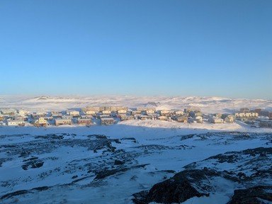
The territory of Nunavut, the largest by area in Canada, was separated from the Northwest Territories in 1999. Iqaluit was chosen by the area's residents to be its capital in 1995. Located on Baffin Island, Iqaluit is the only city in Nunavut, and the northernmost city in Canada. Because it is located on an island, there is no highway to connect it to other settlements; Iqaluit is only accessible by boat.
The city does, however, have a local road system. Mining, tourism, fishing, and handcrafts are important industries there.
14. Hudson Bay
Answer: Nunavut
While Hudson Bay borders on Manitoba, Ontario, and Quebec, it is politically controlled by Nunavut. Originally controlled by Hudson Bay Company, which had been given a trade monopoly in the area by England by royal charter in 1677, the land touching the bay was called Rupert's Land.
When the company lost its charter, almost two hundred years later, Rupert's Land became part of the Northwest Territories, and, of course, Nunavut was carved from the Northwest Territories in 1999. It was decided in 1993 that all of the islands in Hudson Bay would be governed by Nunavut.
It probably wasn't very easy to draw boundaries in the water!
15. Mary River Mine
Answer: Nunavut
As is the case in the other Canadian territories, mining is an important occupation in Nunavut. Located on Baffin Island, the Mary River Mine was opened in 2014. The mine, first studied in 1962, is believed to contain one of the richest iron ore deposits in the world.
In 2009 it was determined that Canada contains about 42% of the world's iron ore, and most of it comes from either the Mary River Mine or Schefferville, Quebec.
This quiz was reviewed by FunTrivia editor agony before going online.
Any errors found in FunTrivia content are routinely corrected through our feedback system.