FREE! Click here to Join FunTrivia. Thousands of games, quizzes, and lots more!
Benin Quizzes, Trivia and Puzzles
Benin Quizzes, Trivia

Benin Trivia

Benin Trivia Quizzes

  1. Home
  2. »
  3. Quizzes
  4. »
  5. Geography Trivia
  6. »
  7. Africa

Fun Trivia
5 Benin quizzes and 50 Benin trivia questions.
1.
  Been in Benin?    
Multiple Choice
 10 Qns
Have you been in Benin? No? Come with me on this trip across this skinny African country!
Average, 10 Qns, Ewefojhghjkbw, Nov 19 24
Recommended for grades: 10,11,12
Average
Ewefojhghjkbw
Nov 19 24
50 plays
2.
  Republic of Benin, Formerly Dahomey   best quiz  
Multiple Choice
 10 Qns
How much do you know about this French-speaking country on the 'Slave Coast' of Western Africa?
Average, 10 Qns, looney_tunes, Sep 21 12
Average
looney_tunes editor
4746 plays
3.
Come In Come In to Benin to Benin
  Come In, Come In, to Benin, to Benin    
Photo Quiz
 10 Qns
Welcome, welcome, welcome to the Republic of Benin. Let's take a trip around this small west African country to see what we can discover...
Average, 10 Qns, EnglishJedi, May 10 15
Average
EnglishJedi gold member
313 plays
4.
  Have You Been In Benin?   great trivia quiz  
Multiple Choice
 10 Qns
A quiz all about Benin. Enjoy.
Average, 10 Qns, salami_swami, Oct 22 11
Average
salami_swami gold member
1081 plays
5.
  Benin Trivia    
Multiple Choice
 10 Qns
What do you know about this African country?
Average, 10 Qns, Vermic, Mar 21 20
Average
Vermic
Mar 21 20
1166 plays

Benin Trivia Questions

1. The Republic of Dahomey existed from 1960 until 1975, when it was given the more politically-neutral name of Benin. After what geographical feature was the country renamed?

From Quiz
Republic of Benin, Formerly Dahomey

Answer: Bight of Benin

The area was called Dahomey while it formed part of French West Africa, and retained the name on gaining independence in 1960. However, the Kingdom of Dahomey was only the southern third of the present country of Benin, so the use of that name ignored the regions of Atakora in the northwest and Borgu in the northeast. In 1975 the Marxist government renamed it The People's Republic of Benin; in 1990, on completion of the new constitution, this was changed to The Republic of Benin. The Bight of Benin is the part of the Gulf of Guinea on which Benin has its coastline.

2. Since 1975 the country has been called Benin. What was Benin called before that?

From Quiz Benin Trivia

Answer: Dahomey

3. In Benin, there is a memorial site at the end of a two-and-a-half-mile long route that was once used to transport slaves to the New World. What is this memorial called?

From Quiz Have You Been In Benin?

Answer: Door of No Return

Benin is also referred to as the "Slave Route", and for good reason. A 2.5 mile (4 km) long trail led chained, beaten, and branded slaves to ships that would take them to their new "lives" in the New World. A two-and-a-half-mile long journey is hard enough; but try being chained, beaten, and branded! The route begins what is now the Ouidah Museum of History to the Door of No Return. This "door" symbolizes the end of a slave's life in Africa. Most slaves would never return to their homes after being shipped to the Americas. Of course, nobody wanted to leave their homeland to become slaves in the Americas. Some reportedly ate sand from the beach so as not to forget their homeland. Others even chose death by strangling themselves with the chains they were tied with. This all happened near the site of the Door of No Return.

4. What major African river forms the border between Benin and its neighbour to the northeast, Niger?

From Quiz Republic of Benin, Formerly Dahomey

Answer: Niger

The Niger River is the main river of western Africa, stretching 4,180 km (2,600 mi) from its origin in the highlands of southern Guinea through Mali and Niger, along the border between Niger and Benin, and then through Nigeria where it enters the Atlantic Ocean. It is the third longest river in Africa, behind the Nile and the Congo (also known as the Zaire).

5. The capital of Benin is?

From Quiz Benin Trivia

Answer: Porto Novo

The largest city, however, is Cotonou.

6. What is the Bight of Benin?

From Quiz Have You Been In Benin?

Answer: Body of water

A bight is a type of bay. The Bight of Benin is part of the Gulf of Guinea. The Bight of Benin also served as the hub of the slave market in Ouidah, Benin.

7. When slaves would leave Benin to be shipped to the Americas, they would first walk around a specific object several times. What was this location, which now is the site of a memorial?

From Quiz Have You Been In Benin?

Answer: Tree of Forgetfulness

The Tree of Forgetful was a tree that was supposedly magical to many of the tribes of Africa. When the slave reached this tree, they would walk around it. The men circled the tree nine times and the women seven times. They would do this in hopes to erase their memory of their past lives and identities in Africa before being shipped to live lives as slaves in the New World. Today, the tree is gone, but a memorial stands in its place.

8. Benin is a key-shaped country (a thin rectangle with a rounded swelling on one end). In which portion of the country is the rounded bulge located?

From Quiz Republic of Benin, Formerly Dahomey

Answer: North

Benin runs north-south, with a bulge on the northern end. Its length is roughly of 700 km (435 mi), and its maximum width is about 325 km (202 mi). The southern coastline measures 121 km (75 mi).

9. Which countries are located west and east of Benin?

From Quiz Benin Trivia

Answer: Togo and Nigeria

10. Ouidah has a Repentance Monument, where people go every year to ask for forgiveness for all those who assisted the slave trade. What is this monument called?

From Quiz Have You Been In Benin?

Answer: Zomachi

The Zomachi is a monument that was built in 1998 to ask forgiveness for ancestors who were involved in the slave trade. It symbolizes repentance and reconciliation. Ever year, on the third Sunday of January, people gather at the memorial site to pray to God for past sins to be forgiven. Both descendants of slaves and of slave merchants gather there to ask forgiveness for their ancestors. The Zomai were huts where slaves were kept until they were shipped to the Americas. "Zomai" refers to the extreme darkness inside the huts.

11. With an area of 112,622 sq km (43,484 sq mi), Benin is about the same size as which American state?

From Quiz Republic of Benin, Formerly Dahomey

Answer: Virginia

Virginia has an area of 110,784 sq km (42,774 sq mi). Rhode Island (4,002 sq km) and Massachusetts (27,337 sq km) are significantly smaller, while Alaska (1,717,854 sq km) is dramatically larger. Other countries with an area similar to that of Benin include Honduras (112,492 sq km) and Bulgaria (110,879 sq km). Benin is one of the smaller countries in western Africa, being an eighth the size of its eastern neighbour, Nigeria, but twice the size of Togo to its west.

12. How long is the coastline of Benin?

From Quiz Benin Trivia

Answer: 121 km

13. Though most noted as being popular in Haiti, this magical religion spread in Africa as well, and even comes from a word from the Fon language of Benin. What religion is this?

From Quiz Have You Been In Benin?

Answer: Voodoo

Voodoo comes from the word "vodun", which means "god" or "spirit" in the Fon language of the people of Benin. Depending on the location of where this magic practicing religion is, it can be spelled different. It is spelled as "vodun", "vodon", "voodoun", "voodoo", "voodou", and many other variations.

14. How is the climate of Benin described in the 2010 CIA World FactBook?

From Quiz Republic of Benin, Formerly Dahomey

Answer: Hot and humid in the south, semi-arid in the north

The average daily temperature on the coast ranges from a minimum of 24 °C (75.2 °F) to a maximum of 31 °C (87.8 °F). Annual rainfall on the coast averages 1,360 mm (53.54 in), spread across two rainy seasons (April to July and September to November) and two dry seasons (December to April and July to September). The north of Benin borders on the region called the Sahel, a zone of transition between the Sahara desert in the north and the savannas to the south which stretches across the north of Africa. A dry wind from the Sahara called the harmattan causes vegetation in this region to dry up dramatically during the season from December to March.

15. The highest point in Benin is Mount Sokbaro. But how high is this mountain?

From Quiz Benin Trivia

Answer: 658 m.

16. Benin is a fairly flat country, with an average height above sea level of 200 m (650 ft), but there are some mountains in the northwest. The peak of which mountain is the highest point in Benin, with an altitude of 658 m (2160 ft)?

From Quiz Republic of Benin, Formerly Dahomey

Answer: Sokbaro

Mont Sokbaro is part of the Atakora Range which runs from Ghana (where it is called the Akwapim Hills) through Togo (where it is called the Togo Range) to Benin. Mont Sokbaro is on the border between Togo and Benin, in the department of Donga. Alibori is the northeastern-most department of Benin.

17. How many natural harbors can you find in Benin?

From Quiz Benin Trivia

Answer: None, there are no natural harbors in Benin

18. The national animal of Benin can be found twice on its coat of arms. I'll give you a hint: it is spotted. What is it?

From Quiz Have You Been In Benin?

Answer: Leopard

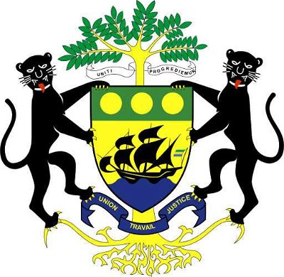
Benin's coat of arms has a leopard on either side of a shield. The shield is split into four sections, each with a picture that represents a piece of Benin's history. At the bottom of the shield is Benin's motto, in French. The English translation of this motto is "Fellowship, Justice, Work".

19. Near the border with Burkina Faso, surrounded by the Atakora mountain range and bounded by a river, is Benin's most important national park. What is its name (in English)?

From Quiz Republic of Benin, Formerly Dahomey

Answer: Pendjari National Park

Parc National de la Pandjari, as it is called in Benin's official language of French, is named for the Pendjari River which forms the border with Burkina Faso. It is part of a large complex of protected areas spanning Burkina Faso, Benin and Niger, called "The WAP", which also includes Arli National Park in Burkina Faso and W National Park. The area is known for its wildlife, including elephants, monkeys, lions, hippopotamuses, buffalo, various antelopes, and a vast array of birds, including many species of stork. It was considered one of the last habitats of the Painted Hunting Dog (Lycaon pictus), but the species is now considered to be locally extinct.

20. In what town is the Benin Government situated?

From Quiz Benin Trivia

Answer: Cotonou

Porto Novo is the capital of Benin, but Cotonou is the seat of the government.

21. The main language in Benin is French, and the country also shares many similarities with France. For example, what do both France and Benin call political divisions in their countries?

From Quiz Have You Been In Benin?

Answer: Departments

Many places around the world use departments as their division. France, Benin, Haiti, Paraguay, Argentina, and Gabon use departments, to name a few. Until 1999, there were six departments in Benin. In 1999, however, each department was split into two, forming twelve departments. The six new departments were not given capital cities. The twelve departments are further subdivided into 77 communes.

22. Cotonou, the largest city of Benin, is located close to Lake Nokoue, where the village of Ganvie can be found. What is unusual about Ganvie which brings tourists flocking with their cameras?

From Quiz Republic of Benin, Formerly Dahomey

Answer: It is built on stilts in the lake.

Ganvie, on the western edge of Lake Nokoue, is probably the largest lake village in Africa, with all buildings being on stilts. It was established four or five centuries ago by the local Tofinu people, and was built in the lake for security. The most dangerous of the other local tribes practiced a religion which forbade them from entering water, so the lake offered an excellent defense. As well as tourism, the town's economy relies on fishing.

23. Benin gained its independence in 1960 from what European country?

From Quiz Benin Trivia

Answer: France

24. The official capital of Benin is Porto-Novo, its second-largest city. In the 1990s, an important resource was discovered nearby. Which one?

From Quiz Republic of Benin, Formerly Dahomey

Answer: Petroleum

Porto-Novo, also known as Hogbonou and Adjace, was the capital of French Dahomey, and is the official capital of Benin, although Cotonou is the economic capital, and houses much of the government and diplomatic offices. It is located on the coast, in the southeast corner of the country. In the 1990s petroleum was discovered off the coast of Porto-Novo, and it has since become an important export for Benin.

25. How many colors does the flag of Benin have?

From Quiz Benin Trivia

Answer: Three

The flag of Benin has two equal horizontal bands of yellow (top) and red with a vertical green band on the hoist side.

This is category 20345
Last Updated Dec 21 2024 5:52 AM
play trivia = Top 5% Rated Quiz, take trivia quiz Top 10% Rated Quiz, test trivia quiz Top 20% Rated Quiz, popular trivia A Well Rated Quiz
new quizzes = added recently, editor pick = Editor's Pick editor = FunTrivia Editor gold = Gold Member

Teachers / educators: FunTrivia welcomes the use of our website and quizzes in the classroom as a teaching aid or for preparing and testing students. See our education section. Our quizzes are printable and may be used as question sheets by k-12 teachers, parents, and home schoolers.

 ·  All questions, answers, and quiz content on this website is copyright FunTrivia, Inc and may not be reproduced without permission. Any images from TV shows and movies are copyright their studios, and are being used under "fair use" for commentary and education.