FREE! Click here to Join FunTrivia. Thousands of games, quizzes, and lots more!
Quiz about Oh No This Ruins Everything

Oh No! This Ruins Everything! Trivia Quiz


I decided to become a mapmaker, and it was the worst decision of my life. Every few years some country decides to mess everything up and bam, oh no, it ruins everything. Here are a few contemporary examples of how the world map has changed.

A multiple-choice quiz by adams627. Estimated time: 5 mins.
  1. Home
  2. »
  3. Quizzes
  4. »
  5. Geography Trivia
  6. »
  7. Historical Geography

Author
adams627
Time
5 mins
Type
Multiple Choice
Quiz #
339,907
Updated
Dec 03 21
# Qns
10
Difficulty
Easy
Avg Score
8 / 10
Plays
3314
Awards
Top 5% quiz!
Last 3 plays: JoannieG (9/10), ozzz2002 (10/10), nikkitem (10/10).
- -
Question 1 of 10
1. In 2005, the problem wasn't that this nation changed its name; instead, it changed its capital city, from Yangon to the much-less pronounceable Naypyidaw. Oh no, that ruins everything! Back to the drawing board, I guess, to move that little star an inch north. Which Asian nation, led by a military junta until 2011, is it? Hint


Question 2 of 10
2. I could hardly sleep after seeing how arrogant the island country of Kiribati was on January 1, 1995. I know it was just a tourist-y ploy for more people to come there to see the dawn of a new millennium, but its measly action just about ruins everything! Which of these lines did I have to fix on my map to account for Kiribati's actions? Hint


Question 3 of 10
3. Don't even get me started on countries that change about two vowels in the names of their cities, just so that I have more work in front of me. Do you think it's fair to change names of cities that aren't even CAPITALS, but are big enough to be on any world map, just because you're offended by decades of British colonization? Maybe I'm just biased. Which nation's cities changed their names from Bombay to Mumbai and Calcutta to Kolkata around the turn of the millennium?

Answer: (One Word)
Question 4 of 10
4. I'm firmly of the opinion that areas shouldn't be allowed to completely mess up my maps unless they've been established for at least 60 years, which one dependency in the Caribbean certainly wasn't. After its creation in 1954, it decided in 2010 that dependency simply wasn't good enough, so Curacao and Saint Maarten became new constituent countries, in the model of Aruba's 1986 action. That ruins everything! To which European country and former colonial power did that group in the Lesser Antilles belong? Hint


Question 5 of 10
5. I never, ever get fan mail from people who buy my maps. The only letters I get are from fervent nationalists saying "So-and-so's not a country! How could you do that?" You know, guys, I didn't enjoy reprinting thousands of maps in 2008 when a Balkan country declared itself independent, so don't glorify me as a Serbia-hater or whatever. Which country's proclamation was met with mixed reviews from the world public? Hint


Question 6 of 10
6. In January 2007, an Asian nation was pretentious enough to change its name from a "Kingdom" to a "State," since having a king for two hundred years or so simply wasn't acceptable. Well, after a 2001 massacre killed nine members of the royal family, I understand why King Gyanendra would surrender power in 2006, but why do I have to make all these new maps just to change one measly little word? Which mountainous Asian nation was led by a Communist Party soon after it became a republic in 2008? Hint


Question 7 of 10
7. There are some years that I just try to put out of my memory. One was a year in which at least a dozen countries declared independence. Just think about those long, sleepless nights, phoning correspondents and printing map after map, for the next to become outdated! The emergence of Turkmenistan, Tajikistan, Georgia, Latvia, Armenia, and all those other former SSRs ruined my life for months. In which year did the map change that dramatically? Hint


Question 8 of 10
8. Look, I can accept changing a country's name once, maybe even twice. What really gets my goat is changing it back to virtually the same thing that we started with, and getting it all confused with a similarly-named country to the northwest. In 1997, an African country once known under the name of Zaire changed its name after its long-time leader Mobutu Sese Seko was ousted. What is the modern name of that country, which feels a pathological need to ruin everything? Hint


Question 9 of 10
9. One former country constantly breaks up piece-by-piece, so every few years or so, I have to readjust the maps to get it right. In 2003, the last piece of this nation dissolved to form Serbia and Montenegro, while Croatia, Macedonia, and Bosnia and Herzegovina broke apart from it in the 90s. Don't mind the humble mapmaker, who doesn't get mad when this ruins everything! Which former socialist state, an Eastern European nation led by Josip Tito during the Cold War, is it?

Answer: (One Word--Ten Letters)
Question 10 of 10
10. A simple little referendum in an African country in 2011 made me give up; not only did it force me to recolor the entire area on a political map, but then we had a whole new "largest country on the continent". Everyone's going to have to edit their trivia almanacs and encyclopedias- I'll be laughing at your misery from the unemployment line. Which country's 2011 secession led to Algeria becoming the largest country in Africa? Hint


(Optional) Create a Free FunTrivia ID to save the points you are about to earn:

arrow Select a User ID:
arrow Choose a Password:
arrow Your Email:


Most Recent Scores
Dec 18 2024 : JoannieG: 9/10
Dec 17 2024 : ozzz2002: 10/10
Dec 15 2024 : nikkitem: 10/10
Dec 12 2024 : Guest 81: 8/10
Dec 11 2024 : rossian: 10/10
Dec 10 2024 : MargaritaD: 8/10
Dec 08 2024 : Guest 173: 10/10
Dec 03 2024 : caparica: 10/10
Dec 01 2024 : Guest 70: 10/10

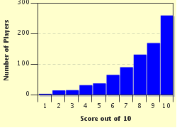
Score Distribution

quiz
Quiz Answer Key and Fun Facts
1. In 2005, the problem wasn't that this nation changed its name; instead, it changed its capital city, from Yangon to the much-less pronounceable Naypyidaw. Oh no, that ruins everything! Back to the drawing board, I guess, to move that little star an inch north. Which Asian nation, led by a military junta until 2011, is it?

Answer: Myanmar

Cave paintings found in modern-day Myanmar indicate that settlement in the Southeast Asian country began long ago, and civilization there flourished under the Taungoo and Konbaung Dynasties. In 1824, the British began a war against the Burmese that gave away much of the nation's land, and later took more territory in a second war. Finally, in 1885, the British captured the Burmese capital Mandalay and incorporated the region into the British Raj, with India. Sentiment against the colonizers heightened (a good depiction is included in George Orwell's "Burmese Days" and "Shooting an Elephant"), and Burma finally got its independence in 1948, when the trouble began.

Launched as a republic, Burma's first few years in independence saw the creation of a bicameral legislature and the emergence of native U Thant to become Secretary-General of the UN. Then, in 1962, a coup led by Ne Win created an unpopular socialist dictatorship. In 1988, Saw Maung launched a new coup, established martial law, and changed the country's name to Myanmar. When free elections in 1990 resulted in the election of a democratic party, however, the military junta refused to step down. In 2006, the national capital was moved from Yangon (which, confusingly, is also known as Rangoon) to Naypyidaw, which is further north and more centrally located. Not everyone accepted the capital change.

Then, in 2007, new riots against the government known as the Saffron Revolution began, effected by the leader under house arrest, Aung San Suu Kyi. In an election in 2010, voters agreed to change the country's name back to the "Republic of the Union of Myanmar" from the previous "Union of Myanmar," probably just to annoy mapmakers.
2. I could hardly sleep after seeing how arrogant the island country of Kiribati was on January 1, 1995. I know it was just a tourist-y ploy for more people to come there to see the dawn of a new millennium, but its measly action just about ruins everything! Which of these lines did I have to fix on my map to account for Kiribati's actions?

Answer: International Date Line

Kiribati, an island country in the Pacific Ocean, spreads a population of 100,000 over just 32 atolls and the island of Banaba. The country has no military other than a police force. Kiritimati, also known as Christmas Island, to make life difficult for mapmakers confusing it with a similarly-named island in the Indian Ocean, belongs to Kiribati and is the world's largest atoll.

Kiribati is considered the "easternmost" country in the world because of a 1995 decision criticized by some: its realignment of the International Date Line. The Date Line is not straight, unlike its opposite-of-the-world Prime Meridian counterpart, so that countries aren't split down the middle (despite its novelty), being able to drive from today to tomorrow across a five-mile island is probably not good government. Kiribati, however, extends far across several meridians, so accommodating its entire territory into one day means that the IDL shifted to approximately 150 degrees longitude. The distinction means that Kiribati's Line Islands are the first to see the new day, and accordingly, the new year. Critics of the decisions claimed that the poor island country made the realignment strictly to boost its tourism for eager visitors determined to be the first to see the "new millennium."
3. Don't even get me started on countries that change about two vowels in the names of their cities, just so that I have more work in front of me. Do you think it's fair to change names of cities that aren't even CAPITALS, but are big enough to be on any world map, just because you're offended by decades of British colonization? Maybe I'm just biased. Which nation's cities changed their names from Bombay to Mumbai and Calcutta to Kolkata around the turn of the millennium?

Answer: India

India had a long history with the British Empire, and its independence movement inspired by leaders like Mohandas Gandhi and Jawaharlal Nehru is well-known. During their rule over the subcontinent, the British used easy-to-pronounce, English-friendly names for the emerging cities- think Bombay, Bangalore, Calcutta, etc. After independence, though, Indians tried to counteract that trend. Cities were renamed to their original local names, or to words more easily spelled in local languages, or to names that rejected European, Persian, or Arab influence to more culturally-Indian monikers.

For example, Bombay became Mumbai in 1995, a change that is fairly accepted around the world. Calcutta's 2001 change to Kolkata has taken perhaps less hold. Madras became Chennai in 1996, Pondicherry became Pudicherry in 2006, and so on. Some changes have hardly taken hold at all. Bangalore was renamed Bengaluru in 2006, but the official process for renaming was stalled. Other proposed name changes included the cities of Mysore (to Mysooru), Bhopal (to Bhojpal), Delhi (to Indraprastha), and Hyderabad (to the cartographically-miserable Bhagyanagaram).
4. I'm firmly of the opinion that areas shouldn't be allowed to completely mess up my maps unless they've been established for at least 60 years, which one dependency in the Caribbean certainly wasn't. After its creation in 1954, it decided in 2010 that dependency simply wasn't good enough, so Curacao and Saint Maarten became new constituent countries, in the model of Aruba's 1986 action. That ruins everything! To which European country and former colonial power did that group in the Lesser Antilles belong?

Answer: The Netherlands

In the fifteenth century, Spanish explorers like Christopher Columbus explored the Caribbean and laid claim to dozens of smaller islands, known as the Lesser Antilles. Later, though, in the 1600s, the not-as-well-known Dutch West India Company conquered several of the islands- among them, Aruba, Curacao, Bonaire, and Saba. When slavery was ended on the islands in 1863, the islands' economies took a major hit, even as they were granted limited political autonomy by the Netherlands a few years later. Only the construction of oil refineries to refine Venezuelan oil saved Curacao.

Queen Wilhemina promised independence for Dutch possessions after World War II, and the Netherlands Antilles became a semi-autonomous constituent country in 1954. In 1986, Aruba seceded from the group, influencing its eventual dissolution that ended in October 2010. Curacao and Sint Maarten became constituencies of the Netherlands, while Bonaire, Saba, and Sint Eustacius became "special municipalities".
5. I never, ever get fan mail from people who buy my maps. The only letters I get are from fervent nationalists saying "So-and-so's not a country! How could you do that?" You know, guys, I didn't enjoy reprinting thousands of maps in 2008 when a Balkan country declared itself independent, so don't glorify me as a Serbia-hater or whatever. Which country's proclamation was met with mixed reviews from the world public?

Answer: Kosovo

Kosovo, a small region north of Albania and Macedonia, became the center of controversy in February 2008 when it declared independence from Serbia. It was recognized by several countries (among them: the United States, France, the United Kingdom, and Australia), but the UN Security Council was slower to act, with Russia and China opposing the declaration, and Serbian nationalists were outraged at the action.

In July 2010, the International Court of Justice handed down an opinion that no illegal actions had occurred.

Although other countries in the Balkans have supported Kosovo during the conflict, ethnic and political strife has dominated the region. Kosovo is home to both ethnic Albanians (who are mostly Muslim) and Serbians (more prevalently Christian).
6. In January 2007, an Asian nation was pretentious enough to change its name from a "Kingdom" to a "State," since having a king for two hundred years or so simply wasn't acceptable. Well, after a 2001 massacre killed nine members of the royal family, I understand why King Gyanendra would surrender power in 2006, but why do I have to make all these new maps just to change one measly little word? Which mountainous Asian nation was led by a Communist Party soon after it became a republic in 2008?

Answer: Nepal

The Kingdom of Nepal originated with Prithvi Narayan Shah in the 1760s, who united several smaller kingdoms to create a fairly large polity. Nepal successfully repelled British forces in India during the nineteenth century, retaining a large part of its autonomy during the age of imperialism. In 1846, the Kot Massacre of 40 members of the royal family ushered in a new dynasty and set a precedent for the tragedies that would later occur.

Power struggles and failed experiments with democracy characterized Nepal's government for most of the twentieth century, and in 1996, a large civil war broke out between the government of the king and Nepal's Communist Party. The war led to the death of 150,000, including King Birendra, whose family was killed in 2001. Birendra's successor Gyanendra decided to cede power in 2006 to a democratic movement in order to defeat the Maoist forces, which was successful. A new secular republic was established as the monarchy fell in 2008, so the country's name could be officially changed to the "Federal Democratic Republic of Nepal" instead of "State of Nepal".
7. There are some years that I just try to put out of my memory. One was a year in which at least a dozen countries declared independence. Just think about those long, sleepless nights, phoning correspondents and printing map after map, for the next to become outdated! The emergence of Turkmenistan, Tajikistan, Georgia, Latvia, Armenia, and all those other former SSRs ruined my life for months. In which year did the map change that dramatically?

Answer: 1991

The difference between maps created in 1990 and 1992, particularly in Eastern Europe and Western Asia, are simply remarkable. The effective breakup of the Soviet Union meant that dozens of former "Soviet socialist republics" were going to become independent. Germany was reunified in 1990, the year that Belarus, Latvia, Lithuania, and (in an unrelated note) Namibia gained independence. In 1991, however, the following sixteen countries became independent nations: Kazakhstan, Russia, Uzbekistan, Turkmenistan, Azerbaijan, Armenia, Tajikistan, Macedonia, Latvia, Kyrgyzstan, Moldova, Ukraine, Estonia, Croatia, Slovenia, and Georgia.

If that wasn't enough, 1991 saw other geographic changes too. In 1703, Tsar Peter the Great captured a Swedish fortress on the Neva River and began constructing his capital there. In 1924, the metropolis was renamed Leningrad after the leader who had died three days before, but in 1991, it became Saint Petersburg once more. The northwest region of Somalia, a country on Africa's eastern Horn, declared independence as Somaliland; luckily for African cartographers, however, virtually no countries recognized its independence, so no new maps were needed for that region.
8. Look, I can accept changing a country's name once, maybe even twice. What really gets my goat is changing it back to virtually the same thing that we started with, and getting it all confused with a similarly-named country to the northwest. In 1997, an African country once known under the name of Zaire changed its name after its long-time leader Mobutu Sese Seko was ousted. What is the modern name of that country, which feels a pathological need to ruin everything?

Answer: Democratic Republic of the Congo

The Congo's location in Central Africa made it one of the later areas to be exploited by European imperialism, but one of the hardest-hit. Belgium eventually took control of the Belgian Free State, what was essentially a private possession of King Leopold II. Leopold's rule in the Congo was characterized by brutal exploitation of labor; famously, rubber workers had their hands chopped off to prompt them into working faster. The Belgian Congo remained in European hands until the 60s, when a nationalist movement under Patrice Lumumba surfaced. In June 1960, the Congo became independent, with Lumumba becoming Prime Minister and Joseph Kasavubu becoming President.

In September, Kasavubu made a power-grab by dismissing Lumumba from his office, causing the "Congo Crisis." The resulting power vacuum was filled by Joseph Mobutu, an army chief of staff who was supported by the United States (the US feared Lumumba's government would turn Communist). Mobutu instituted a Western-supported dictatorship, resulting in the country's name becoming first the "Democratic Republic of the Congo," and later, "Zaire." Mobutu tried to reinstill nationalist sentiment by reinstating native names for cities, so Leopoldville was renamed Kinshasa, Elizabethville was renamed Lubumbashi, Stanleyville became Kisangani, and so on. It never worked. Zaire's "kleptocracy" became more and more unpopular, and after the Cold War ended, the United States saw no reason to fund the country. Fleeing in 1997, Mobutu's departure allowed the nation to be renamed "Democratic Republic of the Congo" that year.

Tensions in Central Africa continued, however, as the Rwandan conflict spilled into the DRC. Ongoing war killed more than 45,000 people per month in the Congo in 2009, making it one of the bloodiest conflicts after the Second World War.
9. One former country constantly breaks up piece-by-piece, so every few years or so, I have to readjust the maps to get it right. In 2003, the last piece of this nation dissolved to form Serbia and Montenegro, while Croatia, Macedonia, and Bosnia and Herzegovina broke apart from it in the 90s. Don't mind the humble mapmaker, who doesn't get mad when this ruins everything! Which former socialist state, an Eastern European nation led by Josip Tito during the Cold War, is it?

Answer: Yugoslavia

Here's a handy trivia fact: there were actually three Yugoslavias.

The first Yugoslavia was a kingdom formed at the end of World War I, incorporating territory in the western Balkans now a part of Serbia, Montenegro, Bosnia, and other regions. The kingdom provided weak resistance against the Axis powers during World War II (forming the "Little Entente" with Czechoslovakia and Romania), but was invaded and officially dissolved as a nation in the latter stages of the war.

The second Yugoslavia is the one most people think of. The Socialist Federal Republic of Yugoslavia (SFRY) was made up of Bosnia and Herzegovina, Serbia, Montenegro, Croatia, Slovenia, and Macedonia. Although originally a supporter of the USSR, Yugoslavia's long-time leader Josep Tito split with Stalin in 1948 and founded the Non-Aligned Movement (NAM) with other neutral world leaders. Tito's rule from 1953 to 1980 saw economic successes but the suppression of nationalist and ethnic movements. After his death, the SFRY began to weaken as its constituent countries began to secede. The second Yugoslavia was essentially dissolved by 2002.

The third Yugoslavia was the Federal Republic of Yugoslavia, formed by Serbia and Montenegro. Lasting from 1992 until Serbia and Montenegro declared independence in 2005 and 2006 respectively, the FRY is perhaps best known for the rule of Slobodan Milosevic. Milosevic's war crimes during the Bosnian Wars went unpunished when he died of a heart attack five years into his trial at the Hague's International Criminal Tribunal.
10. A simple little referendum in an African country in 2011 made me give up; not only did it force me to recolor the entire area on a political map, but then we had a whole new "largest country on the continent". Everyone's going to have to edit their trivia almanacs and encyclopedias- I'll be laughing at your misery from the unemployment line. Which country's 2011 secession led to Algeria becoming the largest country in Africa?

Answer: South Sudan

Sudan, located south of Egypt in Eastern Africa, saw violent military conflict at the end of the 20th and beginning of the 21st centuries. The first civil war in the country was fought from 1955 to 1972 between the northern and southern parts of the country, while a later civil war beginning in 1983 killed four million people, a large part of whom were civilians. The Second Sudanese Civil War ended in 2005 in the signing of the Comprehensive Peace Agreement, granting the south limited autonomy for six years and a referendum for independence in 2011.

The referendum was held in January 2011 and saw 98.8% of voters support independence for South Sudan. The new country, incorporated with its capital at Juba, was granted full independence on July 9, 2011. It became a member of the UN on July 14. Sudan, previously the largest country in Africa, lost that distinction with South Sudan's independence, so Algeria edged it out (and replaced it in the top ten of the world's largest countries by land area).
Source: Author adams627

This quiz was reviewed by FunTrivia editor Pagiedamon before going online.
Any errors found in FunTrivia content are routinely corrected through our feedback system.
Related Quizzes
This quiz is part of series Commission #18:

Oh no, indeed! This Quiz Commission from June 2011 featured quizzes that contained the phrase 'Oh No!'. What hi-jinx did our authors get into this time?

  1. Oh No! My Wife Took the Kids! Very Easy
  2. Oh No, Mr. Bill! Average
  3. Oh no! Not You Again? Tough
  4. Oh No! The Window's Smashed! Average
  5. Oh No! I'll Never Remember That! Average
  6. Oh No! I Have To Sell My Kids! Average
  7. Oh No! There's Germs on the GermX Bottle! Average
  8. Oh No! It's Raining! Average
  9. Oh No! Not Another Harry Potter Quiz! Average
  10. Oh No! This Ruins Everything! Easier
  11. Oh No! I Dropped It! Easier
  12. Oh No! Time's Up! Average

12/21/2024, Copyright 2024 FunTrivia, Inc. - Report an Error / Contact Us