FREE! Click here to Join FunTrivia. Thousands of games, quizzes, and lots more!
Quiz about Saskatchewan

Saskatchewan! Trivia Quiz


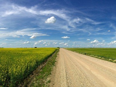
Take a look at this Albertan's second favourite province, Saskatchewan.
This is a renovated/adopted version of an old quiz by author melizza9

A multiple-choice quiz by agony. Estimated time: 3 mins.
  1. Home
  2. »
  3. Quizzes
  4. »
  5. Geography Trivia
  6. »
  7. Canada
  8. »
  9. Saskatchewan

Author
agony
Time
3 mins
Type
Multiple Choice
Quiz #
27,141
Updated
Dec 14 22
# Qns
10
Difficulty
Average
Avg Score
7 / 10
Plays
395
Awards
Top 35% Quiz
Last 3 plays: Upstart3 (7/10), Guest 216 (5/10), Guest 174 (6/10).
- -
Question 1 of 10
1. Has Regina always been the capital of Saskatchewan?


Question 2 of 10
2. Saskatchewan's other large city lies to the northwest of the capital.

Which city is it?
Hint


Question 3 of 10
3. What town is on the Saskatchewan-Alberta border? Hint


Question 4 of 10
4. Just as Saskatchewan has border towns, it also has border lakes. The eighth largest and ninth largest lakes in Canada (and the first and second largest in the province) are border lakes with other provinces.

Which are they?
Hint


Question 5 of 10
5. There's an interprovincial park at the highest point between the east coast and the Rockies on the Canadian mainland, in southwestern Saskatchewan.

What is it called?
Hint


Question 6 of 10
6. Wanuskewin Heritage Park, just north of Saskatoon, includes a structure that shines a light on Saskatchewan's past.

What is it?
Hint


Question 7 of 10
7. South of Moose Jaw you will find the Claybank National Historic Site. The name might give you a clue as to what it is. Hint


Question 8 of 10
8. The Saskatchewan River is formed by the joining of the South Saskatchewan and the North Saskatchewan Rivers. Both the North and South Saskatchewan originate in Rocky Mountain icefields.

Which ones?
Hint


Question 9 of 10
9. What is the common link between these Saskatchewan places?

Frog Lake, Batoche, Duck Lake, and Fish Creek.
Hint


Question 10 of 10
10. Saskatchewan is unusual in that none of its borders are based on natural features (rivers, drainage divisions, etc). All of the borders are lines of latitude or longitude.

Which parallels of latitude make up the south and north borders, respectively?
Hint


(Optional) Create a Free FunTrivia ID to save the points you are about to earn:

arrow Select a User ID:
arrow Choose a Password:
arrow Your Email:


Most Recent Scores
Oct 25 2024 : Upstart3: 7/10
Oct 24 2024 : Guest 216: 5/10
Oct 13 2024 : Guest 174: 6/10
Oct 02 2024 : Guest 71: 5/10
Oct 02 2024 : Guest 107: 5/10

Quiz Answer Key and Fun Facts
1. Has Regina always been the capital of Saskatchewan?

Answer: yes

Regina was established as the capital of the North-West Territories in 1882, through a process that could be described as somewhat dodgy. There were already developed towns in perhaps better locations, but the lieutenant-governor of the time had financial interests in putting the new capital at what became Regina. Wascana Creek was dammed to make Wascana Lake, and a really very pleasant city grew up around it.

When Alberta and Saskatchewan were formed in 1905 from part of the North-West Territories, Regina became the capital of the new province of Saskatchewan.
2. Saskatchewan's other large city lies to the northwest of the capital. Which city is it?

Answer: Saskatoon

Saskatoon and Regina together make up roughly 3/4 of the urban population of the province, the rest being made up by smaller centres like Moose Jaw, Prince Albert, and others.

Saskatoon is another pleasant little city, on the banks of the South Saskatchewan River. I had always thought that our most well known (and best!) wild prairie berry, the saskatoon, was named for the city, but it seems that it's the other way around - Saskatoon was apparently a good place to pick saskatoon berries, and that's where the name came from. It's originally a Cree word.
3. What town is on the Saskatchewan-Alberta border?

Answer: Lloydminster

Saskatchewan has two border cities - Flin Flon is on the border with Manitoba.

Lloydminster started as the Barr Colony, an imperial (and maybe just a wee bit racist) expedition to secure western Canadian settlement for the British. It was badly mismanaged, and Isaac Barr soon lost leadership to George Lloyd, for whom the city of Lloydminster ended up being named. Eventually the homesteaders prospered, and the colony was instrumental in opening up settlement in that part of the province.
4. Just as Saskatchewan has border towns, it also has border lakes. The eighth largest and ninth largest lakes in Canada (and the first and second largest in the province) are border lakes with other provinces. Which are they?

Answer: Lake Athabasca and Reindeer Lake

Lake Athabasca is shared with Alberta, high in the northwest corner of the province. About 3/4 of the 7,850 km2 lake is in Saskatchewan. It drains into the Arctic Ocean via the Slave and Mackenzie Rivers.

Reindeer Lake is in the northeast corner of Saskatchewan, and is shared with Manitoba. The vast majority of the 6,650 km2 lake is in Saskatchewan, with only 8% in Manitoba. It drains to Hudson Bay by way of the Reindeer and Churchill Rivers.
5. There's an interprovincial park at the highest point between the east coast and the Rockies on the Canadian mainland, in southwestern Saskatchewan. What is it called?

Answer: Cypress Hills

The Cypress Hills are a rarity - a portion of Canada east of the Rockies that was not covered by the Laurentide Ice Sheet during the Pleistocene (ice age) epoch. As such, the geology and ecology are quite different from the surrounding prairies.

The Cypress Hills were also the location of an important incident in western Canadian history, the Cypress Hills Massacre. An altercation between mostly American wolf hunters and whisky traders, and the local people, led to the deaths of about fifteen people, primarily members of Chief Little Soldier's Assiniboine band. This was one of the factors that led to the creation of the North-West Mounted Police (later the Royal Canadian Mounted Police).
6. Wanuskewin Heritage Park, just north of Saskatoon, includes a structure that shines a light on Saskatchewan's past. What is it?

Answer: A medicine wheel

Medicine wheels are stone circles with a central cairn and stone spokes radiating out from this central point. These sacred circles are extremely important to traditional Indigenous spirituality and have been in use in the Central Plains for several thousand years.

First Nations people have been coming to the opimihâw Creek valley for about six thousand years, as part of their nomadic way of life. There are more than a dozen Pre-Contact archaeological dig sites in the area. There is a wonderful interpretive centre, and a trail system through the site allows visitors to visit the medicine wheel.
7. South of Moose Jaw you will find the Claybank National Historic Site. The name might give you a clue as to what it is.

Answer: Historic brick factory

Anyone driving through the small towns of southern Saskatchewan will notice the large number of public buildings and older homes built of or faced with brick. Brickmaking was a large part of early European settlement in the province; during the early 20th century there were more than sixty brick plants. (The quiz author has a family connection to the small town of Wolseley, and many buildings there are built from the lovely mellow brownish brick from the one-time local brick factory.)

Although the clay deposits at Claybank have probably been used for pottery since prehistoric times, the first modern use started in 1886. Once the railway came through the area in 1910, and made large scale commercial brick production economically feasible, a factory was soon built. Much of the original factory, which closed in 1989, still remains, and can be toured at the historic site.
8. The Saskatchewan River is formed by the joining of the South Saskatchewan and the North Saskatchewan Rivers. Both the North and South Saskatchewan originate in Rocky Mountain icefields. Which ones?

Answer: The Columbia and the Wapta

The North Saskatchewan forms from the Saskatchewan Glacier in the Columbia Icefield in Banff National Park. It flows through central Alberta and heads in a southerly direction into Saskatchewan before making a fairly sharp turn northwards.

The South Saskatchewan (as the Bow River) forms from the Bow Glacier on the Wapta Icefield, also in Banff. As the Bow it flows through Calgary and becomes the South Saskatchewan when it joins with the Oldman River about midway between Lethbridge and Medicine Hat in Alberta. It then heads roughly in a northeasterly direction, through Saskatoon, and up to the meeting with the North Saskatchewan not far from Prince Albert.
9. What is the common link between these Saskatchewan places? Frog Lake, Batoche, Duck Lake, and Fish Creek.

Answer: Battles during the North-West Resistance

The North-West Resistance (also known as the North-West Rebellion and the Second Riel Rebellion) is too big a subject to cover here.

Briefly, though, the Indigenous peoples and the Métis both had (mostly quite legitimate) grievances against the Canadian government and white settlers, while the settlers were also unhappy with the government and with their First Nations neighbours. In 1884/85 this all led to armed conflict, with the Cree in the western part of what would become Saskatchewan, and the Métis further east at Batoche. It didn't end well for anyone, though the white settlers lost the least.
10. Saskatchewan is unusual in that none of its borders are based on natural features (rivers, drainage divisions, etc). All of the borders are lines of latitude or longitude. Which parallels of latitude make up the south and north borders, respectively?

Answer: 49th parallel and 60th parallel

The US/Canada border for Manitoba, Saskatchewan, Alberta and part of BC runs along the 49th parallel (roughly - survey techniques at the time of the 1818 treaty that established the border were not perfect). The border between the four western provinces and the northern territories lies on the 60th parallel.

Saskatchewan's eastern and western borders are on, roughly (errors in surveying, again) the 102W and 104W meridians of longitude.
Source: Author agony

This quiz was reviewed by FunTrivia editor WesleyCrusher before going online.
Any errors found in FunTrivia content are routinely corrected through our feedback system.
Related Quizzes
This quiz is part of series FunTrivia Advent Calendar 2022:

Missing the advent calendar? Looks like there's some tech issues and the advent quizzes are not properly displaying as such this year. Until this can be fixed, just use this quiz list! This year's calendar theme is "Adopted" - all the quizzes you'll see are brand new versions of some old poor orphans!

  1. Moving Forward, Now as One Average
  2. An Animal Group Project Average
  3. A Christie for Christmas Easier
  4. Take the Future in Our Hand Average
  5. Built on All That We Have Done Average
  6. Angel of Harlem Average
  7. Wordwise Revisited Easier
  8. Egyptian Deities Average
  9. Rare Bird Visitors to Britain Average
  10. The Singers of Disney Easier
  11. A Very Viking Season Easier
  12. Dinosaur Diets Easier

11/21/2024, Copyright 2024 FunTrivia, Inc. - Report an Error / Contact Us