FREE! Click here to Join FunTrivia. Thousands of games, quizzes, and lots more!
Quiz about Lets Travel Down the Orinoco River

Let's Travel Down the Orinoco River Quiz


You find yourself about to head down a major river in South America. But it's not the Amazon! This time we will be exploring the Orinoco River and the countryside through which it flows.

A photo quiz by stephgm67. Estimated time: 5 mins.
  1. Home
  2. »
  3. Quizzes
  4. »
  5. Geography Trivia
  6. »
  7. South America
  8. »
  9. South American Rivers and Oceans

Author
stephgm67
Time
5 mins
Type
Photo Quiz
Quiz #
387,902
Updated
Dec 03 21
# Qns
10
Difficulty
Average
Avg Score
7 / 10
Plays
192
Awards
Top 10% Quiz
-
Question 1 of 10
1. You are very excited to be heading on an expedition to tour the Orinoco River in South America. It might be helpful to know what areas you shall be passing through! What two countries contain the Orinoco River? Hint


Question 2 of 10
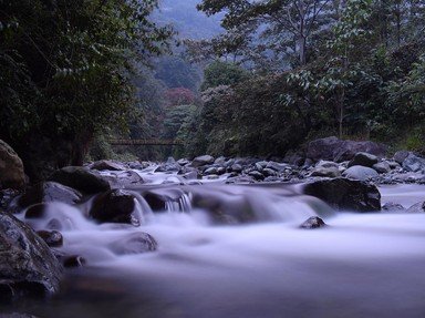
2. We decide to start where the Orinoco itself begins. It begins its journey as a series of streams fed by fresh springs in mountains on the border of Brazil and Venezuela. What is this mountain range that is an outlying range of the Guiana Highlands (pictured)? Hint


Question 3 of 10
3. We are now on the Upper Orinoco and heading westward when we pass the small town of Esmerelda. Almost immediately afterward we see the Casiquiare Canal forking off and heading south (as seen in the photo). It is one of the biggest natural river bifurcations in the world. What does that mean? Hint


Question 4 of 10
4. Watch out! We're now in the Middle Orinoco section and we are flowing northward along the border of Colombia and Venezuela. We're in the Region of the Rapids and the water is forcing itself through narrow, stony passages. What are these rocks formed from that also depict art on them from ancient civilizations? Hint


Question 5 of 10
5. The river has turned back to the east and we are floating through the Lower Orinoco now. The river is very wide here and it is slowly crossing over vast plains. We have noticed the incredible amount of flora and fauna and learn from our guide many of them are local just to this area. In particular, one reptile is the largest of its species of its kind in the Americas. What is it? Hint


Question 6 of 10
6. As we continue through the Lower Orinoco we notice we are surrounded by a unique ecological area called a llano. It combines flooded grasslands, foothills, and a savanna. What climate would you say we are experiencing here in the llano? Hint


Question 7 of 10
7. We pass many tributaries joining the Orinoco as we head toward the end of the Lower region. One of the rivers joining us is the Caroni River which in turn leads to the world's highest waterfall. Situated on the Churun River, what is the name of this amazing scene we could visit? Hint


Question 8 of 10
8. We now come out of the Lower Orinoco and come across around 16,800 square miles of land made from sediment that this great river has deposited. Tides bring sea water in to mix with the fresh water from the Orinoco. What is this type of vast area called? Hint


Question 9 of 10
9. As we come toward the end of the Orinoco Delta, we pass several villages of a local people called the Warao. They have lived in this watery area for centuries and even their name means "boat people". They are very friendly and wave to us from their homes. What do these abodes look like? Hint


Question 10 of 10
10. Yes! We celebrate as we are now done and at the end of the Orinoco's long journey. What major body of water did we just feed into? Hint


(Optional) Create a Free FunTrivia ID to save the points you are about to earn:

arrow Select a User ID:
arrow Choose a Password:
arrow Your Email:


View Image Attributions for This Quiz

Quiz Answer Key and Fun Facts
1. You are very excited to be heading on an expedition to tour the Orinoco River in South America. It might be helpful to know what areas you shall be passing through! What two countries contain the Orinoco River?

Answer: Venezuela and Colombia

The Orinoco River is one of the top ten longest rivers in South America and the fourth largest in the world when measuring discharge of water flow. It is 1,330 miles long and forms a large arc across the two countries of Venezuela and Colombia. Most of the river, over three-fourths, and its tributaries are found within Venezuela where it serves as a major transportation hub and natural iron source.

The river itself is divided geographically into the Upper, Middle, and Lower stretches.
2. We decide to start where the Orinoco itself begins. It begins its journey as a series of streams fed by fresh springs in mountains on the border of Brazil and Venezuela. What is this mountain range that is an outlying range of the Guiana Highlands (pictured)?

Answer: Parima Mountains

The Parima Mountains, called Sierra Parima in Spanish, form a range about 200 miles long near the border of Brazil and Venezuela. They go up to 5,000 feet above sea level and their western slopes feed the Orinoco while their eastern slopes eventually lead into the Amazon River.

The springs that bubble up and form the Orinoco are found at the southern end of the range near Mount Delgado Chalbaud. They are approximately 3,000 feet above sea level. The mountainous area is fairly uninhabited except for the villages of the local Yanomami tribes who have outlasted conquistadors, gold rushes, and threat of encroaching civilization.
3. We are now on the Upper Orinoco and heading westward when we pass the small town of Esmerelda. Almost immediately afterward we see the Casiquiare Canal forking off and heading south (as seen in the photo). It is one of the biggest natural river bifurcations in the world. What does that mean?

Answer: A separation of a river into separate streams

The Casiquiare is peculiar to the Orinoco River. It is a natural canal that branches off of the Orinoco and flows to the Rio Negro which in turns flows into the Amazon. Over the centuries, the lower elevation of the lands near the Amazon helped separate the water into a perfect canal as some of the Orinoco waters flowed over the lower land. Species of fish tend to either stay in the acidic waters of the Negro or the neutral waters of the Orinoco.

However, humans have used this natural 'cut-through' since it was discovered in the 1600s by slave traders.

The Casiquiare runs southwest just 9 miles from Esmeralda and flows for about 200 miles.
4. Watch out! We're now in the Middle Orinoco section and we are flowing northward along the border of Colombia and Venezuela. We're in the Region of the Rapids and the water is forcing itself through narrow, stony passages. What are these rocks formed from that also depict art on them from ancient civilizations?

Answer: Granite

The Orinoco has been joined up with other mountains streams and by the time it reaches the Middle Orinoco section it is a large volume of water being rushed over and around huge granite boulders in the area. This series of rapids ranges for miles and ends with the Atures Rapids which marks the beginning of the Lower Orinoco.

These rapids have created small settlements over time where people got aid in transporting goods around the dangerous rocks and rapids. In the late 2000s, an archaeological study around the Atures Rapids found beads, fragments of fabric, and rock art on the granite facings.

This helped prove the theory of pre-colonial people having lived in the area.
5. The river has turned back to the east and we are floating through the Lower Orinoco now. The river is very wide here and it is slowly crossing over vast plains. We have noticed the incredible amount of flora and fauna and learn from our guide many of them are local just to this area. In particular, one reptile is the largest of its species of its kind in the Americas. What is it?

Answer: Orinoco crocodile

The Orinoco crocodile can grow up to 17 feet long and weigh over 800 pounds. It is light tan with scattered dark spots and has a long snout. When the Orinoco River gets low during the dry season, the crocodile goes into burrows along the riverbanks. They are at the top of the food chain for the area and eat fish, birds, and mammals. Even though they can live up to 70 years, they are highly endangered animals because of the small population and threats to their environment.

They have also been heavily hunted for their skin over the years. Venezuela has several programs aimed at preserving the habitat and lives of this unique fresh water animal.
6. As we continue through the Lower Orinoco we notice we are surrounded by a unique ecological area called a llano. It combines flooded grasslands, foothills, and a savanna. What climate would you say we are experiencing here in the llano?

Answer: Tropical with wet and dry seasons

The llano is a region of Venezuela that is low lying and combines multiple habitats into a form of an ecoregion. There are grasslands that flood during the rainy season, foothills that form up toward the mountains, and dryer grassy plains. The llano, with its ability to absorb excess water, helps keep the Orinoco and its tributaries from flooding.

The climate is tropical and the Orinoco only has two seasons: summer and winter. Winter is considered the rainy season and spans from April to October and the remaining months are the dry months, or summer.

The average 78 degree Fahrenheit temperature fluctuates from day to night but remains pretty consistent on a monthly basis.
7. We pass many tributaries joining the Orinoco as we head toward the end of the Lower region. One of the rivers joining us is the Caroni River which in turn leads to the world's highest waterfall. Situated on the Churun River, what is the name of this amazing scene we could visit?

Answer: Angel Falls

Angel Falls is located in Canaima National Park and falls an astounding 3,212 feet down into Devil's Canyon. This makes it the world's tallest uninterrupted waterfall. The falls were ignored by local tribes as they feared evil spirits abounded there so it was not until the mid-1930s that the site was discovered by a pilot doing a routine flight over the area. Since that time, visitors have been amazed at the area and it was made a UNESCO World Heritage Site in 1994. From camps near the base, it still takes about five hours to canoe to a lagoon, hike through the jungle growth, and settle around the pools at the bottom of the falls.
8. We now come out of the Lower Orinoco and come across around 16,800 square miles of land made from sediment that this great river has deposited. Tides bring sea water in to mix with the fresh water from the Orinoco. What is this type of vast area called?

Answer: Delta

The delta has two major waterways within it: the Manamo in the north part of the huge area and the Rio Grande in the east. These are connected via a gigantic array of smaller canals and channels. Giant mangrove swamps abound throughout the region. Piranha swim through the waters alongside pink dolphins and giant otters.

When the rainy season starts in April, mosquito swarms fill the air and fly near toucans and hummingbirds. Every year, the Orinoco adds another 100 million cubic meters of sediment and sand to this vast delta and helps form fertile soil.
9. As we come toward the end of the Orinoco Delta, we pass several villages of a local people called the Warao. They have lived in this watery area for centuries and even their name means "boat people". They are very friendly and wave to us from their homes. What do these abodes look like?

Answer: Thatch roofed huts on stilts

There are about 20,000 Warao living in the Orinoco Delta region. They build their wall-less huts upland to avoid floods and put them on stilts so they stay above the water. The spend most of their time on canoes or boats on the water so the homes are very simple and usually only contain a few hammocks and a cooking area. Hundreds of years ago, the Warao tribes learned to grow a few crops but they have always counted on the water to provide their food in the way of fish, crabs, insects, and plants.

The ancestors of today's people probably didn't know that it was their very huts over the canals that inspired European explorers to name the area Venezuela or "Little Venice".
10. Yes! We celebrate as we are now done and at the end of the Orinoco's long journey. What major body of water did we just feed into?

Answer: Atlantic Ocean

The Orinoco River, which means "a place to paddle", measures 1,330 miles and descends almost 3,500 feet on its trip to meet the Atlantic Ocean from the mountains where it starts. More than 1/3 of the river is navigable and ocean ships can even go 270 miles upstream from the Atlantic. Tourists enjoy cruises that start at the shores of the Atlantic then switch to wetland trips where salt and fresh water animals mix.

The Orinoco and its path from fresh springs to mighty ocean passes through people, animals, and plants that define life in South America.
Source: Author stephgm67

This quiz was reviewed by FunTrivia editor Pagiedamon before going online.
Any errors found in FunTrivia content are routinely corrected through our feedback system.
11/24/2024, Copyright 2024 FunTrivia, Inc. - Report an Error / Contact Us