FREE! Click here to Join FunTrivia. Thousands of games, quizzes, and lots more!
Quiz about Northern Canada

Northern Canada Trivia Quiz


Cold, secluded, remote, beautiful! Picture perfect words that describe Canada's true north. How well do you know the history, geography, and interesting facts surrounding Canada's best known secret?.

A multiple-choice quiz by apathy100. Estimated time: 6 mins.
  1. Home
  2. »
  3. Quizzes
  4. »
  5. Geography Trivia
  6. »
  7. Canada
  8. »
  9. Canada - Territories

Author
apathy100
Time
6 mins
Type
Multiple Choice
Quiz #
208,259
Updated
Nov 19 23
# Qns
20
Difficulty
Tough
Avg Score
11 / 20
Plays
958
- -
Question 1 of 20
1. According to the Northwest Territories Bureau of Statistics in 2000, what was the approximate population of the Northwest Territories? Hint


Question 2 of 20
2. Which of the following is not found on the Northwest Territories Coat of Arms? Hint


Question 3 of 20
3. Which of the territories was the first to be admitted into confederation? Hint


Question 4 of 20
4. The largest island in Canada is located in which of Canada's territories? Hint


Question 5 of 20
5. The ____________ Highway runs from Dawson Creek, British Columbia to Fairbanks, Alaska, while the ____________ Highway runs from the Klondike Highway to Inuvik, Northwest Territories. Hint


Question 6 of 20
6. Which of the following roads is the last road in Canada having a road sign with an imperial measurement on it? Hint


Question 7 of 20
7. On September 18, 1992, nine replacement workers were killed by an explosion at the height of a labour dispute. Who was later convicted of placing a bomb in the mine shaft and murdering those nine miners? Hint


Question 8 of 20
8. What native group was employed to carry radioactive uranium ore during the 1940s and have subsequently become victim to high rates of cancer? Hint


Question 9 of 20
9. What park, located in the extreme southwestern portion of the Yukon Territory, is primarily dominated by mountains and glaciers? Hint


Question 10 of 20
10. Mount Logan, Canada's highest point (5959 m) is located in what territory? Hint


Question 11 of 20
11. Which city was the capital of the Yukon until 1952? Hint


Question 12 of 20
12. According to the Northwest Territories Official Languages Act, how many official languages are recognized in the Northwest Territories? Hint


Question 13 of 20
13. Which of the following is not a community in the territory of Nunavut? Hint


Question 14 of 20
14. In Canada, there is only one location where the boundaries of four provinces/territories intersect. What is this intersection known as?

Answer: (Two Words)
Question 15 of 20
15. The system of radar stations in the far Arctic region of Canada as a means to detect Soviet bombers and missiles during and following WWII was known as what? Hint


Question 16 of 20
16. What is the parallel of latitude that runs at 66 degrees 33' 38" N called? Hint


Question 17 of 20
17. What railroad located in the Yukon has an isolated system (meaning it has no connection to any other railway)? Hint


Question 18 of 20
18. In 1987, what major figure made a trip to Fort Simpson, Northwest Territories, after being prevented from doing so three years earlier? Hint


Question 19 of 20
19. What was Iqaluit, Nunavut, formerly known as? Hint


Question 20 of 20
20. What settlement is located at 82 degrees 28'N, 62 degrees 30'W? Hint


(Optional) Create a Free FunTrivia ID to save the points you are about to earn:

arrow Select a User ID:
arrow Choose a Password:
arrow Your Email:


Most Recent Scores
Oct 16 2024 : Guest 196: 0/20
Oct 07 2024 : twlmy: 18/20

Score Distribution

quiz
Quiz Answer Key and Fun Facts
1. According to the Northwest Territories Bureau of Statistics in 2000, what was the approximate population of the Northwest Territories?

Answer: 42000

After the Northwest Territories split into two separate territories (Nunavut and Northwest Territories) in 1999, the approximate population of the Northwest Territories was just over 42000 people.
2. Which of the following is not found on the Northwest Territories Coat of Arms?

Answer: a mace

"The magnetic north pole of the north is symbolized by two narwhals guarding a compass rose. Various colours make up the Northwest Territories coat of arms including white (representing the ice pack), green (represents the tree line), red (represents tundra), blue wavy line (represents the Northwest Passage), and gold billets (representing mineral wealth). Within the red, is the mask of the white fox, one of the most common animals in the Northwest Territories" (http://en.wikipedia.org/wiki/Northwest_Territories).
3. Which of the territories was the first to be admitted into confederation?

Answer: Northwest Territories

The Northwest Territories became an official Canadian territory in 1870 after the Hudson's Bay Company ceded its land to Canada. The Yukon Territory was officially admitted on June 13, 1898 while Nunavut became an official territory on April 1, 1999.
4. The largest island in Canada is located in which of Canada's territories?

Answer: Nunavut

"Baffin Island is the largest island in Canada and the fifth largest island in the world at 195,928 sq mi (507,451 kmē) in size".
(http://en.wikipedia.org/wiki/Baffin_island)
5. The ____________ Highway runs from Dawson Creek, British Columbia to Fairbanks, Alaska, while the ____________ Highway runs from the Klondike Highway to Inuvik, Northwest Territories.

Answer: Alaska, Dempster

"The Alaskan Highway was officially completed in 1942 and is the main roadway connecting Alaska, Yukon, and British Columbia together. Although it was officially opened in 1942 for military purposes, it was not usable by general vehicles until 1943" (http://en.wikipedia.org/wiki/Alaska_Highway). "The Dempster Highway was completed in 1979 and extends 736 km (457 miles) from the Klondike Highway (40 km east of The town of the city of Dawson) to Inuvik, Northwest Territories.

In the winter, the Dempster Highway extends another 194 km to Tuktoyaktuk when portions of the Mackenzie Delta freeze over" (http://en.wikipedia.org/wiki/Dempster_Highway).
6. Which of the following roads is the last road in Canada having a road sign with an imperial measurement on it?

Answer: Eureka Highway

The Eureka Highway is a 20 km stretch of highway that runs from the Eureka Weather Station to CFB Eureka and the Eureka Airport in Northern Nunavut.
7. On September 18, 1992, nine replacement workers were killed by an explosion at the height of a labour dispute. Who was later convicted of placing a bomb in the mine shaft and murdering those nine miners?

Answer: Roger Warren

This incident happened at the Giant Mine located in Yellowknife, Northwest Territories. From 1948 until it ceased operations in 2004, the Giant Mine produced over seven million ounces of gold.
8. What native group was employed to carry radioactive uranium ore during the 1940s and have subsequently become victim to high rates of cancer?

Answer: Dene

The Dene were employed to carry radioactive uranium ore from many of the mines located on Great Bear Lake. Unlike their white colleagues, the Dene were not properly given instruction on the safety procedures associated with radioactive materials.
9. What park, located in the extreme southwestern portion of the Yukon Territory, is primarily dominated by mountains and glaciers?

Answer: Kluane National Park

"Kluane National Park is a land of precipitous, high mountains, immense icefields and lush valleys that yield a diverse array of plant and wildlife species and provides for a host of outdoor activities" (http://www.pc.gc.ca/pn-np/yt/kluane/index_e.asp).
10. Mount Logan, Canada's highest point (5959 m) is located in what territory?

Answer: Yukon

Mount Logan is located in Kluane National Park in the southwestern part of the Yukon.
11. Which city was the capital of the Yukon until 1952?

Answer: Dawson City

"Dawson City is the second largest community in the Yukon. When the Klondike Gold Rush began in 1896, Dawson City was a thriving city with a population of about 40 000. By the end of the gold rush in 1899, the city's population had plummeted drastically.

In 1902, only 5000 inhabitants remained. Today, the population of Dawson City is just under 2000 and the main industry is tourism and gold mining" (http://en.wikipedia.org/wiki/Dawson_City%2C_Yukon).
12. According to the Northwest Territories Official Languages Act, how many official languages are recognized in the Northwest Territories?

Answer: 8

The eight officially recognized languages of the Northwest Territories are: English, French, Inuktitut, Cree, Dogrib, Gwich'in, Chipewyan, and Slavey. Citizens of the Northwest Territories have a right to any of the above languages when receiving services from the government, in court, and in proceedings involving legislature.
13. Which of the following is not a community in the territory of Nunavut?

Answer: Aishihik

Aishihik is a small community located in the Yukon. Many communities in Nunavut have two names (many have alternate Inuktitut names). Pangnirtung is also known as "Pangniqtuuq", Gjoa Haven is known as "Uqsuqtuuq", and Kugluktuk is known as "Qurluqtuq".
14. In Canada, there is only one location where the boundaries of four provinces/territories intersect. What is this intersection known as?

Answer: four corners

The boundaries of Manitoba, Saskatchewan, Northwest Territories, and Nunavut are geographically located at 60 degrees N and 102 degrees W.
15. The system of radar stations in the far Arctic region of Canada as a means to detect Soviet bombers and missiles during and following WWII was known as what?

Answer: DEW Line

"The DEW Line or "Distant Early Warning Line", was a system of radars that were spread across the Arctic portion of Canada. These were used to detect missiles and Soviet bombers, however, when intercontinental ballistic missiles became the main delivery system for nuclear weapons, these radars became outdated. Since the end of the Cold War in 1990, these stations are rarely used for any significant purpose" (http://en.wikipedia.org/wiki/Distant_Early_Warning_Line).
16. What is the parallel of latitude that runs at 66 degrees 33' 38" N called?

Answer: Arctic Circle

Everything north of this parallel is known as the "Arctic" while the zone that is to the south of this is known as the "Northern Temperate Zone".
17. What railroad located in the Yukon has an isolated system (meaning it has no connection to any other railway)?

Answer: White Pass & Yukon Route

This railway was officially closed down in the late 1990s, however, for tourism purposes, a train runs down this line a few times during the summer months.
18. In 1987, what major figure made a trip to Fort Simpson, Northwest Territories, after being prevented from doing so three years earlier?

Answer: Pope John Paul II

Foggy conditions and extreme weather hazards prevented the Pope from making a trip to Fort Simpson in 1984. He met 3000 people gathered at an open air station in Fort Simpson during his trip to Canada in 1987. This would be one of the smallest crowds the Pontiff would ever address. His trip to Fort Simpson lasted five hours.
19. What was Iqaluit, Nunavut, formerly known as?

Answer: Frobisher Bay

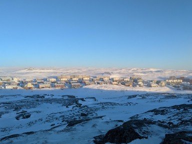
In 1987, this community changed its name to Iqaluit, meaning "place of fish". It was founded in 1576 by Martin Frobisher during his search for the Northwest Passage.
20. What settlement is located at 82 degrees 28'N, 62 degrees 30'W?

Answer: Alert

Alert is the northernmost permanent settlement in the world. It is located on the Northeastern tip of Ellesmere Island in the territory of Nunavut.
Source: Author apathy100

This quiz was reviewed by FunTrivia editor minch before going online.
Any errors found in FunTrivia content are routinely corrected through our feedback system.
Related Quizzes
This quiz is part of series Apathy's Canadian Connections:

All of these quizzes are of Canadian content. Have fun!

  1. Rocks At A Cost: Canadian Mining Disasters Average
  2. The Greatest Canadian Inventions Average
  3. Speak Cree Tough
  4. The Halifax Explosion Average
  5. A Stroll Down Memory Lane: "Today's Special" Tough
  6. NHL Teams From Canada Very Easy
  7. Northern Canada Tough
  8. 9 for 10 - Canadian Cities & Towns Average
  9. Hidden Canadian Cities Easier
  10. Fractured Canada Easier
  11. Gino Vanelli Average
  12. Fractured Canadian and American Soda Pop Average

11/21/2024, Copyright 2024 FunTrivia, Inc. - Report an Error / Contact Us