FREE! Click here to Join FunTrivia. Thousands of games, quizzes, and lots more!
Quiz about Suriname What Can You See

Suriname: What Can You See? Trivia Quiz


Suriname? Sure I am! What could you find in this South American country?

A photo quiz by AcrylicInk. Estimated time: 3 mins.
  1. Home
  2. »
  3. Quizzes
  4. »
  5. Geography Trivia
  6. »
  7. South America
  8. »
  9. Suriname

Author
AcrylicInk
Time
3 mins
Type
Photo Quiz
Quiz #
401,904
Updated
Dec 03 21
# Qns
10
Difficulty
Easy
Avg Score
9 / 10
Plays
1409
Awards
Top 5% quiz!
Last 3 plays: Guest 110 (1/10), ceetee (10/10), Guest 68 (5/10).
-
Question 1 of 10
1. The inner city of Paramaribo, Suriname's capital, was designated a World Heritage site in 2002. What was special about it? Hint


Question 2 of 10
2. Remnants of the colonial period can still be seen across Suriname. For instance, when the country became independent in 1975, the official language remained the same as a country on the North Sea coast. What is the official language of Suriname? Hint


Question 3 of 10
3. The Suriname River flows north through the country and empties out into an ocean near the capital. Which ocean does the Suriname River empty into? Hint


Question 4 of 10
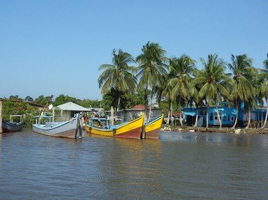
4. Suriname's coastal plain is home to mangroves and a wide range of birds, including the vibrant scarlet ibis. What kind of terrain can be found there? Hint


Question 5 of 10
5. Suriname became home to an enormous nature reserve in 1998. In 2000, it became a World Heritage site due to its pristine condition. What is the name of the nature reserve? Hint


Question 6 of 10
6. With a Latin-based name meaning 'youthful', what is Suriname's highest peak? Hint


Question 7 of 10
7. Much of the native plant life that can be seen is a result of Suriname's climate. Which word best describes the climate in Suriname? Hint


Question 8 of 10
8. Suriname is known for mining an ore used in aluminium production. Which ore can be found there? Hint


Question 9 of 10
9. The beaches of eastern Suriname are the breeding grounds of which marine animal? Hint


Question 10 of 10
10. Suriname is home to some interesting rock formations. What exactly is the landmark known as The Devil's Egg? Hint


Most Recent Scores
Dec 18 2024 : Guest 110: 1/10
Dec 01 2024 : ceetee: 10/10
Nov 04 2024 : Guest 68: 5/10
Nov 04 2024 : Guest 92: 9/10
Nov 04 2024 : dslovin: 10/10
Nov 04 2024 : Guest 205: 8/10
Nov 04 2024 : Guest 162: 6/10
Nov 04 2024 : Guest 146: 9/10
Nov 04 2024 : Guest 195: 9/10

Quiz Answer Key and Fun Facts
1. The inner city of Paramaribo, Suriname's capital, was designated a World Heritage site in 2002. What was special about it?

Answer: The architecture had barely changed since the town was established.

Originally an Indian village, Paramaribo has passed through numerous hands. When Europeans arrived, it became the site of both English and French settlements, but the current layout of the city dates back to the 17th and 18th centuries when it was a Dutch colonial town. By 2002, the inner city area retained its grid pattern, along with many of its original wooden buildings. This portion of the town gradually evolved to the point where it contained a mixture of styles. Colonial architecture and Creole influences stood side-by-side - a reflection of the mix of cultures within the country itself.

The drawing is of the Presidential Palace of Suriname, which is in Paramaribo.
2. Remnants of the colonial period can still be seen across Suriname. For instance, when the country became independent in 1975, the official language remained the same as a country on the North Sea coast. What is the official language of Suriname?

Answer: Dutch

The Netherlands, which borders the North Sea, had colonies across the world. For a long time, Suriname was one of them. When the country gained independence in 1975, Dutch was retained as an official language. Despite its status, it is by no means the only language spoken. Since the 17th century, workers and slaves from Asia and Africa had been brought into the country, bringing their languages and dialects with them. Over time, a creole language known as Sranan Tongo has developed as a lingua franca.
3. The Suriname River flows north through the country and empties out into an ocean near the capital. Which ocean does the Suriname River empty into?

Answer: Atlantic Ocean

The Suriname River travels north for 480km and meets the Atlantic Ocean near Paramaribo and Nieuw Amsterdam. The name 'Suriname' came from Spanish explorers who visited the area in 1593 and named the region after a local tribe called the Surinen.

Another north-flowing river is the Courantyne River (also spelled Corentyne and Coeroeni in Suriname). The Courantyne provides a 700km western border with the neighbouring country, Guyana.
4. Suriname's coastal plain is home to mangroves and a wide range of birds, including the vibrant scarlet ibis. What kind of terrain can be found there?

Answer: Swamps

The scarlet ibis is endemic to South America and breeds on the mud flats and swamps along the coast of Suriname. There are over 100 species of bird that call the region their home, including the black-bellied whistling duck and the tricolored egret. Mangrove trees grow in the swamps throughout the coastal region.

The trees are a valuable wildlife habitat themselves, but also provide sediment control that protect habitats further inland. Unfortunately, human activity like over-fishing threatens the mangrove trees and their environment.
5. Suriname became home to an enormous nature reserve in 1998. In 2000, it became a World Heritage site due to its pristine condition. What is the name of the nature reserve?

Answer: Central Suriname Nature Reserve

Three separate nature reserves were brought together to form the Central Suriname Nature Reserve. When it was awarded World Heritage status in 2000, the reserve covered roughly 11% of Suriname's surface area. It was protected land and was notable because it was largely untouched: it was uninhabited, unhunted, and largely inaccessible.
6. With a Latin-based name meaning 'youthful', what is Suriname's highest peak?

Answer: Juliana Top

At over 1,200 metres, Juliana Top is Suriname's highest mountain. It is part of the Wilhelmina Mountain range in the huge Sipaliwini District. The mountain is within the extensive Central Suriname Nature Reserve, a protected area that was created in 1998. Like the surrounding countries of Venezuela and Guyana, Suriname also has some magnificent table-top mountains known as tepuis.

The picture is based on a marble statue of Julius Caesar.
7. Much of the native plant life that can be seen is a result of Suriname's climate. Which word best describes the climate in Suriname?

Answer: Tropical

Suriname's climate is tropical with dry and rainy seasons throughout the year. With over 1000 species of tree and around 4,000 species of fern, Suriname's flora relies on warm temperatures and plenty of rain. On average, the country receives between 1,900 mm and 2,400 mm of rain annually.

In comparison, between 1981 and 2010 the UK received an average of 1,154 mm of annual rainfall (according to the Met Office). The UK has a reputation for being rainy but it's nothing compared to a tropical rainforest!
8. Suriname is known for mining an ore used in aluminium production. Which ore can be found there?

Answer: Bauxite

The largest deposits of bauxite can be found in tropical climates like Suriname. As the rock usually consists of aluminium oxides, bauxite is the main source of aluminium across the world. Mines for other minerals, such as iron ore and diamonds, have also been created in the country. Some land in Suriname is used for farming crops like rice and sugar, too.
9. The beaches of eastern Suriname are the breeding grounds of which marine animal?

Answer: Sea turtles

Galibi Nature Reserve is one of the places where breeding sea turtles go to lay their eggs. They are particularly common on the eastern side of Suriname's coast near French Guiana. Leatherback turtles, for instance, will mate at sea and then bury their eggs in a hole in the sand. The females can lay up to 80 eggs beneath the sand before covering them up and returning to the water.
10. Suriname is home to some interesting rock formations. What exactly is the landmark known as The Devil's Egg?

Answer: A huge, round rock balanced on top of a mountain

One of Suriname's most famous natural landmarks is the Voltzberg dome, an inselberg (an isolated hill that rises out of much lower terrain, like Uluru in Australia) of granite that offers astounding views from the top. The Devil's Egg (Duivelsei) is another peculiar rock formation. It's a large boulder that appears to be balanced at the peak of a granite tower.
Source: Author AcrylicInk

This quiz was reviewed by FunTrivia editor agony before going online.
Any errors found in FunTrivia content are routinely corrected through our feedback system.
12/21/2024, Copyright 2024 FunTrivia, Inc. - Report an Error / Contact Us