FREE! Click here to Join FunTrivia. Thousands of games, quizzes, and lots more!
Quiz about Water Water Everywhere

Water, Water Everywhere... Trivia Quiz


"Water, water, every where, and all the boards did shrink; Water, water, every where, nor any drop to drink." from the 1798 epic poem 'The Rime of the Ancient Mariner' by Samuel Taylor Coleridge.

A photo quiz by EnglishJedi. Estimated time: 5 mins.
  1. Home
  2. »
  3. Quizzes
  4. »
  5. Geography Trivia
  6. »
  7. Bodies of Water
  8. »
  9. Bodies of Water Photo Quizzes

Author
EnglishJedi
Time
5 mins
Type
Photo Quiz
Quiz #
378,906
Updated
Dec 03 21
# Qns
10
Difficulty
Average
Avg Score
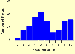
7 / 10
Plays
562
-
Question 1 of 10
1. The strait known as Eagle Passage and the fjords/bays of Choiseul Sound (pictured), Brenton Loch, Grantham Sound, Adventure Sound and Bay of Harbours separate the region known as Lafonia. In which archipelago can you find these bodies of water? Hint


Question 2 of 10
2. Dark Harbour (pictured) is a Canadian cultural heritage site located on the south side of the island of Grand Manan, the largest of the Fundy Islands. Chaleur Bay, the Bay of Fundy and Northumberland Strait are other bodies of water that surround which Canadian province? Hint


Question 3 of 10
3. The photograph shows a magnificent sunrise over the Sunda Strait. The Strait of Malacca, the Karimata Strait, the Badung Strait, Saleh Bay and the Gulf of Tomini are all bodies of water with coastlines in which island nation? Hint


Question 4 of 10
4. Buffalo Bayou (pictured), flows through a major U.S. city on its sedate 50-mile journey to the Gulf of Mexico. Big Cypress Bayou, a series of wetlands bordering Caddo Lake, forms part of the world's largest Cypress forest. Originally called Lake Granite Shoals, this 6,500-acre reservoir on the Colorado River was renamed for a U.S. President who owned a ranch on its shores. In which U.S. state can you find these bodies of water? Hint


Question 5 of 10
5. The photograph shows a longboat traversing the Pontcysyllte Aqueduct. Completed in 1805, it is both the longest and highest aqueduct in the UK. Further along the same canal, you can cross another Thomas Telford construction, the Chirk Aqueduct, which spans the border between England and Wales. Which canal, the longest in Wales, is carried by these aqueducts? Hint


Question 6 of 10
6. A different type of body of water here as we look at some of the world's great frozen rivers. Pictured is the Biafo Glacier which 'runs' for 42 miles through the Karakoram Mountains before joining the 30-mile long Hispar Glacier, thus forming the world's longest non-polar glacial system. Here you can also visit the Baltoro Glacier and the Batura Glacier, both over 35 miles long and amongst the Top 7 longest glaciers outside the polar regions. Which country are we visiting? Hint


Question 7 of 10
7. The photograph shows Hyams Beach, one of three beaches that surround Jervis Bay which claims to have the whitest sand in the world. Other bays in this country include Memory Cove and Pondalowie Bay in the south, Israelite Bay and William Bay in the west, Runaway Bay and Broad Sound in the east. Which beach-loving country are we visiting? Hint


Question 8 of 10
8. This lovely photograph shows Taal Lake which fills the volcanic Taal Caldera. With an area of over 90 square miles, Taal Lake is the world's largest lake on an island in a lake on an island. After Laguna de Bay and Lake Lanao, Lake Taal is also the third largest lake in which island country? Hint


Question 9 of 10
9. The photograph shows a truly spectacular sunset over the Andaman Sea. With an area of 231,000 square miles, the Andaman Sea is the size of Ukraine. It is, though, a relatively small part of a much larger body of water. The Gulf of Khambat, Palk Strait and the Laccadive Sea are also part of which of the world's oceans? Hint


Question 10 of 10
10. Passageways between two land masses, some narrow, some not, can be given numerous names. The picture shows the Revillagigedo Channel, a 35-miles long oceanic gap through the Alexander Archipelago. Also located in this U.S. state are Sumner Strait, the Dixon Entrance, Stephens Passage, the Behm Canal and The Narrows. Which state are we visiting?
Hint


(Optional) Create a Free FunTrivia ID to save the points you are about to earn:

arrow Select a User ID:
arrow Choose a Password:
arrow Your Email:


View Image Attributions for This Quiz

Quiz Answer Key and Fun Facts
1. The strait known as Eagle Passage and the fjords/bays of Choiseul Sound (pictured), Brenton Loch, Grantham Sound, Adventure Sound and Bay of Harbours separate the region known as Lafonia. In which archipelago can you find these bodies of water?

Answer: Falkland Islands

Lafonia is the southern region of East Falkland, one of the two main islands that make up the Falkland Islands. With an area of 4,700 square miles, the Falkland Islands are about the same size as the Middle East state of Qatar. East Falkland, which is about the size of the State of Palestine, covers about half of the territory's land area.

Eagle Passage separates the southern end of East Falkland from Speedwell Island. Running parallel to Eagle Passage, Choiseul Sound divides the eastern side of Lafonia from the unnamed northern part of East Falkland. On the western side of the island, the same function falls to Brenton Loch, one of the few so-called sea lochs outside of Scotland. Brenton Loch and Choiseul Sound are divided by a narrow isthmus of land on which stands the cities of Darwin and Goose Green.
2. Dark Harbour (pictured) is a Canadian cultural heritage site located on the south side of the island of Grand Manan, the largest of the Fundy Islands. Chaleur Bay, the Bay of Fundy and Northumberland Strait are other bodies of water that surround which Canadian province?

Answer: New Brunswick

New Brunswick is the largest of Canada's three 'Maritime Provinces' (Prince Edward Island and Nova Scotia being the other two), the countries three smallest provinces. With an area of 27,500 square miles, it is slightly larger than Ireland.

Known for having the world's highest tidal range, the Bay of Fundy is surrounded by New Brunswick, Nova Scotia and the US state of Maine. The Fundy Islands lie within the bay, and the largest of those islands, Grand Maran, is also the primary island in the Grand Manan Archipelago. It is here that Scottish pirate Captain William Kidd reputedly buried his treasure, in a region now known as 'Money Cove'.

The western end of Northumberland Strait separates New Brunswick (to the south) and Prince Edward Island. The strait is crossed by the 8-mile long Confederation Bridge which opened in 1997. Chaleur Bay, whose name translates to "bay of torrid weather", is an arm of the Gulf of Saint Lawrence. It lies to the north of New Brunswick, separating it from the Province of Quebec.
3. The photograph shows a magnificent sunrise over the Sunda Strait. The Strait of Malacca, the Karimata Strait, the Badung Strait, Saleh Bay and the Gulf of Tomini are all bodies of water with coastlines in which island nation?

Answer: Indonesia

Whether you count the number of islands (more than 14,000) or population (in excess of 250 million), Indonesia is the world's largest island nation. In terms of area (it is about twice the size of Egypt), only Greenland (which is not an independent nation) is larger.

The Sunda Strait separates the major islands of Sumatra and Java, whilst the narrow, 500-mile long Strait of Malacca separates Sumatra from the Malaysian Peninsula to the north. The Karimata Strait (once called the Karimata Passage) connects the Java Sea to the South China Sea and separates the islands of Sumatra and Borneo.

The Badung Strait, about 40 miles long and 10 miles wide, lies between the islands of Bali and Nusa Penida. Saleh Bay is almost entirely surrounded by the Indonesian island of Sumbawa. The Gulf of Tomini, which opens onto the Molukka Sea, is surrounded on three sides by the island of Sulawesi (Celebes).
4. Buffalo Bayou (pictured), flows through a major U.S. city on its sedate 50-mile journey to the Gulf of Mexico. Big Cypress Bayou, a series of wetlands bordering Caddo Lake, forms part of the world's largest Cypress forest. Originally called Lake Granite Shoals, this 6,500-acre reservoir on the Colorado River was renamed for a U.S. President who owned a ranch on its shores. In which U.S. state can you find these bodies of water?

Answer: Texas

Commonly found in the Mississippi Delta region of the Gulf Coast region of the southern U.S., a bayou is typically a slow-moving stream or river, or a marshy lake or wetland area.

The slow-moving Buffalo Bayou was formed some 18,000 years ago and today flows through Houston on its 50-mile journey from Fort Bend County in southeastern Texas to Galveston Bay. Caddo Lake, located on the eastern border of Texas and extending into Louisiana, is one of the few natural lakes in the state that was not formed by the oxbow method. Standing on the shore of the lake is the wonderfully-named city of Uncertain, Texas. (It was named because the original surveyors were uncertain which side of the state line the city was on.) Lake Granite Shoals, located in Texas Hill Country to the northwest of the state capital, Austin, was renamed Lake Lyndon B. Johnson in 1965. Another reservoir on the Colorado River is named Lady Bird Lake after Johnson's wife.
5. The photograph shows a longboat traversing the Pontcysyllte Aqueduct. Completed in 1805, it is both the longest and highest aqueduct in the UK. Further along the same canal, you can cross another Thomas Telford construction, the Chirk Aqueduct, which spans the border between England and Wales. Which canal, the longest in Wales, is carried by these aqueducts?

Answer: Llangollen Canal

Located in county borough of Wrexham in northeastern Wales, the Pontcysyllte Aqueduct carries the Llangollen Canal over the River Dee. The aqueduct was designed by Thomas Telford and completed in 1805. With a length of 1,008 feet and a height of 126 feet, this is the UK's longest and highest aqueduct.

An 11-mile stretch of the Llangollen Canal was designated as a UNESCO World Heritage Site in 2009. This stretch also includes the 710-foot long Chirk Aqueduct, which carries the Llangollen Canal across the border between England and Wales.

With a length of 46.3 miles, the Llangollen Canal is the longest in Wales. It links Llangollen in Denbighshire, north Wales, with Hurleston in south Cheshire. The route takes you through the town of Ellesmere in Shropshire.
6. A different type of body of water here as we look at some of the world's great frozen rivers. Pictured is the Biafo Glacier which 'runs' for 42 miles through the Karakoram Mountains before joining the 30-mile long Hispar Glacier, thus forming the world's longest non-polar glacial system. Here you can also visit the Baltoro Glacier and the Batura Glacier, both over 35 miles long and amongst the Top 7 longest glaciers outside the polar regions. Which country are we visiting?

Answer: Pakistan

The longest single glacier outside the polar regions is the Fedchenko Glacier, which covers 48 miles through the Pamir Mountains in eastern Tajikistan. The largest concentration of long glaciers outside of the polar regions, though, is in Pakistan, with the Biafo, the Baltoro and the Batura Glaciers ranked third, fifth and seventh respectively.

Located in the Karakoram Mountains in Gilgit Baltistan in the extreme north of Pakistan, the 62-mile long ice highway created by the Biafo and the Hispar glaciers joins the ancient mountain kingdoms of Baltistan in the east and Nagar in the west. The two glaciers meet at the Hispar Pass, some 16,824 feet above sea level.
7. The photograph shows Hyams Beach, one of three beaches that surround Jervis Bay which claims to have the whitest sand in the world. Other bays in this country include Memory Cove and Pondalowie Bay in the south, Israelite Bay and William Bay in the west, Runaway Bay and Broad Sound in the east. Which beach-loving country are we visiting?

Answer: Australia

The most famous of all bays in Australia is Botany Bay. It was on the southern banks of Botany Bay, at Kurnell, just a few miles south of what is now downtown Sydney, that Captain James Cook first landed on Saturday, April 29, 1770.

Jervis Bay is drowned river valley that formed a 39-square mile oceanic bay some 15,000 years ago. Some 110 miles south of Sydney on the south coast of New South Wales and fronting onto the Pacific Ocean, the bay is bordered by (north to south) Chinaman's Beach, Hyams Beach and Seaman's Beach. The 'Guinness World Records' designates Hyams Bay as having the world's whitest sand.
8. This lovely photograph shows Taal Lake which fills the volcanic Taal Caldera. With an area of over 90 square miles, Taal Lake is the world's largest lake on an island in a lake on an island. After Laguna de Bay and Lake Lanao, Lake Taal is also the third largest lake in which island country?

Answer: Philippines

Sixteen miles long and eleven miles wide, Lake Taal has a surface area more than four times the size of Bermuda. Located on the island of Luzon, Lake Taal is the third-largest lake in the Philippines. The lake has an average depth of 330 feet but is more than 550 feet deep in places.

The Taal Volcano National Park was designated in 1967. A popular tourist destination, visitors here first cross the lake before climbing to the top of Volcano Island on horseback. Easily accessible from Manila, the lake has also become a popular spot for kite-boarders.
9. The photograph shows a truly spectacular sunset over the Andaman Sea. With an area of 231,000 square miles, the Andaman Sea is the size of Ukraine. It is, though, a relatively small part of a much larger body of water. The Gulf of Khambat, Palk Strait and the Laccadive Sea are also part of which of the world's oceans?

Answer: Indian Ocean

The Andaman Sea is a continuation of the Bay of Bengal to the southeast. It has coastlines with Myanmar (Burma) to the north, Thailand to the east, the Malay Peninsula to the southeast and the Indonesian island of Sumatra to the south. Some 7450 miles long and 400 miles across, the Andaman Sea has a maximum depth of more than 13,700 feet.

The Gulf of Khambat is an inlet of the Arabian Sea along the west coast of India. Palk Strait connects the Arabian Sea and the Bay of Bengal and separates southern India from Sri Lanka. The Laccadive Sea lies southwest of India and contains the Maldives. Along with the Andaman Sea, they are all part of the Indian Ocean.
10. Passageways between two land masses, some narrow, some not, can be given numerous names. The picture shows the Revillagigedo Channel, a 35-miles long oceanic gap through the Alexander Archipelago. Also located in this U.S. state are Sumner Strait, the Dixon Entrance, Stephens Passage, the Behm Canal and The Narrows. Which state are we visiting?

Answer: Alaska

Containing more than 1,100 islands, the Alexander Archipelago is a 300-mile long group of islands off the southeast coast of Alaska. Part of the "Inside Passage", the Revillagigedo Channel passes west of the mainland, south of Revillagigedo Island and northeast of Duke Island and Annette Island. The channel was named in 1793 after the viceroy of New Spain, Juan Vicente de Güemes, 2nd Count of Revillagigedo.

Charted and named by George Vancouver in 1793, the 108-mile long Behm Canal can also be found in the Alexander Archipelago. So too can Stephens Passage which follows the coastline from just south of the capital, Juneau, for over 100 miles passing to the east of Admiralty Island.
Source: Author EnglishJedi

This quiz was reviewed by FunTrivia editor Tizzabelle before going online.
Any errors found in FunTrivia content are routinely corrected through our feedback system.
Related Quizzes
1. What a Gulf Lies Between Us Very Easy
2. So That's Where It Is! Average
3. A Widening Gulf Easier
4. Beautiful Bays Easier
5. Lakes of the World Easier
6. These Lakes & Rivers are a Big Deal! Very Easy
7. Taking the Plunge Easier
8. Come Sail the Seas Very Easy
9. Unnatural Waters Average
10. Estuaries of the World Average
11. Facts About Water Average
12. How Many Seas Average

1/23/2025, Copyright 2025 FunTrivia, Inc. - Report an Error / Contact Us