FREE! Click here to Join FunTrivia. Thousands of games, quizzes, and lots more!
Quiz about Where the Streets Have No Name

Where the Streets Have No Name Quiz

All About Ethiopia

The lyrics for the song in the title were inspired by a trip that Bono took to Ethiopia. While on a humanitarian mission with his wife, the lyrics for the song were born. See what you know of this inspiring country.

A photo quiz by LeoDaVinci. Estimated time: 4 mins.
  1. Home
  2. »
  3. Quizzes
  4. »
  5. Geography Trivia
  6. »
  7. Africa
  8. »
  9. Ethiopia

Author
LeoDaVinci
Time
4 mins
Type
Photo Quiz
Quiz #
409,193
Updated
Apr 30 23
# Qns
10
Difficulty
Average
Avg Score
7 / 10
Plays
727
Awards
Top 5% quiz!
-
Question 1 of 10
1. Addis Ababa is the capital of Ethiopia, built in an easily defensible place with a source of potable water. Originally called 'Finfinne' for the reason that the city was built at that site, what did that name mean? Hint


photo quiz
Question 2 of 10
2. Other than Eritrea, which broke off from Ethiopia in 1993, Ethiopia shares a border with five other countries. Which is *not* one of them? Hint


photo quiz
Question 3 of 10
3. Ethiopia, one of the largest countries in the world, has many rivers. Do the Blue Nile and the Black Nile, parts of the longest river in the world, originate in Ethiopia?


photo quiz
Question 4 of 10
4. Right through Ethiopia (and that region of Africa) runs a tectonic fault line where the African plate is being split into two smaller plates due to its crashing into the Arabian plate. What name is given to this tectonic boundary? Hint


photo quiz
Question 5 of 10
5. Ethiopia's climate has three distinct seasons, not four. Mon Dieu! Which of the following is *not* one of them? Hint


photo quiz
Question 6 of 10
6. Ethiopia is landlocked. It uses Djibouti as its main port. Was it always landlocked?


photo quiz
Question 7 of 10
7. Aw, due to the size of Ethiopia, it has many types of climate. Located about 600 kilometers from the equator, what is the predominant climate found on the western (inland) side of the country? Hint


photo quiz
Question 8 of 10
8. One of Ethiopia's economic strengths is its agriculture. It produced in 2020 about 90% of the world's supply of this indigenous grain, used for making injera, a traditional part of the Ethiopian meal. What grain is Ethiopia known for? Hint


photo quiz
Question 9 of 10
9. One of the first empires to be based in Ethiopia is that of D'mt, whose capital was at Yeha. Which region of Ethiopia, the site of a civil war that started in 2020, is Yeha located in? Hint


photo quiz
Question 10 of 10
10. The highest point in Ethiopia, Ras Dejen, is a point which used to be a part of an ancient caldera of a volcano. However, what happened to the northern part of the caldera? Hint


photo quiz

(Optional) Create a Free FunTrivia ID to save the points you are about to earn:

arrow Select a User ID:
arrow Choose a Password:
arrow Your Email:


View Image Attributions for This Quiz

Most Recent Scores
Oct 24 2024 : Guest 68: 5/10
Sep 22 2024 : Guest 47: 5/10

Quiz Answer Key and Fun Facts
1. Addis Ababa is the capital of Ethiopia, built in an easily defensible place with a source of potable water. Originally called 'Finfinne' for the reason that the city was built at that site, what did that name mean?

Answer: Natural spring

Addis Ababa is the capital as well as the largest city in Ethiopia. In Oromo, the language of the native Cushites, Finfinne means 'natural spring', referring to the mineral springs that are present there that led to Addis Ababa being founded in the 19th century as a vacation city with health benefits, like a spa resort town. Addis Ababa means 'new flower' in Orome, and this was the name the rapidly growing settlement got. In 1889 the capital was moved to the city by Menelik II coinciding with his rising to be the Emperor of Ethiopia.

Shown is a local church in Addis Ababa.
2. Other than Eritrea, which broke off from Ethiopia in 1993, Ethiopia shares a border with five other countries. Which is *not* one of them?

Answer: Uganda

Around Ethiopia in a clockwise manner, the country shares a border with Eritrea in the north, Djibouti in the northeast, Somalia (and Somaliland) in the east and southeast, Kenya in the south, South Sudan in the west and Sudan in the northwest. The shortest border is with Djibouti; however, the two countries share a very close bond as Djibouti is the easiest access to the sea for Ethiopia. The longest border is with Somalia; conflicts within Somalia (including the de jure status of Somaliland) have made the relationship between the two countries quite dynamic.

Shown is a map of Ethiopia with coffee, the dominant export, covering the silhouette of the country.
3. Ethiopia, one of the largest countries in the world, has many rivers. Do the Blue Nile and the Black Nile, parts of the longest river in the world, originate in Ethiopia?

Answer: Yes

Ethiopia is a country which has many major rivers. While a few of them flow eastwards, eventually draining into the Indian Ocean, most of the rivers are to the west of the East African Rift System and flow into the longest river in the world (by most measurements), the Nile.

Some of the rivers empty into the Atbarah River, also called the Black Nile. The Atbarah River begins flowing in northwestern Ethiopia, north of Lake Tana. Many of them flow into the Abay River, which is the Blue Nile itself. The Black Nile joins with the Nile at Atbarah in Sudan, the last major tributary. The Blue Nile joins with the Nile earlier, at Khartoum, Sudan, and gives the Nile about 80% of its water.

Ethiopia also has a few rivers that flow into South Sudan's Sobat River, a tributary of the White Nile. So, Ethiopia, as a country, provides a lot of water to the Nile.

In the picture you can see Lake Tana, the source of the Blue Nile.
4. Right through Ethiopia (and that region of Africa) runs a tectonic fault line where the African plate is being split into two smaller plates due to its crashing into the Arabian plate. What name is given to this tectonic boundary?

Answer: East African Rift System

The East African Rift System is the fault boundary that passes through Ethiopia and six other countries where the African (Nubian) Plate is breaking into two tectonic plates due to its motion into the Arabian Plate. Originally just a rift zone, this is developing into a divergent plate system where the two plates will eventually drift away from one another and the sea will start to pour into the valley, similar to what happened to form the Red Sea.

This system is relatively "new", having formed about 22-25 million years ago. In Ethiopia, it formed the Rift Valley, close to where Addis Ababa is located. Much evidence from early human evolution was found in this area.

Pictured is the Great Rift Valley, although taken a bit south of Ethiopia itself.
5. Ethiopia's climate has three distinct seasons, not four. Mon Dieu! Which of the following is *not* one of them?

Answer: Hiver

The climate of Ethiopia is characterized by three distinct seasons. Kiremt runs from June to September, approximately, and is the rainy season. This is when the majority of the rains fall in the country, especially in the western parts where monsoons are characteristic. Bega is next, lasting from about October to January. It is the hot and dry season in the day, but with cool nights. Belg is from February to May, and is characterized by occasional rains, leading up to the rainy season.

In the picture you can see the salt flats in the southwestern side of the country.
6. Ethiopia is landlocked. It uses Djibouti as its main port. Was it always landlocked?

Answer: No

Ethiopia was not always landlocked. When it was founded, it had access to the Red Sea through its land in what is now Eritrea. At the time, Eritrea was made a part of Ethiopia's territory because of Haile Selassie's insistence that the two nations be as one. However, under the direction of the United Nations, a referendum was held and Eritrea gained its independence in 1993. This took away all Ethiopian ports and shoreline and made Ethiopia dependent on Djibouti as their conduit for international trade.

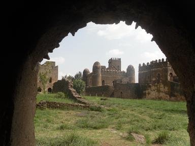
In the picture is a vista from Ethiopia.
7. Aw, due to the size of Ethiopia, it has many types of climate. Located about 600 kilometers from the equator, what is the predominant climate found on the western (inland) side of the country?

Answer: Savannah

According to the Köppen climate classification system, Ethiopia has fourteen different types of climate. However, that's not very surprising considering it's one of the largest countries in the world. In the eastern parts of the country is where you'd find the desert and hot arid and semi-arid climates. In the high central mountains are the tropical and subtropical climates. Finally, in the west are the savannah (Aw classification) and monsoon regions. Believe it or not, tundra and subpolar oceanic can also be found, though in tiny pockets.

The picture was taken during the rainy season in the western parts of Ethiopia.
8. One of Ethiopia's economic strengths is its agriculture. It produced in 2020 about 90% of the world's supply of this indigenous grain, used for making injera, a traditional part of the Ethiopian meal. What grain is Ethiopia known for?

Answer: Teff

Teff (sometimes spelled tef) is one of the oldest cultivated grains in the world. It originated in Ethiopia and Eritrea and is a very useful grain. Not only can the seeds be ground up into a flour, but the stalks of the crop can be used to feed livestock. It is relatively simple to grow from just a handful of seeds.

In Ethiopia, teff flour is used to make injera, the national bread that constitutes an important part of the Ethiopian meal. Ethiopia produces the vast majority of the world's supply of teff and has outlawed the export of raw teff to prevent other countries from cultivating the crop and squeezing Ethiopia out of the teff market.

A teff harvest can be seen in the picture, an important event.
9. One of the first empires to be based in Ethiopia is that of D'mt, whose capital was at Yeha. Which region of Ethiopia, the site of a civil war that started in 2020, is Yeha located in?

Answer: Tigray

D'mt was an empire that was founded in 980 BCE whose capital was in Yeha, in the Tigray province of Ethiopia. It straddled the Red Sea and had holdings in current-day Yemen as well, and held on for at least 500 years before dissolving. It is unclear whether it evolved into the Aksumite Kingdom or not, as very few archaeological records have been discovered.

Tigray is a province in northers Ethiopia which has a fierce national identity. On November 3, 2020, the local militia launched attacks against the Ethiopian Army as well as the local gendarmerie, launching the Tigray War, an internal conflict in the country. Despite international pleading, both sides have committed war crimes in the course of the conflict, a tragic turn of events.

You can see in the picture the inside of the Temple of the Moon, one of many ruins and archaeological finds in Ethiopia.
10. The highest point in Ethiopia, Ras Dejen, is a point which used to be a part of an ancient caldera of a volcano. However, what happened to the northern part of the caldera?

Answer: Washed away by a river

Ras Dejen (or Ras Dashen, as a corruption of the original Amharic name), is the highest point in Ethiopia and the 14th-highest point in Africa. It is a part of an ancient caldera of a volcano along with its sister peak Mount Bwahit to the west. However, the northern part of the caldera and part of the southern were washed away by a river which now flows there - the Meshaha river and other smaller rivers all which flow into the Tekezé River, one of Ethiopia's major waterways.

The side of Ras Dejen is pictured, not the most hospitable place, but not a difficult climb.
Source: Author LeoDaVinci

This quiz was reviewed by FunTrivia editor agony before going online.
Any errors found in FunTrivia content are routinely corrected through our feedback system.
11/21/2024, Copyright 2024 FunTrivia, Inc. - Report an Error / Contact Us