FREE! Click here to Join FunTrivia. Thousands of games, quizzes, and lots more!
Quiz about A Handy Guide to Papua New Guinea

A Handy Guide to Papua New Guinea Quiz


Are you after some basic facts about Papua New Guinea? Then this quiz on the Pacific island nation might be just the thing you need. Try it and find out...

A photo quiz by Fifiona81. Estimated time: 4 mins.
  1. Home
  2. »
  3. Quizzes
  4. »
  5. Geography Trivia
  6. »
  7. Pacific Islands
  8. »
  9. Papua New Guinea

Author
Fifiona81
Time
4 mins
Type
Photo Quiz
Quiz #
393,095
Updated
Dec 03 21
# Qns
10
Difficulty
Average
Avg Score
7 / 10
Plays
1670
Awards
Top 5% quiz!
Last 3 plays: Guest 60 (4/10), Guest 136 (9/10), Guest 202 (7/10).
-
Question 1 of 10
1. The boundary separating the island of New Guinea between Papua New Guinea and Indonesia is largely a straight line, except for one point where it takes a bit of a detour (see the map in the picture clue). What type of geographic feature caused this deviation? Hint


Question 2 of 10
2. Papua New Guinea's territory includes several islands in the western Pacific. Which of these is the largest island of the Bismarck Archipelago? Hint


Question 3 of 10
3. Papua New Guinea is covered in rainforest, so travelling around the country can be a bit tricky. What would be the most likely way for someone to get from the capital, Port Moresby, to the city of Lae, which is located at one end of the Highlands Highway? Hint


Question 4 of 10
4. The Torres Strait separates Papua New Guinea from which Australian state or territory? Hint


Question 5 of 10
5. Papua New Guinea's capital city, Port Moresby, is located on the Papuan Peninsula. By what alternative name is this peninsula also known? Hint


Question 6 of 10
6. The annual Goroka Show is one of Papua New Guinea's most popular tourist attractions and involves different tribes showcasing their culture, particularly through music and dancing. By what name is this type of Papuan cultural gathering known? Hint


Question 7 of 10
7. In addition to the country's second-highest volcano, what other geographical feature of Papua New Guinea is called Mount Hagen? Hint


Question 8 of 10
8. The island of New Guinea is one of the most biologically diverse places on earth with hundreds of endemic species. Which of these animals found there is specifically endemic to Papua New Guinea? Hint


Question 9 of 10
9. Manus Island, which gives its name to Papua New Guinea's smallest province, is part of which island group? Hint


Question 10 of 10
10. The other countries of the world with 'Guinea' in their name - Equatorial Guinea, Guinea and Guinea-Bissau - are located on the African continent, but island-based Papua New Guinea is larger than all of them. True or false?


(Optional) Create a Free FunTrivia ID to save the points you are about to earn:

arrow Select a User ID:
arrow Choose a Password:
arrow Your Email:


View Image Attributions for This Quiz

Most Recent Scores
Jan 20 2025 : Guest 60: 4/10
Jan 04 2025 : Guest 136: 9/10
Dec 16 2024 : Guest 202: 7/10
Dec 14 2024 : Guest 99: 2/10
Dec 04 2024 : Johnmcmanners: 10/10
Nov 27 2024 : Guest 202: 1/10

Quiz Answer Key and Fun Facts
1. The boundary separating the island of New Guinea between Papua New Guinea and Indonesia is largely a straight line, except for one point where it takes a bit of a detour (see the map in the picture clue). What type of geographic feature caused this deviation?

Answer: River

Papua New Guinea occupies the eastern half of the island of New Guinea, while the western half consists of two Indonesian provinces - Papua and West Papua. Eastern New Guinea was formerly split into two colonies, with the northern part known as German New Guinea while the southern part was controlled by Britain. The area came under Australian control during the Second World War and remained as such until it became an independent nation in 1974. By contrast, the western part of the island was a Dutch colony until control over it was transferred to Indonesia in 1963.

When the boundary line across the island was drawn up in the 1890s, its northern end was placed on the line of longitude at 141 degrees east of Greenwich and it continued southwards on that alignment until it was diverted to follow the course of the Fly River - leaving a small portion of land to the west of that longitude under British control. When the straight boundary continued south from the river, it did so slightly east of the 141st meridian in order to balance out the western territory lost by the diversion. The idea behind this apparently odd decision was to keep the course of the Fly River within British territory.
2. Papua New Guinea's territory includes several islands in the western Pacific. Which of these is the largest island of the Bismarck Archipelago?

Answer: New Britain

The Bismarck Archipelago is located off the northern coast of Papua New Guinea and consists of dozens of small islands in addition to the major islands of New Britain and New Ireland. Overall, the islands cover a land area of approximately 50,000 square kilometres (19,000 square miles), but New Britain - the largest of the islands - accounts for over 70% of that.

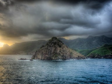
Islands in the Bismarck Archipelago were first colonised by Germany in 1884 and named after the German leader, Otto von Bismarck. New Britain (shown in the picture clue) was originally named Neupommern (or New Pomerania). The islands were part of the colony of German New Guinea until the First World War, when they were captured by Australia. They remained under Australian control until Papua New Guinea gained its independence.
3. Papua New Guinea is covered in rainforest, so travelling around the country can be a bit tricky. What would be the most likely way for someone to get from the capital, Port Moresby, to the city of Lae, which is located at one end of the Highlands Highway?

Answer: Aeroplane

Port Moresby is located on Papua New Guinea's south-west coast, while Lae is almost 300 kilometres (186 miles) north of it on the opposite coastline. Lae is located at one end of the Highlands Highway, which connects a number of the country's major towns and cities, but Port Moresby is not on it and has no road connection to it. Since there are no major passenger railways in Papua New Guinea, that just leaves air or sea as the only viable means to travel between the capital and most other places in the country. Port Moresby is home to the country's international airport and domestic flights are available from there to a range of other cities, including Lae.

As both Port Moresby and Lae have port facilities, it would also be possible - but much, much, slower - to travel between them by ship.
4. The Torres Strait separates Papua New Guinea from which Australian state or territory?

Answer: Queensland

The Torres Strait (named after the explorer Luis Vaz de Torres) lies between the southern coast of Papua New Guinea and the northern-most tip of the Australian mainland - Cape York Peninsula in Queensland. The strait connects the Arafura Sea to the west and the Coral Sea to the east and is noted for being particularly shallow and difficult to navigate. There are hundreds of small islands located in the strait that are collectively known as the Torres Strait Islands, but only about 5% of these are inhabited. The indigenous people of the islands are known as Torres Strait Islanders. While most of the islands are considered to be part of Queensland (but under the control of their own elected regional authority), a few that lie closer to Papua New Guinea are part of its territory.

The picture clue shows a satellite image of the Great Barrier Reef, which is also located just off Queensland.
5. Papua New Guinea's capital city, Port Moresby, is located on the Papuan Peninsula. By what alternative name is this peninsula also known?

Answer: Bird's Tail Peninsula

The Papuan Peninsula - the long, tapering bit of New Guinea that extends out to the south-east - is also known as the Bird's Tail Peninsula. The more rounded peninsula in the north-west of the Indonesian part of the island is correspondingly known as the Bird's Head Peninsula. The central part of the Bird's Tail Peninsula is mountainous and heavily forested, with the Owen Stanley Range running down it like a backbone (or tailbone, I suppose!). The highest point in this range is Mount Victoria, which is around 75 km (45 miles) from Port Moresby and visible from that city.

The picture clue shows a Raggiana bird-of-paradise (complete with prominent tail), which is Papua New Guinea's national bird and was included in the design of both the national flag and national emblem in 1971.
6. The annual Goroka Show is one of Papua New Guinea's most popular tourist attractions and involves different tribes showcasing their culture, particularly through music and dancing. By what name is this type of Papuan cultural gathering known?

Answer: Sing-sing

The events in question are known as sing-sings. Performers from different tribes and villages across the country dress up in a range of traditional decorative costumes, often with elaborate feather (and sometimes whole bird) headdresses, and demonstrate their local dances, songs and other cultural rituals.

While it may look like a traditional event, the first Goroka Show actually took place in 1957 and was organised by the Australian administration to try and reduce the amount of fighting and violence between Papua New Guinea's different peoples. It proved to be a successful venture and quickly became fixed as an annual event and subsequently as a tourist attraction. Other well-known sing-sings include the Mount Hagen Cultural Show and the National Mask Festival in Kokopo.

The picture clue shows Sing Sing prison in New York State, USA.
7. In addition to the country's second-highest volcano, what other geographical feature of Papua New Guinea is called Mount Hagen?

Answer: City

The city of Mount Hagen is one of the largest in Papua New Guinea, although (as shown by the photo of it in the picture clue) it is quite small by worldwide city standards! It is the capital of the Western Highlands Province and is located in a mountain valley, close to the volcano from which it takes its name, at around 1,700 metres (5,500 feet) above sea level. Although the city wasn't founded until 1934, the area had previously been inhabited by a range of native tribes and the strong cultural heritage of the area is reflected in the annual Mount Hagen Show - another popular and well-known "sing-sing".

The other Mount Hagen is an eroded stratovolcano which stretches up to nearly 3,800 metres (12,400 feet) above sea level. Although the second-highest volcano on the whole Australasian continent, it is nowhere near the highest peak overall. That honour goes to Puncak Jaya, a mountain in the Indonesian portion of New Guinea (at around 4,900 metres or 16,000 feet above sea level).
8. The island of New Guinea is one of the most biologically diverse places on earth with hundreds of endemic species. Which of these animals found there is specifically endemic to Papua New Guinea?

Answer: Giant Bandicoot

Bandicoots are generally small marsupials found across Australia and the island of New Guinea. There are about 20 known species of bandicoot (one of which is shown in the picture clue) and quite a few of those are endemic to Papua New Guinea. The giant bandicoot (Peroryctes broadbenti) is, rather unsurprisingly, the largest of these and can be found in the tropical forests surrounding the rivers of the Bird's Tail Peninsula in the south-east of the country. Its rarity, limited habitat and the dangers posed by deforestation and hunting led to the giant bandicoot being placed on the IUCN Red List of Threatened Species.

Sir David's long-beaked echidna is named after the famous British naturalist, Sir David Attenborough, and is endemic to the Cyclops Mountains in the Indonesian part of New Guinea. The common spotted cuscus is a tree-dwelling marsupial (not a North African dish made from semolina) found across New Guinea and Australia's Cape York Peninsula. The dingiso (not to be confused with a dingo) is a tree-kangaroo found in western New Guinea (i.e. the Indonesian bit).
9. Manus Island, which gives its name to Papua New Guinea's smallest province, is part of which island group?

Answer: Admiralty Islands

Manus Island is the largest of the Admiralty Islands, which are, in turn, part of the wider Bismarck Archipelago. All of the 18 islands that make up the Admiralty Islands are covered in tropical rainforest and home to an exotic range of rare birds and bats - many of which are endemic to the area. The islands are part of Papua New Guinea's Manus Province, which also includes the Western Islands group. Lorengau is Manus Island's major town and is also the capital of Manus Province.

The picture clue shows HMS Victory, the flagship of Admiral Lord Nelson at the Battle of Trafalgar in 1805. Commodore Island can be found in Canada's Hudson Bay and the Marshall Islands are an island nation in the Pacific Ocean. There is no such place as the "Commandant's Islands", but historically many islands have been governed by a commandant.
10. The other countries of the world with 'Guinea' in their name - Equatorial Guinea, Guinea and Guinea-Bissau - are located on the African continent, but island-based Papua New Guinea is larger than all of them. True or false?

Answer: True

Papua New Guinea covers a land area of approximately 453,000 square kilometres (175,000 square miles), which is getting on for twice the size of Guinea, the next-largest of the four countries at around 246,000 square kilometres (95,000 square miles). Guinea-Bissau and Equatorial Guinea are both about 28,000 square kilometres (11,000 square miles).

However, it shouldn't be that surprising that Papua New Guinea is bigger than countries on the much larger African continent. New Guinea is the second-largest island in the world (behind Greenland) and Papua New Guinea occupies approximately half of it, in addition to numerous surrounding islands.

The picture clue shows an outline map of each of the four 'Guinea's, but I'm afraid it might not have been much help in answering this question since they're not all shown to the same scale!
Source: Author Fifiona81

This quiz was reviewed by FunTrivia editor agony before going online.
Any errors found in FunTrivia content are routinely corrected through our feedback system.
Related Quizzes
This quiz is part of series A Handy Guide to...:

Are you after some basic facts about countries and places around the world? Then these quizzes might be just the thing you need. Try them and find out...

  1. A Handy Guide to the Caribbean Easier
  2. A Handy Guide to Colombia Easier
  3. A Handy Guide to Ethiopia Average
  4. A Handy Guide to Fiji Average
  5. A Handy Guide to Kazakhstan Average
  6. A Handy Guide to Mauritius Average
  7. A Handy Guide to Papua New Guinea Average
  8. A Handy Guide to Paraguay Average
  9. A Handy Guide to Singapore Average
  10. A Handy Guide to Spain Average
  11. A Handy Guide to Vanuatu Average
  12. A Handy Guide to Venezuela Easier

1/21/2025, Copyright 2025 FunTrivia, Inc. - Report an Error / Contact Us