FREE! Click here to Join FunTrivia. Thousands of games, quizzes, and lots more!
Quiz about Bhutan  Dont Worry Be Happy

Bhutan - Don't Worry, Be Happy Quiz


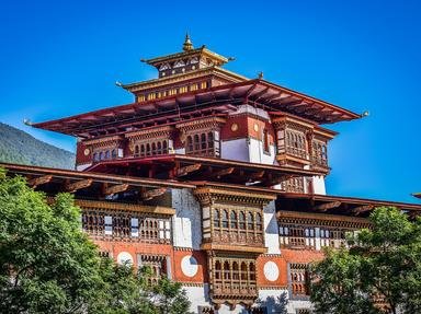
Bhutan is perhaps known for being an isolated "Land of the Thunder Dragon", which bases its political decisions not on their impact on Gross Domestic Product, but on Gross National Happiness. What else do you know about this fascinating nation?

A multiple-choice quiz by doublemm. Estimated time: 4 mins.
  1. Home
  2. »
  3. Quizzes
  4. »
  5. Geography Trivia
  6. »
  7. Asia
  8. »
  9. Bhutan

Author
doublemm
Time
4 mins
Type
Multiple Choice
Quiz #
345,260
Updated
Dec 03 21
# Qns
10
Difficulty
Average
Avg Score
7 / 10
Plays
6624
Awards
Top 10% Quiz
Last 3 plays: portalrules123 (8/10), Kalibre (5/10), WolfInSnow (9/10).
- -
Question 1 of 10
1. Drangme Chhu, one of the major rivers of Bhutan, flanks a small mountain range found in the central region of the country which shares its name with ranges found in Arizona and Wales. What is the name of this mountain range? Hint


Question 2 of 10
2. The remote, landlocked nation of Bhutan was largely shut off from the rest of the world until the 1960s. Which of the following infrastructure items was NOT first established in Bhutan in the 1960s? Hint


Question 3 of 10
3. How many administrative districts, known as dzongkhags, is Bhutan divided into? Hint


Question 4 of 10
4. Which of the following are all examples of Bhutanese dzongkhags (districts), their names' similar to words meaning respectively, 1) a humorous outcry, 2) a Palestinian territory found on the Mediterranean Sea, and 3) a period of play in the sport of polo? Hint


Question 5 of 10
5. True/False - Parts of Bhutan have a tropical/subtropical climate?


Question 6 of 10
6. Between 1957 and 2000, Bhutan suffered four of the natural disasters abbreviated to GLOFs. What exactly is a GLOF? Hint


Question 7 of 10
7. One of Bhutan's primary exports is electricity, particularly to their main import and export partner India. How is the vast majority of Bhutan's exported electricity generated? Hint


Question 8 of 10
8. The rare black-necked crane visits its breeding grounds near the Gangteng Monastery in Bhutan every winter. This valley is home to various other rare and endangered species, and is the site of a protected wildlife reserve. Apart from Gangteng, by which other name is this stunningly beautiful glacial valley known? Hint


Question 9 of 10
9. Like most Himalayan countries, stories can be heard in Bhutan about encounters with the Migoi (or Yeti). What occurred in 1966 which meant the Migoi could be seen by many people in Bhutan? Hint


Question 10 of 10
10. Perched precariously on a cliff, Paro Taktsang, also known as The Tiger's Nest, is perhaps the most photographed site in Bhutan. What is it? Hint


(Optional) Create a Free FunTrivia ID to save the points you are about to earn:

arrow Select a User ID:
arrow Choose a Password:
arrow Your Email:


Most Recent Scores
Jan 09 2025 : portalrules123: 8/10
Dec 18 2024 : Kalibre: 5/10
Dec 17 2024 : WolfInSnow: 9/10
Dec 06 2024 : hellobion: 10/10
Dec 02 2024 : Edzell_Blue: 10/10
Nov 29 2024 : Guest 119: 9/10

Score Distribution

quiz
Quiz Answer Key and Fun Facts
1. Drangme Chhu, one of the major rivers of Bhutan, flanks a small mountain range found in the central region of the country which shares its name with ranges found in Arizona and Wales. What is the name of this mountain range?

Answer: The Black Mountains

The Drangme Chhu empties into the Brahmaputra, which is unique amongst Indian rivers in that it is considered masculine.
Along with the Mo Chhu, the Drangme Chhu flanks the Black Mountains - a range found in central Bhutan and one which is dwarfed by its Himalayan neighbours. "Chhu" is Dzongkha for "water".
2. The remote, landlocked nation of Bhutan was largely shut off from the rest of the world until the 1960s. Which of the following infrastructure items was NOT first established in Bhutan in the 1960s?

Answer: Airport

The first airport in Bhutan, Paro International Airport, was built in 1983. The airport, located in a valley surrounded by steep peaks, is considered one of the most difficult to negotiate, and only a limited number of pilots have been certified to land there. Bhutan's first paved road was built in 1961, the first telephone network was installed in 1963, and the Bank of Bhutan was established in 1968.

Incidentally, television didn't arrive in Bhutan until the late 1990s.
3. How many administrative districts, known as dzongkhags, is Bhutan divided into?

Answer: Twenty

The twenty dzongkhags are grouped into four zones, or dzongdey, according to their location in the country. Each dzongdey has its own capital city, with Thimphu being the capital of the Western dzongda as well as Bhutan's capital. The Eastern zone holds the smallest dzongkhag (Pemagatshel), while the Central dzongda's Wangdue Phodrang is the country's largest district. Until 1992, there were eighteen districts, but some were divided down again to create two additional dzongkhags.
4. Which of the following are all examples of Bhutanese dzongkhags (districts), their names' similar to words meaning respectively, 1) a humorous outcry, 2) a Palestinian territory found on the Mediterranean Sea, and 3) a period of play in the sport of polo?

Answer: Haa, Gasa and Chukha

Haa and Chukha are both found in the Eastern zone, and Gasa is located in the Central zone. Dzongkhags can be further divided into gewogs, of which there are 205, each administered by a Gewog Tshogdu.
5. True/False - Parts of Bhutan have a tropical/subtropical climate?

Answer: True

Bhutan has three distinct climatic zones, the Alpine Zone above around 4000m in altitude, the Temperate Zone from around 2000-4000m altitude, and the Tropical Zone below 2000m. The lowest elevation in Bhutan is around 150m above sea level. There is much variance between sources as to whether Bhutan's climate is tropical or subtropical.
6. Between 1957 and 2000, Bhutan suffered four of the natural disasters abbreviated to GLOFs. What exactly is a GLOF?

Answer: Glacial Lake Outburst Flood

The four major GLOFs occurred in 1957, '63, '68, and '94, and they caused massive damage to both the infrastructure and the environment. They are thought to have been caused by the Himalayan glaciers retreating as the planet warms. There are around 680 glaciers in Bhutan and scientists have identified at least 25 as being high risk for future GLOF.
7. One of Bhutan's primary exports is electricity, particularly to their main import and export partner India. How is the vast majority of Bhutan's exported electricity generated?

Answer: Hydropower

Bhutan's location in the Himalayas presents great opportunities to harness the power of the mountain range's glacial flows to generate electricity through hydropower. Over 99% of the country's electricity comes from hydropower, with a very small amount as a result of burning fossil fuels. Bhutan's agricultural exports, which include fruits, rice, and spices, are primarily directed to India, Hong Kong and Bangladesh.
8. The rare black-necked crane visits its breeding grounds near the Gangteng Monastery in Bhutan every winter. This valley is home to various other rare and endangered species, and is the site of a protected wildlife reserve. Apart from Gangteng, by which other name is this stunningly beautiful glacial valley known?

Answer: Phobjika Valley

The black-necked cranes arrive in Phobjika Valley in late October each year, and soon after they arrive the local people celebrate with the Festival of Tsechu. The people who live in the valley, including the monks of the Gangteng Monastery, are semi nomadic, with everyone moving out during the winter months.
9. Like most Himalayan countries, stories can be heard in Bhutan about encounters with the Migoi (or Yeti). What occurred in 1966 which meant the Migoi could be seen by many people in Bhutan?

Answer: A postage stamp was issued depicting the creature

Migoi is the Bhutanese term for a Yeti.

Bhutan is found on the eastern end of the Himalayas and its highest point is Gangkhar Puensum, the 40th highest peak in the world. It is the highest unclimbed mountain in the world as of January 2012.
10. Perched precariously on a cliff, Paro Taktsang, also known as The Tiger's Nest, is perhaps the most photographed site in Bhutan. What is it?

Answer: A monastery

Located at 10,240 feet (3,120 metres) above sea level, the monastery complex is perched 3,000 feet (900 metres) above the Paro Valley in western Bhutan. The monastery was built in the 17th century near the site of a cave where Indian Guru Padmasambahva meditated during the eighth century.

Although it looks inaccessible, it is about a two or three hour hike to reach the monastery, and there's even a restaurant near it.
Source: Author doublemm

This quiz was reviewed by FunTrivia editor Tizzabelle before going online.
Any errors found in FunTrivia content are routinely corrected through our feedback system.
Related Quizzes
This quiz is part of series Intercontinental Ballistic Sheep (ICBS) - Amazing Race 1:

These quizzes were crafted by doublemm, eburge, PDAZ and Rowena8482 for the FT Amazing Race 1.

  1. Amazing Races Average
  2. Bhutan - Don't Worry, Be Happy Average
  3. Picture Perfect! Tough
  4. Sometimes it's Hard to be a Woman Average
  5. Expatriate Actors Average
  6. Let Me Entertain Ewe! Average
  7. When I Was Very Young... Tough
  8. Think Ink Average
  9. A Toast to the French Average
  10. Leading Ladies Average
  11. A Lion's Pride Average
  12. Levellers Lyrics Tough

1/20/2025, Copyright 2025 FunTrivia, Inc. - Report an Error / Contact Us