FREE! Click here to Join FunTrivia. Thousands of games, quizzes, and lots more!
Quiz about Drifting Through the Namib Desert

Drifting Through the Namib Desert Quiz


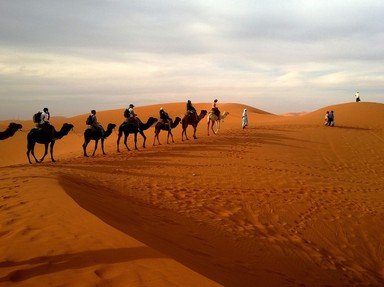
Considered to be the one of the oldest (if not the oldest!) deserts in the world, geologists have estimated that the area which is called the Namib Desert today first began to experience desertification 55 million years ago. Come along and explore!

A multiple-choice quiz by ponycargirl. Estimated time: 4 mins.
  1. Home
  2. »
  3. Quizzes
  4. »
  5. Geography Trivia
  6. »
  7. Physical Geography
  8. »
  9. Deserts

Author
ponycargirl
Time
4 mins
Type
Multiple Choice
Quiz #
392,285
Updated
Dec 03 21
# Qns
10
Difficulty
Average
Avg Score
7 / 10
Plays
198
Awards
Top 10% Quiz
Last 3 plays: Guest 1 (6/10), Guest 103 (4/10), Guest 184 (7/10).
- -
Question 1 of 10
1. The Namib Desert is located on the southwest coast of Africa. What does the name "Namib" mean? Hint


Question 2 of 10
2. Of course, one would expect to find the Namib Desert in Namibia. In which other two countries is the desert also located? Hint


Question 3 of 10
3. Sometimes used to describe the entire coastal area of the Namib Desert, what name is used to describe the region there that is known to be dangerous for ships? Hint


Question 4 of 10
4. The Namib Desert is so vast that it actually runs into two other deserts. To the north it runs into a desert called the Moçâmedes Desert; which, perhaps better known, desert does it border to the south? Hint


Question 5 of 10
5. Near the coastal area of the Namib Desert there are sand seas, ares where the terrain is relatively flat with very little vegetation. What is another name for this type of sand feature? Hint


Question 6 of 10
6. Although the term "desert" may signify to some an area that is barren and nonproductive, the Namib Desert contains some of the area's most important natural resources. What is NOT mined there? Hint


Question 7 of 10
7. What is the name of the ocean current that is responsible for the thick fog that can be seen at some times in some areas of the Namib Desert? Hint


Question 8 of 10
8. Prior to the 20th century, which of the following groups lived a hunter-gatherer existence in the Namib Desert? Hint


Question 9 of 10
9. Despite being one of the driest deserts in the world, a number of animals call the Namib Desert home. Is the desert elephant that lives there considered to be a separate species?


Question 10 of 10
10. What type of geographical feature is "Big Daddy", which is located in the Sossusvlei area of the Namib Desert? Hint


(Optional) Create a Free FunTrivia ID to save the points you are about to earn:

arrow Select a User ID:
arrow Choose a Password:
arrow Your Email:


Most Recent Scores
Dec 05 2024 : Guest 1: 6/10
Nov 07 2024 : Guest 103: 4/10
Nov 03 2024 : Guest 184: 7/10

Quiz Answer Key and Fun Facts
1. The Namib Desert is located on the southwest coast of Africa. What does the name "Namib" mean?

Answer: Vast Place

The name "Namib" comes from the Nama, or Khoekhoe, language, which is a non-Bantu language that is spoken by the Nama, Damara, and Haiǁom peoples who have been living in the area for thousands of years. Indeed, the Namib Desert is a "vast place"; covering an area of 31,274 square miles, the desert receives, depending on the region, 0.079-7.9 inches of rainfall a year.

In spite of its dryness, the Namib Desert is home to many different types of animals, and, in some locations, plant life.
2. Of course, one would expect to find the Namib Desert in Namibia. In which other two countries is the desert also located?

Answer: Angola and South Africa

A desert located on the Atlantic coast of Africa, the Namib stretches for approximately 1200 miles through Angola, Namibia, and South Africa. Much of the area has been designated as national parks. Iona National Park, the largest national park in Angola, is located near its border with Namibia.

It is part of a region that the Portuguese called "The Gates of Hell", however, today it is one of the most-visited attractions in the country. In Namibia visitors can find the Namib-Naukluft National Park, which is considered to be the oldest national park in the world. Sossusvlei, which is a clay and salt dry lake or pan, is one of the most-visited sites in the park. Found on the border of Namibia and South Africa is the ǀAi-ǀAis/Richtersveld Transfrontier Park, that was founded in 2003 and is now a protected boundary between the two countries.

The park not only promotes tourism, but also protects the migration paths of many of the animals.
3. Sometimes used to describe the entire coastal area of the Namib Desert, what name is used to describe the region there that is known to be dangerous for ships?

Answer: Skeleton Coast

Okay! This is the area that the Portuguese called "The Gates of Hell" and the Bushmen called "The Land God Made in Anger". In the past, the name came from all of the skeletons of whales and seals that were found there; whalers would process their catch - both whales and seals - on the coast, and, even today, an enormous seal population, which some estimate to be around 100,000, live there.

As far as sailors are concerned, however, the area is called the Skeleton Coast because of the blinding fog, strong winds, and rocky cliffs that are found in the region. Sources state that "thousands" of wrecked ships are still visible along the coast. Tourists today pay as much as $6,000 a person for a four day guided trip through the area, which is called the Skeleton Coast National Park.
4. The Namib Desert is so vast that it actually runs into two other deserts. To the north it runs into a desert called the Moçâmedes Desert; which, perhaps better known, desert does it border to the south?

Answer: Kalahari Desert

Located in southern Angola, the Moçâmedes Desert forms the northern tip of the Namib Desert. The area is virtually uninhabited with just small communities of fishermen living in settlements along the coast. The much larger Kalahari Desert covers parts of Namibia, South Africa, and Botswana. Meaning "a waterless place" in the Tswana language, the Kalahara is classified as a semi-desert because it has more rain (4.3-20 inches) than what typically falls in a desert.

In fact, there are some areas that even have standing pools of water during the rainy season.
5. Near the coastal area of the Namib Desert there are sand seas, ares where the terrain is relatively flat with very little vegetation. What is another name for this type of sand feature?

Answer: Erg

Called a sand sea, dune sea, or sand sheet if there are no dunes, an erg is an area of the desert where there is no vegetation cover and is mostly flat. From the Arabic for "dune field", an erg is a region of the desert that has at least 20% of the terrain covered with sand.

In the Namib Desert the ergs exist near the coast and are considered by geologists to be active; that means they are located in an area that has less than 5.9 inches of rainfall a year. Traveling east from the coastal area of the Namib Desert there are also gravel plains and mountain ridges.
6. Although the term "desert" may signify to some an area that is barren and nonproductive, the Namib Desert contains some of the area's most important natural resources. What is NOT mined there?

Answer: Coal

A large uranium deposit - the third largest of uranium only - was found in the Namib Desert in 2008. Since then, the Husab Uranium Project, an open pit operation, has received a license from the Namibia Ministry of Mines and Energy to mine in the area.

It has been estimated that the mine contains approximately 280 metric tons of uranium and will be in operation about 20 years. Namibia has been the site of diamond mining since the turn of the 20th century; today much of the diamond mining is done using marine mining offshore.

The Rosh Pinah mine, located in southwest Namibia, is the source of much of the country's lead and zinc. A 2012 report listed diamond, silver, tungsten, lead, zinc, tin, uranium, and copper mining forming 8% of Namibia gross domestic product and 50% of its foreign exchange revenue.
7. What is the name of the ocean current that is responsible for the thick fog that can be seen at some times in some areas of the Namib Desert?

Answer: Benguela Current

The heavy fog is basically caused by the cold water of the Benguela Current meeting the warm air that is caused by the Hadley Cell. It has been estimated that parts of the Namib Desert are enveloped by fog for more than half of each year. While this does pose some danger to human activity in the area, the moisture produced by the fog is an invaluable source of water for some of the plants that grow in the desert.

The Welwitschia plant, which is found only in the Namib desert, for example, does have a taproot, however, most of its water needs are provided by the moisture that the fog produces on its leaves.
8. Prior to the 20th century, which of the following groups lived a hunter-gatherer existence in the Namib Desert?

Answer: San

Archaeologists believe that the San have been living in the southern part of Africa for at least 30,000 years, as is evidenced by the presence of their rock art in various locations, such as Twyfelfontein and the Brandberg, which is Namibia's highest mountain.

They lived a life of hunting and gathering, following sources of both food and water; the men would hunt while the women would gather. The arrival of Europeans to the area greatly affected their numbers, and today many have settled down and become farmers. An estimated 35% of the 55,000 San people alive today live in Namibia.
9. Despite being one of the driest deserts in the world, a number of animals call the Namib Desert home. Is the desert elephant that lives there considered to be a separate species?

Answer: no

Desert elephants are currently found living in both the Sahara and Namib Deserts in Mali and Namibia respectively. They are not a separate species, even though they are physically different from other elephants, with a smaller body mass, longer legs, and larger feet. Classified as African bush elephants, it is estimated that they can go without water for three days.

In Nambia an estimated 600 elephants are found in the Kunene Region in the northwest part of the country. While currently some say there are only two types of elephants - Asian elephants and African elephants, others say there are three types - Asian elephants ("Elephas maximus"), African bush elephants, ("Loxodonta africana"), and African forest elephants ("L. cyclotis").
10. What type of geographical feature is "Big Daddy", which is located in the Sossusvlei area of the Namib Desert?

Answer: Dune

Big Daddy is a sand dune that measures over a thousand feet high in the Sossusvlei region. The region is a clay pan, or dry lake that is composed of sand mixed with salt deposits. Located inside the Namib-Naukluft National Park, Big Daddy faces another dune named Big Mama! Neither of these dunes, however, are considered to be the tallest in the Namib Desert. That distinction goes to Dune 7, which is located near Walvis Bay.
Source: Author ponycargirl

This quiz was reviewed by FunTrivia editor agony before going online.
Any errors found in FunTrivia content are routinely corrected through our feedback system.
12/22/2024, Copyright 2024 FunTrivia, Inc. - Report an Error / Contact Us