FREE! Click here to Join FunTrivia. Thousands of games, quizzes, and lots more!
Quiz about Place Name Oddities in Otago NZ

Place Name Oddities in Otago, N.Z. Quiz


Although Otago was settled late in the European colonisation of New Zealand, the gold rush made it an "interesting" place. What do you know about the province from those far-off days?

A multiple-choice quiz by Capfka. Estimated time: 6 mins.
  1. Home
  2. »
  3. Quizzes
  4. »
  5. Geography Trivia
  6. »
  7. New Zealand
  8. »
  9. NZ Regions

Author
Capfka
Time
6 mins
Type
Multiple Choice
Quiz #
239,905
Updated
Dec 03 21
# Qns
10
Difficulty
Difficult
Avg Score
5 / 10
Plays
612
- -
Question 1 of 10
1. The town of Ophir, on the terraces above the Manuherikia Valley 20km from Alexandra, has had two names during its relatively brief existence. What was the original name? Hint


Question 2 of 10
2. The Milford Road climbs gently up the Eglinton Valley before dropping very steeply to Marion Camp in the Hollyford River valley. What is the name of the highest point of the road, where it crosses from the east coast watershed to the western side? Hint


Question 3 of 10
3. Cromwell, which is now nearly surrounded by Lake Dunstan courtesy of the Clyde Dam, used to be the place where the Kawarau and Clutha Rivers met. But it wasn't always known as Cromwell. What was it originally called? Hint


Question 4 of 10
4. John Turnbull Thomson surveyed the Maniototo area for the Otago Provincial Council between 1856 and 1858. He named many of the streams in the area, quite prosaically, after farm animals. Which of the following is NOT the name of a stream in the area? Hint


Question 5 of 10
5. Queenstown hasn't always be called Queenstown. F.W.G. Miller states that the name was chosen at a public meeting in the early 1860s. What was the settlement called prior to this? Hint


Question 6 of 10
6. What was the name of the surveyor who laid out Dunedin's basic street plan in the late 1840s? Hint


Question 7 of 10
7. The name "Otago" is a corruption of the Maori name for a village near the entrance to Otago Harbour. What is the name of that village? Hint


Question 8 of 10
8. The Arrow River gold rush only began after a small group of prospectors had been quietly making a fortune on the river in secret. Before it became Arrowtown, the settlement at the lower end of the Arrow Gorge was named after the American leader of this secretive band of miners. What was his name? Hint


Question 9 of 10
9. State Highway 85 between Palmerston and Ranfurly has an unusual name for a road. What is it? Hint


Question 10 of 10
10. Perhaps Dunedin's best-known claim to fame is that it has the steepest street in the world. While the veracity of this claim is open to question, the street itself is undoubtedly very steep. What is its name? Hint


(Optional) Create a Free FunTrivia ID to save the points you are about to earn:

arrow Select a User ID:
arrow Choose a Password:
arrow Your Email:


Quiz Answer Key and Fun Facts
1. The town of Ophir, on the terraces above the Manuherikia Valley 20km from Alexandra, has had two names during its relatively brief existence. What was the original name?

Answer: Blacks

I've never been quite sure why the name was changed from Blacks Diggings (always shortened to Blacks) to Ophir, or why the town survived the 1860s when so many others didn't. For a while it was a stop on the stage coach route over Blacks Hill to Polnoon and the Ida Valley, and that may have been the reason why it outlasted the gold which was the reason for its existence.

The hotel at the junction with the Blacks Hill Road is still called the Blacks Pub.
2. The Milford Road climbs gently up the Eglinton Valley before dropping very steeply to Marion Camp in the Hollyford River valley. What is the name of the highest point of the road, where it crosses from the east coast watershed to the western side?

Answer: The Divide

The Divide is well-known to tourists taking the road to Milford and to backpackers who walk the Hollyford Track and Greenstone River tracks. The contrast between the bush on the east coast side and the steeper rain forest on the western side is quite remarkable.

As are the keas, the large mountain parrots which just love stripping the rubber off windscreen wipers and pulling the sealing strip from around your windscreen ...
3. Cromwell, which is now nearly surrounded by Lake Dunstan courtesy of the Clyde Dam, used to be the place where the Kawarau and Clutha Rivers met. But it wasn't always known as Cromwell. What was it originally called?

Answer: The Junction

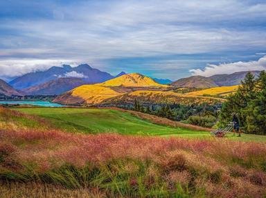
The Cromwell Gorge, downstream of the town, used to be a very pretty touristy kind of road, with the greens of rosehips and cherry trees contrasting with the ochre and grey of the mountains. At Cromwell itself, the two rivers provided a stunning sight where they met immediately below the town.

The brown, muddier water of the Kawarau met the glacial blue-green water of the Clutha, and the two currents ran side by side for a couple of hundred metres before they merged into a darker green. The meeting of the two large rivers was, of course, the reason why the town was originally called The Junction.
4. John Turnbull Thomson surveyed the Maniototo area for the Otago Provincial Council between 1856 and 1858. He named many of the streams in the area, quite prosaically, after farm animals. Which of the following is NOT the name of a stream in the area?

Answer: Ramburn

For many years afterwards, the Maniototo was known as "Thomson's Barnyard" because of the names. There is a myth, not true, that Thomson originally went to some trouble to find the Maori names for all of the streams. When he presented his map of the area to the council, so the story goes, the councillors found they couldn't pronounce the names and rejected them all.

In a fit of fury, Thomson, it was said, went back to his office and renamed the streams after farm animals. In fact he named most of the streams after streams around his boyhood home in Northumberland. Wedderburn and Kyeburn are the giveways! The Maniototo Plain is rising at the rate of 14cm per century due, the tectonic people tell us, to the pressure being applied by two faultlines to the north and south of the area.
5. Queenstown hasn't always be called Queenstown. F.W.G. Miller states that the name was chosen at a public meeting in the early 1860s. What was the settlement called prior to this?

Answer: The Camp

There are two theories as to why the name "Queenstown" was chosen. One (which I favour for no particular reason) was that it was named in honour of Queen Victoria. The other was that the view from the settlement was "fit for a queen". Queenstown was the centre of the largest and most prolonged gold rush in Otago, with hardrock mines such as the Bullendale in Skippers Gorge operating well into the twentieth century. Today, of course, Queenstown is the centre of South Island tourism with skiing, sailing, tourist trips on the lake and on the surrounding rivers, bungy jumping and extreme sports all available to the visitor at the flip of a credit card.
6. What was the name of the surveyor who laid out Dunedin's basic street plan in the late 1840s?

Answer: Charles Kettle

Kettle followed instructions from The New Zealand Company and imposed his "ideal" street plan, on paper, on the Otago Harbour foreshore. It didn't appear to matter to him that many of the streets he planned would actually be IN the harbour or running up hills too steep to walk up, never mind drive a horse-drawn vehicle along them.

He named many of the street after streets in Edinburgh New Town, although the Dunedin settlement's layout bore no resemblance to Edinburgh's at all. Dunedin, of course, means "Edinburgh of the South" which was how Captain Cargill, the leader of the 1848 settlement of Dunedin, wanted it to be - a little piece of Scotland transplanted in the antipodes.

But a mere thirteen years later, gold was discovered at Gabriel's Gully, and all such social engineering went straight out of the window!
7. The name "Otago" is a corruption of the Maori name for a village near the entrance to Otago Harbour. What is the name of that village?

Answer: Otakau

I've never been able to find out exactly when the corruption occurred, but the why and how are a little clearer. At the time, there was no written form of the Maori language. Kettle may well have heard "Otakau" as "Otago" because of the more gutteral form of Maori used in the south. Kettle was made welcome by the Taiaroa subtribe of the Ngai Tahu who lived in the villages along the harbour side of the Otago Peninsula at that time.

They paddled him up the harbour in their canoes and helped him cart his surveying equipment around.

The same tribe had made some whalers feel slightly less welcome some thirty years before this, however. They killed several of the whalers at what is now a popular body-surfing beach a couple of miles to the north of the harbour entrance.

It's still called Murdering Beach!
8. The Arrow River gold rush only began after a small group of prospectors had been quietly making a fortune on the river in secret. Before it became Arrowtown, the settlement at the lower end of the Arrow Gorge was named after the American leader of this secretive band of miners. What was his name?

Answer: Fox

Fox and about twenty other miners had a couple of months to themselves in the Arrow. Fox was a big man and ruthlessly kept the secret. He also ruthlessly kept order among the group. Anyone who transgressed his homegrown goldfield rules had to fight him.

He was a big man, and few cared to take him on. However, the secret got out when a couple of prospectors followed two of Fox's men from The Dunstan back to the Arrow. Fox was all for killing the prospectors to keep the secret when they stumbled onto the mining activity but was persuaded that the jig was up.

The Arrow Rush began that very week.
9. State Highway 85 between Palmerston and Ranfurly has an unusual name for a road. What is it?

Answer: Pigroot

Actually, the name has nothing to do with pigs at all. S.H. 85 was originally a dray road leading over the Otago Escarpment to The Dunstan gold diggings, with the drays being hauled either by oxen or horses. When it was wet, the consistency of the clay on the hills at the head of the Shag River reminded the hauliers of the muck in a pig root, and the name ... stuck.
10. Perhaps Dunedin's best-known claim to fame is that it has the steepest street in the world. While the veracity of this claim is open to question, the street itself is undoubtedly very steep. What is its name?

Answer: Baldwin Street

There is an annual race up and down Baldwin Street, organised by the University of Otago athletics club. It is more about power than endurance. Thousands turn up to do the race.
Source: Author Capfka

This quiz was reviewed by FunTrivia editor Exit10 before going online.
Any errors found in FunTrivia content are routinely corrected through our feedback system.
12/22/2024, Copyright 2024 FunTrivia, Inc. - Report an Error / Contact Us