FREE! Click here to Join FunTrivia. Thousands of games, quizzes, and lots more!
Quiz about Steep Point  Western Australia

Steep Point - Western Australia Quiz


One of the most beautiful, rugged places in Australia, and great fishing too! Learn about Steep Point and the surrounding Shark Bay area.

A multiple-choice quiz by lones78. Estimated time: 4 mins.
  1. Home
  2. »
  3. Quizzes
  4. »
  5. Geography Trivia
  6. »
  7. Australia
  8. »
  9. Western Australia

Author
lones78
Time
4 mins
Type
Multiple Choice
Quiz #
316,086
Updated
Aug 04 24
# Qns
10
Difficulty
Average
Avg Score
6 / 10
Plays
325
Awards
Top 35% Quiz
- -
Question 1 of 10
1. Steep Point is the westernmost point of mainland Australia. It is situated north of Perth, but approximately how far north? Hint


Question 2 of 10
2. Steep Point is located within one of Australia's 16 World Heritage Areas. In which World Heritage Area is it located? Hint


Question 3 of 10
3. The only access to Steep Point is via 4 wheel drive and a permit must be sought to pass through Carrarang Station. Which other strangely named place will you pass by on the dirt track to Steep Point? Hint


Question 4 of 10
4. If the only way to access Steep Point is by 4 wheel drive vehicle, in what type of accommodation would you be most likely to stay? Hint


Question 5 of 10
5. As Steep Point is 'in the middle of nowhere' it is difficult and very time consuming if you need to go into town for supplies. Luckily, the ranger (who lives on site) can help out with minor needs or emergencies. If, however, an emergency does arise and medical help is needed, you will have to drive to the nearest township, almost 250km away and a 3 hour drive. What is the name of this township? Hint


Question 6 of 10
6. Steep Point is known as one of the best land fishing locations in the world. What type of fishing are people NOT likely to engage in while in the area? Hint


Question 7 of 10
7. The waters around Steep Point are full of amazing marine life. What sort of animals are you NOT likely to find in the area? Hint


Question 8 of 10
8. Starting south of Kalbarri, the Zuytdorp cliffs finish at Steep Point. From where do the cliffs get their name? Hint


Question 9 of 10
9. Originally called 'Eendrachtsland' in 1616 by its founder, and directly north from Steep Point - across the South Passage, is which island (or group of islands)? Hint


Question 10 of 10
10. Steep Point is quite often used as a reference point for nautical 'misadventures'. On 16th March 2008, which Australian Naval ship wreckage was found 67 years after being sunk? Hint


(Optional) Create a Free FunTrivia ID to save the points you are about to earn:

arrow Select a User ID:
arrow Choose a Password:
arrow Your Email:


Most Recent Scores
Nov 22 2024 : Guest 1: 3/10
Oct 13 2024 : ZWOZZE: 0/10

Score Distribution

quiz
Quiz Answer Key and Fun Facts
1. Steep Point is the westernmost point of mainland Australia. It is situated north of Perth, but approximately how far north?

Answer: 700km

Steep Point is nearly 700km from Perth. When travelling by car from Perth, it takes about 8 hours to get to the turn-off from the North West Coastal Highway at the Overlander Roadhouse. It is then a further 30 minutes to the dirt track that leads to Useless Loop, Carrang Station and Steep Point. Another 2 hours (depending on track conditions) will get you to Steep Point.
2. Steep Point is located within one of Australia's 16 World Heritage Areas. In which World Heritage Area is it located?

Answer: Shark Bay

The Great Barrier Reef and Fraser Island are situated off the coast of mainland Queensland, and the Kakadu National Park is in the Northern Territory.

The Shark Bay World Heritage Area covers 2.3 million hectares and is one of few worldwide on the list for possessing four out of the ten selection criteria.

The four selection criteria met by Shark Bay are:
*Natural beauty
*Biological diversity
*Ecological processes
*Earth's history

Huge seagrass meadows in the area have led to the emergence of salt-tolerant animals that are genetically distinct from other species. They have also allowed the forming of the most diverse and abundant examples of stromatolites in the world, in Hamelin Pool.

Stromatolites look like a bunch of rocks in water and are very uninteresting to the naked eye. According to Wikipedia, Stromatolites are "layered accretionary structures formed in shallow water by the trapping, binding and cementation of sedimentary grains by biofilms of microorganisms, especially cyanobacteria (commonly known as blue-green algae). They include some of the most ancient records of life on Earth." They were also more abundant on Earth in Precambrian times and not too many examples exist in the world today.
3. The only access to Steep Point is via 4 wheel drive and a permit must be sought to pass through Carrarang Station. Which other strangely named place will you pass by on the dirt track to Steep Point?

Answer: Useless Loop

Useless Loop is a closed company salt mining town. The salt produced is among the purest in the world and the site has been in operation since 1968. The salt hills can be seen from Denham over 250km away.

Foul Bay can be found in South Australia. It is due south-west of Adelaide and directly north from Kangaroo Island. Bobbin Head is in New South Wales, due north of Sydney and Nowhere Else can be found in the top, middle part of Tasmania.
4. If the only way to access Steep Point is by 4 wheel drive vehicle, in what type of accommodation would you be most likely to stay?

Answer: A Tent

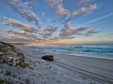
Steep Point is pretty much tent-only. It is almost impossible to get a caravan out there and the only buildings in the area are the ranger station and the lighthouse on the point. There are several beautiful, sheltered camping spots right on the beach which have to be booked weeks in advance, especially during school holidays. Most camping areas don't have toilets so you either have to drive to another site or right out near the point to find a 'long drop' or take your own 'porta-potty'.
5. As Steep Point is 'in the middle of nowhere' it is difficult and very time consuming if you need to go into town for supplies. Luckily, the ranger (who lives on site) can help out with minor needs or emergencies. If, however, an emergency does arise and medical help is needed, you will have to drive to the nearest township, almost 250km away and a 3 hour drive. What is the name of this township?

Answer: Denham

To get to Denham from Steep Point you will have to drive the 2 or so hours via dirt track back to the main road. After turning left, it's another 45-60 minutes to Denham. A VERY long time if you need to get there in a hurry due to a medical emergency. You would want to hope that someone in your travelling party knows First Aid if this is the case.

Kalbarri and Geraldton are a few hours south of Steep Point, and Carnarvon is several hours to the north.
6. Steep Point is known as one of the best land fishing locations in the world. What type of fishing are people NOT likely to engage in while in the area?

Answer: Fly fishing

Steep Point is also a great place for beach fishing, especially for children.
Fly fishing just isn't going to work with the water a loooong way down, and the sort of fish attracted by fly fishing just aren't found in that area.

Balloon fishing off the cliffs is quite popular. It entails tying a helium-filled balloon to the fishing line and letting the wind blow both the balloon and the line out to sea. Of course this only works with an off-shore breeze but some fantastic fish can be caught using this method.
7. The waters around Steep Point are full of amazing marine life. What sort of animals are you NOT likely to find in the area?

Answer: Great White Sharks

Great White Sharks tend not to be found in the Shark Bay area as they prefer the colder waters around the southern parts of Australia, although there are plenty of sharks to be found in the area, hence the name 'Shark Bay'. Of the 28 different types of sharks commonly found in the Shark Bay area, most are pretty harmless. The whale shark is definitely the biggest (and probably the most awesome) and the tiger shark the most aggressive. Other sharks in the area include wobbegongs, reef sharks, bull sharks and hammerheads. A complete list can be found on the Shark Bay website.

Dolphins are found all through the Shark Bay area, although most notably at Monkey Mia. Whales are a common sight and whale watching cruises are quite prevalent during the winter months.

Spanish Mackerel are one of the most sought after fish in the area. They are good fighters and great to eat (according to my husband).
8. Starting south of Kalbarri, the Zuytdorp cliffs finish at Steep Point. From where do the cliffs get their name?

Answer: A shipwreck in the area

In 1712, the Dutch East India Company merchant ship the Zuytdorp ('south village') was wrecked on its way to Batavia (Jakarta, Indonesia). Most of the 200+ passengers and crew died in the wreck but some lived for a short time in Shark Bay and were helped by local aboriginal people. This is thought to be the first contact between Europeans and any of Australia's aboriginal peoples.
9. Originally called 'Eendrachtsland' in 1616 by its founder, and directly north from Steep Point - across the South Passage, is which island (or group of islands)?

Answer: Dirk Hartog Island

Dirk Hartog Island covers an area of about 620 square kilometres and is approximately 850km north of Perth. Dirk Hartog, a Dutch sea captain was blown off course in October of 1616 while sailing from Cape Town to Batavia (Indonesia). He nailed a pewter plate, inscribed with his name and the date, to a tree on the island.

1697 saw Willem de Vlamingh land on the island and discover Hartog's plate. He replaced it with his own plate (including Hartog's inscription) and took the original home to Amsterdam.

Only 8 vehicles are allowed on the island at once and a maximum of 30-35 people. Dirk Hartog island is also closed between November and the start of March (to give the caretakers a well-earned break from tourists)!

The Abrolhos islands are further south from Steep Point, directly west from Geraldton. Barrow Island is due north from Onslow and Rottnest Island is west from Perth.
10. Steep Point is quite often used as a reference point for nautical 'misadventures'. On 16th March 2008, which Australian Naval ship wreckage was found 67 years after being sunk?

Answer: HMAS Sydney

HMAS Sydney, a light cruiser, was sunk on 19 November 1941 with all 645 hands on board, representing the biggest loss of life in an Australian warship.
The ship that sunk HMAS Sydney, the German auxiliary cruiser Kormoran, was found on the 12th March 2008, only 4 days before HMAS Sydney.

Nobody knows for sure the details regarding the battle, and ensuing sinking, of the Kormoran and HMAS Sydney but several theories have been presented, although none have been proved or disproved.
Source: Author lones78

This quiz was reviewed by FunTrivia editor ozzz2002 before going online.
Any errors found in FunTrivia content are routinely corrected through our feedback system.
11/25/2024, Copyright 2024 FunTrivia, Inc. - Report an Error / Contact Us