FREE! Click here to Join FunTrivia. Thousands of games, quizzes, and lots more!
Quiz about Flatland
Quiz about Flatland

Flatland Trivia Quiz


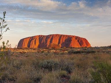
The Nullarbor Plain is flat and arid land that sits in the southern part of Australia. Despite this description it remains one of the most fascinating and stunningly beautiful parts of the country. Let's take a tour.

A photo quiz by pollucci19. Estimated time: 4 mins.
  1. Home
  2. »
  3. Quizzes
  4. »
  5. General Knowledge Trivia
  6. »
  7. Mixed Nations
  8. »
  9. Mixed Australia

Author
pollucci19
Time
4 mins
Type
Photo Quiz
Quiz #
401,578
Updated
Dec 03 21
# Qns
10
Difficulty
Average
Avg Score
8 / 10
Plays
295
Awards
Top 35% Quiz
-
Question 1 of 10
1. What does the term "Nullarbor" mean? Hint


Question 2 of 10
2. The Nullarbor plain sits atop of the world's largest, single, exposure of limestone bedrock. What is this area of Australia's coastline called? Hint


Question 3 of 10
3. Historically the Nullarbor Plain has been occupied by two indigenous Australian peoples; the Wangai and which other? Hint


Question 4 of 10
4. The highway that stretches through the Nullarbor Plain of Australia bears the name of which man, the first European to successfully cross this inhospitable piece of dirt in 1841? Hint


Question 5 of 10
5. "Crossing the Nullarbor" is seen as a significant event for most Australians. What made this crossing more notably dangerous prior to 1950? Hint


Question 6 of 10
6. One of the longest straight stretches of road in the world lies on the Eyre Highway, across the Nullarbor Plain in Australia. By what linear name is this section of road known locally? Hint


Question 7 of 10
7. What is the name of the rail link that runs from Kalgoorlie in Western Australia, across the Nullarbor Plain, through to Port Augusta in South Australia? Hint


Question 8 of 10
8. Before the construction of the highway across the Nullarbor Plain in Australia, had anyone, successfully, crossed this stretch of land on bicycle?


Question 9 of 10
9. For what did Maralinga in Australia's Nullarbor Plain become infamous in the 1950s? Hint


Question 10 of 10
10. What is/are the Nullarbor Links? Hint


(Optional) Create a Free FunTrivia ID to save the points you are about to earn:

arrow Select a User ID:
arrow Choose a Password:
arrow Your Email:


View Image Attributions for This Quiz

Most Recent Scores
Nov 04 2024 : Guest 1: 9/10
Sep 27 2024 : Guest 159: 8/10

Quiz Answer Key and Fun Facts
1. What does the term "Nullarbor" mean?

Answer: No Trees

Contrary to many misguided beliefs, the word Nullarbor does not have its roots in the Australian Aboriginal language. The term comes from the Latin words "nulla", which is the feminine of "nullus" and means "no". The familiar term "arbor" means tree. Out on the plain you will find the odd (poor excuse) for a tree so it is not (technically) treeless. The picture on the left shows a landscape that is pretty much vertically challenged and this topography does not vary significantly.

Aside from being flat it also receives very little in the way of rainfall. To add to its aridity the high summer temperatures ensure that any water that is lying on the surface will evaporate rapidly. The surface does have a "karst" drainage system, which means that water will make its way through the soluble limestone beneath the surface into caves and sinkholes below ground.
2. The Nullarbor plain sits atop of the world's largest, single, exposure of limestone bedrock. What is this area of Australia's coastline called?

Answer: The Great Australian Bight

The Bight came into existence some fifty million years ago when Gondwana (or the supercontinent that was known as Gondwanaland) split into two, separating Antarctica from Australia. The Nullarbor Plain, which stretches along most of the Bight's coastline, was previously a seabed here, was formed as part of a great uplifting at some point during the Miocene period.

There are two definitions as to which points determine the extent of the Bight's coastline. The AHS (Australian Hydrographic Service) has it stretching a distance of 1,160 kilometres from Cape Pasley in Western Australia through to Cape Carnot in South Australia. The IHO (International Hydrographic Organisation) takes the western boundary further into that State to West Cape Howe and stretches it all the way to the South West Cape in Tasmania. For the most part Australians tend to use the AHS definition. More interesting (to the tourist though) is that this area presents wonderful opportunities for camera enthusiasts or even the amateur shutterbug as the cliffs on the left will attest. It is also a great spot for whale watching as large numbers of Southern right whales will migrate here from the waters of Antarctica in winter to breed.

(Picture) This area along the Great Australian Bight is known as the Bunda Cliffs.
3. Historically the Nullarbor Plain has been occupied by two indigenous Australian peoples; the Wangai and which other?

Answer: Spinifex

The Wangai, also written as Wangkatha, people are one of eight tribal groups from the Eastern Goldfields region. Located in the south eastern corner of Western Australia, their land stretches across the Nullarbor to the South Australian border. During the early part of the 1900s they were considered to be the most un-tameable of the Western Australian Indigenous population. Having said that there is also literature available that indicates that they were hospitable to early European explorers, often guiding them to sources of fresh water.

The Pila Nguru, who are also known as the Spinifex people, are, arguably, the most remote of the Australian Aboriginal communities. The heart of their homeland sits in the midst of the Great Victoria Desert, on the northern border of the Nullarbor Plain. Their name, Pila Nguru, is a reflection of their territory, meaning "people from the land of the spinifex".

(Picture) This is Triodia scariosa, which is commonly known as Porcupine grass or Spinifex grass.
4. The highway that stretches through the Nullarbor Plain of Australia bears the name of which man, the first European to successfully cross this inhospitable piece of dirt in 1841?

Answer: Edward Eyre

Edward John Eyre was a remarkable character who'd made a small fortune in 1838, droving (and then selling) 1,000 sheep and 600 head of cattle from Monaro in New South Wales to Adelaide in South Australia. This was a journey that took seven months to complete. He used the funds to try and explore the interior of the State (South Australia). In 1840 he embarked on an endeavour to cross the Nullarbor, a stretch of country that author Henry Kingsley would describe as a "hideous anomaly". The first attempt failed but the knowledge gained was invaluable and, when he made his next attempt in 1841, he planned food and water resources with greater care and exchanged the horses for camels. He set out with his trusted Aboriginal guide Wylie, John Baxter and two other indigenous Australians. The latter two would put the mission in peril when they murdered Baxter and stole the majority of the food and water. Eyre and Wylie continued on and most likely, would have perished had it not been, initially, for Wylie's bushcraft, but also the fortuitous meeting with a French whaling ship near Esperance, who were able to re-supply the pair. After four months and more than two thousand kilometres the pair arrived in Albany in June of 1841.

Eyre would later become governor of Jamaica where he became embroiled in the Morant Bay Rebellion of 1865.

(Picture) Hot air (read Eyre) balloons.
5. "Crossing the Nullarbor" is seen as a significant event for most Australians. What made this crossing more notably dangerous prior to 1950?

Answer: The road was unsealed

"Crossing the Nully" as it is affectionately known, is almost like a "rite of passage" for most Australians and is usually on people's "bucket lists". The Nullarbor wears shroud of mystery for Australians, like some monstrous border that exists between the Eastern States of Australia and the West. It would not be uncommon for a Victorian or New South Welshman say that they're "heading across the Nully to Perth" as if that is likely to draw some reverence toward his or her mission.

The Eyre Highway, named after the first European to make the journey across the plain, stretches 1,660 kilometres (1030 miles) from Norseman in Western Australia's Goldfields region to Port Augusta in South Australia. Initially, this was little more than a carved out dirt track with conditions that ranged from "barely decent" to "downright hazardous". The call for the highway was made by the Royal Automotive Club of Western Australia in 1938. Construction began in 1941 and was completed in June 1942, with the only bitumen sections being at the Madura and Eucla Passes. It remained vastly unchanged throughout the 1940s and 1950s, however, due to the increasing traffic on the road the call came out for the sealing of the highway in 1960. This was completed in a number of stages, with the last section being sealed in 1976.
6. One of the longest straight stretches of road in the world lies on the Eyre Highway, across the Nullarbor Plain in Australia. By what linear name is this section of road known locally?

Answer: The 90 Mile Straight

By straight, I mean "dead straight" for ninety whole miles, there is not a bend in sight to relieve the boredom. This section sits on the Western Australian side of the border, commencing just outside of Balladonia and heading east to Caiguna. Its exact measurement is 146.6 kilometres (91.1 miles).

Whilst it is not the longest straight stretch of road in the world, it is, comfortably, the longest in Australia. Despite its remoteness, its apparent non-ending quality and its lack of variety in scenery the Australian Automobile Association rated it among the lowest risk highways in the country, in 2011.
7. What is the name of the rail link that runs from Kalgoorlie in Western Australia, across the Nullarbor Plain, through to Port Augusta in South Australia?

Answer: Trans-Australia Railway

The "Trans", as it is affectionately known, is a vital link between Western Australia (WA) and the rest of the country. It was also the giant carrot that was dangling before the State to come and join the proposed Federation of Australia. Up until this point the only way to make your way to the east coast was via a dangerous boat ride across the Great Australian Bight.

Legislation to survey the route was passed in 1907, to commence construction in 1911 and the actual building of the line commenced in 1912. Construction started at both ends of the line and they were joined at Ooldea on the 17th October, 1917. Apart from the freight that is transported along the line, two passenger services also make use of it. The Indian-Pacific, which runs from Sydney on the east coast through to Perth in WA uses the entire length of the track in its run, while the Ghan, which runs from Adelaide in the south to Darwin in the north, uses a small section from Port Augusta to Tarcoola. The line runs for 1,693 kilometres (1,052 miles) and is serviced by a series of bores and reservoirs as it does not cross any permanent fresh watercourse on its path. The line also has the world's longest stretch of straight rail-line, a 797 kilometre (495 mile) stretch from Ooldea to a little west of Loongana.

(Picture) Shows the Indian Pacific passenger train at Yorkey's Crossing just outside of Port Augusta in South Australia. The postcard was purchased by the photographer at Cook in South Australia.
8. Before the construction of the highway across the Nullarbor Plain in Australia, had anyone, successfully, crossed this stretch of land on bicycle?

Answer: Yes

The man who was foolhardy enough to attempt this (and succeed) was Arthur Charles Jeston Richardson. He set out from Coolgardie in Western Australia on the 24th of November in 1896, armed with just his bike, a water bag and a small kit. He made it into Adelaide on Christmas Day, some thirty one days later.

He was smart enough to use the telegraph line as his guide but the fool decided to make the run at the start of the Australian summer. Little wonder he would describe the heat as "1,000 degrees in the shade".
9. For what did Maralinga in Australia's Nullarbor Plain become infamous in the 1950s?

Answer: Nuclear testing

The British conducted two sets of nuclear tests at Maralinga. Operation Buffalo in 1956 and Operation Antler in 1957. To allay the fears of Australians, the country's then Prime Minister, Sir Robert Menzies, informed parliament that "no conceivable injury to life, men or property could emerge from the tests". The truth would be a far different matter. A Royal Commission in 1985 revealed that significant residual contamination still existed in some sites within the area, that servicemen from both Australia and Great Britain were deliberately exposed to fallout to test what the effects would be on them and the local Aboriginal community would complain that they were poisoned by the tests. The Australian government would reach a settlement with the Maralinga Tjarutja peoples in 1994 over the matter.

(Picture) Mushroom, representative of a mushroom cloud after a nuclear explosion.
10. What is/are the Nullarbor Links?

Answer: A golf course

Yes indeed, it is an 18 hole, par 72 golf course in the middle of nowhere. But this is not just any old golf course... stretching from Kalgoorlie, moving across two States and covering the Nullarbor Plain all the way to Ceduna in South Australia, it claims to be the world's longest golf course. Alf Caputo and Bob Bongiorno were sitting at the bar of the Balladonia Hotel, enjoying a bottle of red wine, when they came up with the idea. The course, which has been created to relieve the boredom and fatigue factors of such a long crossing, has "borrowed" seven holes from existing golf courses at towns along the journey. Eleven other holes were designed and built at roadhouses or settlements along the Eyre Highway. The average distance between each hole is 66 kilometres (41 miles).

You are able to obtain a scorecard at either end of the course, for a fee of course, and you can either take your own clubs or hire them from the venues on the way.
Source: Author pollucci19

This quiz was reviewed by FunTrivia editor LeoDaVinci before going online.
Any errors found in FunTrivia content are routinely corrected through our feedback system.
Related Quizzes
This quiz is part of series Commission #61:

It doesn't matter if you're a reader or not-- we took book titles for this 61st Commission, launched in April 2020, and handed them off to the quiz-writers of the Author's Lounge to create a veritable booklist of quizzes.

  1. The Odyssey Tough
  2. The Six Sacred Stones Average
  3. Between the World and Me Easier
  4. Anita and Me Easier
  5. The Moon is a Harsh Mistress Average
  6. The Commitments Average
  7. The Last Continent Average
  8. Wacky Wednesday Average
  9. Deafening Average
  10. To the Lighthouse Easier
  11. For Whom the Bell Tolls Average
  12. Best Served Cold Easier

11/21/2024, Copyright 2024 FunTrivia, Inc. - Report an Error / Contact Us