FREE! Click here to Join FunTrivia. Thousands of games, quizzes, and lots more!
Quiz about The Arctic Circle

10 Question Geography Quiz: The Arctic Circle | Geography


Going around the Arctic Circle, around the whole Earth, you will find several countries and several bodies of water. You will also find unusual daylight patterns.

A multiple-choice quiz by hotdogPi. Estimated time: 4 mins.
  1. Home
  2. »
  3. Quizzes
  4. »
  5. Geography Trivia
  6. »
  7. Polar Regions

Author
hotdogPi
Time
4 mins
Type
Multiple Choice
Quiz #
372,993
Updated
Dec 03 21
# Qns
10
Difficulty
Average
Avg Score
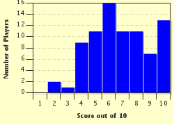
7 / 10
Plays
334
- -
Question 1 of 10
1. The Arctic Circle is a circle around the Earth at 66.5°N. Why is the number 66.5 used? Hint


Question 2 of 10
2. Which one of these events in the Northern Hemisphere only occurs north of the Arctic Circle, and becomes more common the further north a place is? Hint


Question 3 of 10
3. The International Date Line crosses the Arctic Circle in a body of water between eastern Russia and western Alaska (in the United States). What is this body of water called? Hint


Question 4 of 10
4. No part of Canada that is above the Arctic Circle is part of a province. Instead, there are three territories. Which one is the central one of the three? Hint


Question 5 of 10
5. To the east of northern Canada is Greenland. The Arctic Circle goes through Greenland. Is more than half of Greenland north of the Arctic Circle?


Question 6 of 10
6. The Arctic Circle is not at exactly 66.5°N, but it is close enough for most purposes. However, using the exact latitude of the Arctic Circle (which is closer to 66.56°N, or 66° 34' N) significantly changes how much of this country crosses the Arctic Circle. At its true value, only a small island called Grímsey would cross it, while a rounded value of 66.5° would have some of the mainland of this country included. Which European country is it? Hint


Question 7 of 10
7. You travel east along the Arctic Circle in water, and you eventually find land. Your map says you are approaching Norway. There are many inlets of water. What are these inlets called? Hint


Question 8 of 10
8. Along the Arctic Circle, you cross Norway, then Sweden, then Finland. What is the name of the peninsula that includes these three countries? Hint


Question 9 of 10
9. After crossing Norway, Sweden, and Finland east across the Arctic Circle, you reach another country by land. Unlike crossing from North America to Europe, there is no ocean in between. Which country will you find next along the Arctic Circle? Hint


Question 10 of 10
10. Approximately how much of the length of the Arctic Circle lies within Russia, including bodies of water inside Russia? Hint


(Optional) Create a Free FunTrivia ID to save the points you are about to earn:

arrow Select a User ID:
arrow Choose a Password:
arrow Your Email:


Quiz Answer Key and Fun Facts
1. The Arctic Circle is a circle around the Earth at 66.5°N. Why is the number 66.5 used?

Answer: It is 90° minus the Earth's tilt

The Earth's tilt is 23.5°.This means that the Arctic Circle is 90°-23.5°, which is 66.5°. On the opposite side of the Earth, the Antarctic Circle is 66.5°S. In the Northern Hemisphere, the Arctic Circle is the southernmost latitude where there there is a day without the sun setting, due to the Earth's tilt. Also, the Tropic of Cancer is 23.5°N, while the Tropic of Capricorn is 23.5°S, which also use the Earth's tilt in their definition.
2. Which one of these events in the Northern Hemisphere only occurs north of the Arctic Circle, and becomes more common the further north a place is?

Answer: A day without the sun crossing the horizon

At the Arctic Circle, the summer solstice is the only day of the year with a full 24 hours of daylight, and the winter solstice will be the only day without any. Going further north, a place will have more days of constant daylight (centered on the summer solstice) and an equal number of days of no daylight (centered on the winter solstice). At the exact location of the North Pole, there will be six months of constant daylight and six months of no daylight. South of the Antarctic Circle, a similar effect occurs.

The Aurora Borealis and temperatures below -40° can occur south of the Arctic Circle. Acceleration due to gravity increases slightly near the poles (9.8 m/s² to 9.83 m/s²), but it is nowhere near double.
3. The International Date Line crosses the Arctic Circle in a body of water between eastern Russia and western Alaska (in the United States). What is this body of water called?

Answer: Bering Strait

The Bering Strait connects the water north of it (Chukchi Sea and Arctic Ocean) with the water south of it (Bering Sea and Pacific Ocean). The Bering Sea and Bering Strait are named after an explorer named Vitus Bering who explored Russian land and waters surrounding Russia.
4. No part of Canada that is above the Arctic Circle is part of a province. Instead, there are three territories. Which one is the central one of the three?

Answer: Northwest Territories

From west to east, first there is Alaska (which is part of the United States). Then there are three Canadian territories: Yukon, Northwest Territories, and Nunavut. These three territories have their southern border defined at 60°N.
5. To the east of northern Canada is Greenland. The Arctic Circle goes through Greenland. Is more than half of Greenland north of the Arctic Circle?

Answer: Yes

Most of Greenland is north of the Arctic Circle. The exact percentage may be hard to tell, and looking at a map may be inaccurate due to map distortion, since Greenland is so far north. However, using a different map projection does not change the shape or size of the actual land in Greenland.
6. The Arctic Circle is not at exactly 66.5°N, but it is close enough for most purposes. However, using the exact latitude of the Arctic Circle (which is closer to 66.56°N, or 66° 34' N) significantly changes how much of this country crosses the Arctic Circle. At its true value, only a small island called Grímsey would cross it, while a rounded value of 66.5° would have some of the mainland of this country included. Which European country is it?

Answer: Iceland

The Earth's rotational tilt is not constant. Even though it changes extremely slowly, it still changes. An extremely small change of +0.01° N (+0° 0' 40'' N) can make mainland Iceland not cross the Arctic Circle.
7. You travel east along the Arctic Circle in water, and you eventually find land. Your map says you are approaching Norway. There are many inlets of water. What are these inlets called?

Answer: Fjords

A fjord is a type of inlet created by glaciation. They are common on the west coast of Norway, and Norway is the country that is most famous for having them. Norway has many fjords on the coast and lakes inside the country, and the fjords often have islands just off the coast of the mainland, created by the same glacial processes.
8. Along the Arctic Circle, you cross Norway, then Sweden, then Finland. What is the name of the peninsula that includes these three countries?

Answer: Scandinavian Peninsula

The Scandinavian Peninsula includes all of Norway and Sweden, and the northern half of Finland. The Kola Peninsula is part of Russia, and it also crosses the Arctic Circle. The Iberian Peninsula includes Portugal and Spain, while the Arabian Peninsula includes several Asian countries including Oman and Yemen.
9. After crossing Norway, Sweden, and Finland east across the Arctic Circle, you reach another country by land. Unlike crossing from North America to Europe, there is no ocean in between. Which country will you find next along the Arctic Circle?

Answer: Russia

Estonia, Lithuania, and Latvia are too far south. While Russia connects to Finland by land across the Arctic Circle, there are still some areas of water along the Arctic Circle, since there are some bodies of water inside Russia that connect to the rest of the oceans. One of these is the White Sea.
10. Approximately how much of the length of the Arctic Circle lies within Russia, including bodies of water inside Russia?

Answer: 45%

Russia is huge lengthwise and it is the largest country in the world by area. It is bordered to the west by several European countries, and its east end is extremely close to Alaska. This means that it spans some of Europe and all of Asia. Russia is partially north of the Arctic Circle and partially south of the Arctic Circle.
Source: Author hotdogPi

This quiz was reviewed by FunTrivia editor Tizzabelle before going online.
Any errors found in FunTrivia content are routinely corrected through our feedback system.
1/21/2025, Copyright 2025 FunTrivia, Inc. - Report an Error / Contact Us